Ireland day 0112. Tuesday 18 January 2022- Harbour
| Today’s summary | Spanish homework and exercises in the morning, then took train to Balbriggan and explored beach and harbour. Plan to walk to Skerries thwarted by tide and rocks | ||||
| Today’s weather | Overcast with a rain shower in the afternoon. No wind. About 10C | ||||
 |
 |
||||
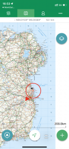
| Today’s overview location (the red cross in a circle shows where Val and I are at the moment) |
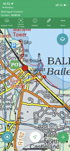
Close-up location (Click button below to download a GPX of today’s walk, or see interactive maps (as recorded, and with altitude correction) at bottom): Balbriggan harbour walk |
||||
Commentary
Some days, things don’t work out quite as you had expected, even when you think you have planned them meticulously in advance. Today was one of those days. Although that doesn’t mean it was a disaster – far from it. We had a very interesting and enjoyable day exploring an area of the Northern coastline that we had only briefly visited in the past, but which we had wanted to see in more detail anyway. So there was a silver lining in the cloud.
The original plan (well it was my idea so I take the blame) was to take the train four stops north up the line, to Balbriggan. Then to walk south back down the coast to Skerries (with the two windmills) and get the train back to Malahide from there. I had been seduced by the wide sandy beaches at Laytown, Portmarnock and Rush into thinking that there would probably be similar on the stretch of coast between Balbriggan and Skerries, so it would make a nice beach walk down the coast from one to the other.
I did take the precaution of checking on Google Earth to see what the coast looked like and although it did look a bit rocky, I thought it was probably just because the tide was in when the aerial photography was taken. I checked the tide tables and discovered that low tide was at about 5pm today so thought that if we set off about noon, the tide would be out by the time we got to the rocky bit, and with a bit of luck the retreating sea would be revealing a wide expanse of firm sand. And in any case, I thought, the road runs near to the coast, so we could just walk down the road even if the shore was impassable.
So we spent the morning – as seems to have become our habit lately – on paperwork and chores. I had to finish off my Spanish homework as I still hadn’t done it even though it’s five weeks since the last lesson. And Val had an online exercise class to go to. Once that was out of the way, we pottered down to the railway station and hopped on the next Drogheda train. As we were speeding north, I spotted the first wrinkle in my plan. I could see from the train that the nearby coast road (which was my backup escape route) was very busy and had no pavement. So that meant all our eggs were in the coastal basket as it wouldn’t have been safe to walk down the road. And even if it had been, I subsequently realised there was a 20 metre muddy cliff between the shore and the road, with no way of getting up.
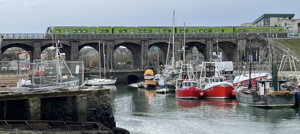
Anyway we duly disembarked at Balbriggan and headed over the footway attached to the railway viaduct over the Bracken River and then down to the harbour. We had a quick look round the harbour which had all theoretical possibilities of charm without actually possessing any of them. You approach it through the ruins of the “Bed” nightclub, which is in the process of being demolished. Then the harbour itself provides anchorage for a number of small fishing boats – some of which do indeed look well used and cared for – but also for a number of rusting hulks which seem just to be unloved and unmaintained, and which are slowly crumbling into the mud of the harbour floor.
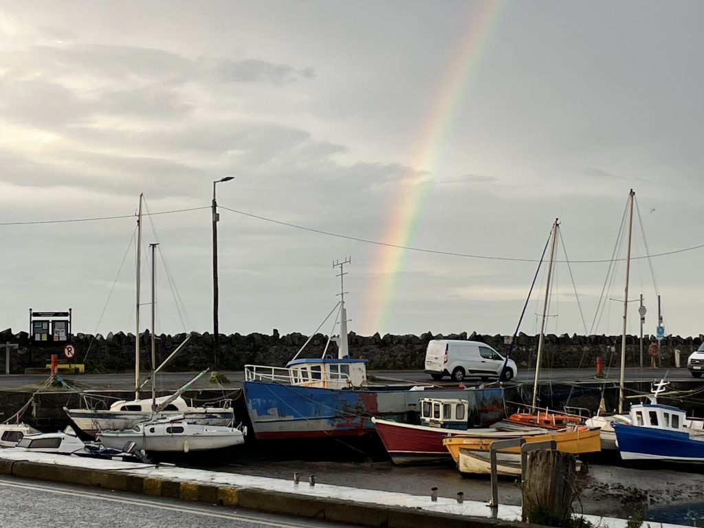
We hung around just long enough to watch of the antics of the seal which seemed to be enjoying splashing around in the lagoon (I decided I would much rather be a seal than a cow, by the way) then it started unexpectedly to rain so we hurried to the shelter of the railway viaduct to have lunch. Only then were we ready to start our march south along the shore.
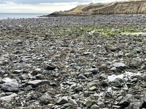
We got onto the beach just the other side of the harbour wall and almost immediately ran into our first problem in the form of rocks. Yes, as we walked the sand soon turned to shingle then to pebbles and finally to ankle-breaking seaweed-covered boulders. We made it no more than 500 metres down the shore before we realised it would be completely impossible to go on. The sandy beach which I had hoped would be exposed by the falling tide simply wasn’t there.
And to our right, the looming cliffs appeared threateningly unstable, although – it has to be said – geologically interesting. They are a sort of semi-consolidated mud which I think is probably glacial till or an alluvial deposit left behind as the glaciers melted. It was peppered with erratic boulders and I imagined that every one of them would have an interesting tale to tell, if you only had the time to study them properly. I also strongly suspect that the erosion of the cliffs by winter storms releases the muddy matrix which forms the sand and silt which gets deposited further south on the Velvet Strand and Bull island, among other places.
So we decided discretion was the better part of valour and turned around and resorted to Plan C – which was to explore Balbriggan. We had been there before, soon after we arrived in Ireland. It’s mainly famed for Smyth & Co, Hosiers to Queen Victoria and the Tsarina of Russia (liquidated in 1980 – the business, that is, not the Tsarina (she was some time earlier)) and the Irish Government Department of Foreign Affairs, which processes passport applications. I have to say it feels a bit down at heel at the moment. It was ransacked by British forces in 1920 during the War of Independence, and it doesn’t feel as if it has ever really recovered properly.
Nevertheless, we had a good walk along the northern beach, and then up to the Martello Tower. It’s still standing there pretty much as it was in 1804 when it was built. The only entrance door has been blocked up so goodness knows what’s in it. The isolated mystery just invites you to want to try and look inside. After a quick look round, it was threatening rain again, so we walked back to the station and only had 10 minutes to wait before for the train back to Malahide rolled into the platform.
We did have a small stroke of fortune (or more accurately of misfortune avoided) at that point as once we got on the train we discovered that trains don’t seem to be stopping at Skerries tonight for some reason. So even if we had actually made it there, we would still have had a long wait for a bus. Instead, we were home in about 20 minutes enjoying a cup of tea (with horrible vego-milk) so all was not lost after all.
Today’s photos (click to enlarge)
 |
 |
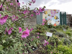
| A whole raft of summer flowers still in full bloom just outside Balbriggan station. Although we’ve had a couple of sharp frosts in Malahide, evidently this sheltered spot, right by the sea, has escaped. Is it really January? |
It turned out that the whole ten km of coast to Skerries would have been like this (even though I had checked on Google Earth before we left). It was navigable – but only with care and only very slowly. There was no way we could have made it to Skerries before nightfall, so we turned on our heels and returned to explore Balbriggan |
 |
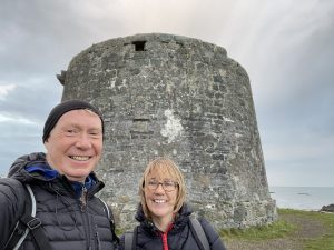 |
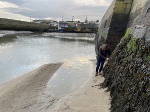
| By the time we got back to the harbour and had had out lunch (sausage sandwiches and a flask, obviously) the tide was well out and it was actually possible to walk right round the harbour wall – effectively on the mud on the harbour floor – onto the beach. Funnily enough, Val was less enthusiastic about this than I was. | According to the nearby information board this is the northernmost Martello tower but I am sure I have seen them further north, near Drogheda. I need to check. One of us is wrong. Anyway this one had no apparent entranceway, which just added to the general mystery of it. I couldn’t help thinking that it would make a fabulous “Grand Designs”-type conversion project. Would be fun to live in a bit of Napoleonic memorabilia, I think |
 |
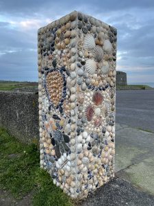 |
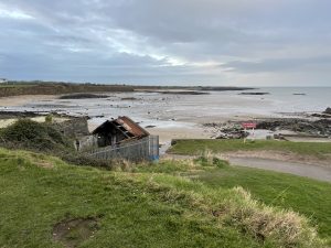
| Looking north from the Tower. the dilapidated building near the shore is a ruined lifeboat station. I don’t know how coastguard services in this area are provided nowadays | I could pretend this is a Neolithic obelisk but actually it’s just a decorative gate-post near the children’s playground. Either way, it looked attractive |
 |
|
| It started raining at lunchtime so we huddled on a stone bench under a railway bridge to eat our sandwiches and enjoy our thermos. A rainbow signalled that the rain had stopped and that it was safe to emerge into the 21st century again | |
Interactive map 1:
Original elevation data
Max elevation: 17 m
Min elevation: -3 m
Total climbing: 44 m
Total descent: -33 m
Total time: 02:02:43
Interactive map 2:
Elevation data replaced by DEM at:
GPS Visualizer: Assign DEM elevation data to coordinates
Max elevation: 15 m
Min elevation: 0 m
Total climbing: 79 m
Total descent: -79 m
Total time: 02:02:43
You can read earlier and later days’ blogs below
Previous day’s blog
Next day’s blog
Ireland home page
 Save as PDF