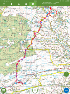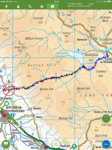
PW day 18: Thu 10 Mar 2016; Byrness to Kirk Yetholm
| Walk descriptor | Pennine Way | Day | 18 | ||
| Date | Thu 10 Mar 2016 | Start to end time | 12h 33m | ||
| Start point | Byrness | End point | Kirk Yetholm | ||
| Miles today | 26.67 | Cu miles | 290.75 | ||
| Ft today | 5,080 | Cu ft | 47,090 | ||
| Route miles left | 0.00 | Route ft left | 0 | ||
| Today’s weather | Low cloud at first, rising later with occasional glimpses of sun. Drizzle at first but dry later. Very light northerly wind, otherwise flat calm. Temp appx 4C | ||||
 |
 |
||||
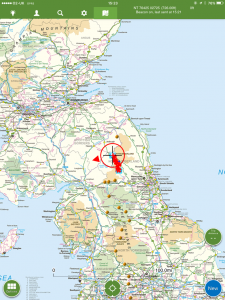
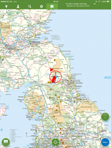
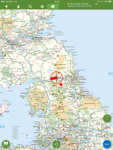
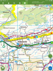
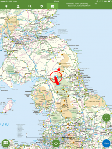
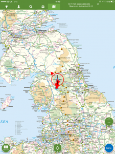
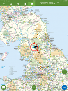
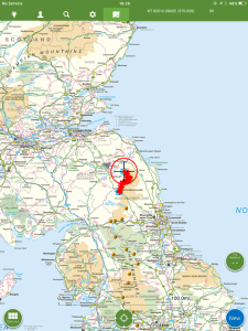
| Today’s location (the red cross in a circle shows where I am at the moment) |
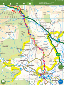
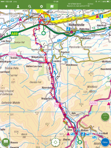
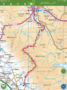
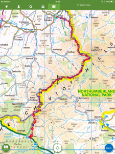
GPX based track of today’s walk (click button to download file) GPX |
||||
Commentary
There is a point on the Pennine Way where every walker without exception reaches the same conclusion. That point is usually somewhere around the summit of Windy Gyle – roughly the halfway point on this last stage of the PW – though for many it is much earlier. And the conclusion that they reach is that:
“There is absolutely no point in even trying to keep my boots dry any more. My feet are soaking wet and sitting in lakes at the bottom of my socks. I am wasting energy and time darting from side to side trying to find a relatively dry way through the bog. From now on I am going to dive straight through in the most direct line possible, in an effort to get to the end as soon as I can”
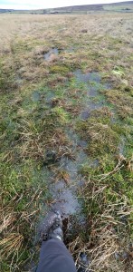
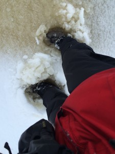
For me, this point was, sadly, almost as soon as I stepped off the pavement alongside the A68 in Byrness this morning. Yes, my Gore-tex boots and Gore-tex socks, leftovers from LEJOG in 2014, are now about as waterproof as colanders. So I hiked the entire 26 miles with soaking feet. There was not one inch of the path that was dry. Water, mud or slushy snow up to the lace-holes of my boots – or deeper – at every single step. Quite the wettest walk I have ever done – and wetter even than the summer of 1977 when I last passed this way.
With everyone I met knowing that I was about to embark on a winter crossing of longest and almost certainly the toughest day of the PW, I was naturally bombarded with lots of helpful advice. The most useful advice I got was, actually “don’t stop” and “eat constantly”. Although difficult to execute simultaneously, they are both helpful.
Not stopping is sensible, as if you do, you get cold almost immediately. So if you are going to stop for any length of time, you have to pile lots of extra clothes on, and then take them off again as you stagger back onto your seized-up limbs. And eating goes without saying. You burn a huge amount of energy on a walk like this – especially when the going is so hard – and if you don’t eat, you will become exhausted probably without noticing it and become much more prone to accident.
So I ate and walked and ate and walked. I never stopped and sat down, and in total I think I probably only paused half a dozen times, for no more than five minutes each – mostly just to get a hot drink from my Thermos. Syrup sandwiches (you should try them one day) on a currant bun were my mainstay – easy to eat, full of energy, and decent texture. Almost as good as millionaire’s shortbread, in fact.
And the most unhelpful advice? Well, I was told by someone that “you will find it much easier than 1977 because a lot of the Way has been paved or laid with boardwalk now”. This is unhelpful because it is simply untrue.
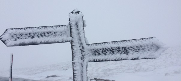
OK – much of the 8 mile section from Windy Gyle to Auchope Cairn has been paved, but almost none of the remaining 26 miles has. And the paving, where it has been laid, has been placed either by accident or design at below bog-level. So in the areas where it wasn’t frozen, it became a natural conduit for water, and was submerged by several inches of icy flow. And in the areas where snow lay, it formed a natural indent for snow to drift and accumulate. In these sections the flagging was downright dangerous, as the snow made it impossible to see what you were stepping on, and carried the high likelihood that whatever it was would be covered in ice and liable to cause you to fall.
So – grumbles aside, what was today’s walk actually like. Well, it was very long, and included thousands of feet of climbing. Just when you got to the top of something, the next mountain would appear in front of you. And the next, and the next, and the next. And all were covered in slush or bog.
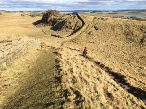
It was also very very very wet. I don’t think this place every dries out. Maybe if it didn’t rain for a decade, it would start to dry, but I can’t see that ever happening. And the thick wet snow from Windy Gyle to the top of Auchope Cairn was eight miles of unmitigated exhaustion. Every footstep required three times the effort to push boots through the snow to an uncertain bottom, then drag them forward and haul them out again. It was exhausting work. At one point, I had to resort to counting my paces, and stopping after every hundred to catch my breath. Something I can only remember doing once before, which was when I was on an 18,000 ft walk in Nepal. But towards the end, the terrain changed a little and the ascent of White Law was much drier – a perfect grassy hill which I imagine would be a delight to climb if it didn’t come after 23 miles of uphill slog.
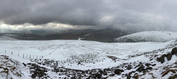
But on the positive side, the weather couldn’t have been better. After early mist and drizzle cleared, the day was largely dry and bright, with no rain and almost no wind. I count myself extremely lucky – if it had been wet or windy – which actually is the norm – it would have been very hard going indeed.
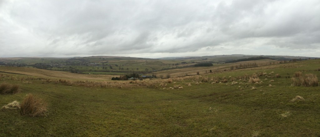
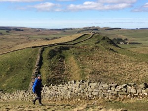
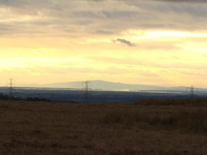
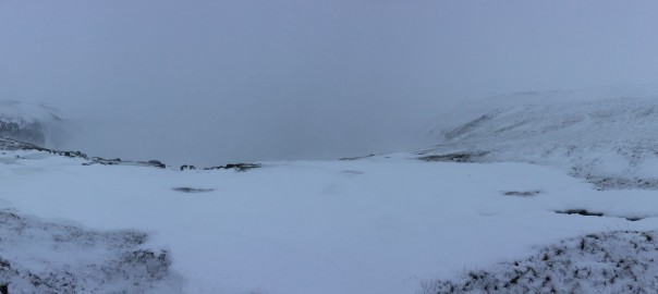
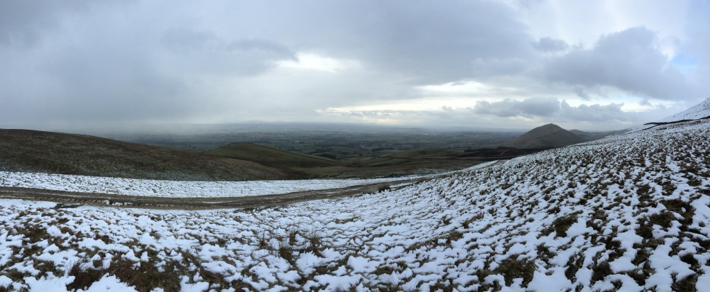
And the views were spectacular! Although still subject to the “whump – boom” of shelling from Otterburn, mostly it was dead silent up there. I only saw three people, a lot of sheep, and four feral goats all day, so I had these amazing panoramas all to myself. Absolutely magical.
So it was a fitting end to a brilliant walk. A magnificent crescendo of toil bringing me right into Scotland. I loved pretty much every minute of today – despite the pain – and of the whole walk. So this time if someone asked me “Did you enjoy it?” and “Would you do it again?”, the answer would be an unhesitating “Yes and Yes!”.
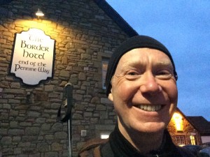
Well, now I’m going to sign off from the Pennine Way and head over to the Border Hotel to claim my free half pint courtesy of Mr Wainwright.
So long, it’s been a blast (as they say in Otterburn)!
Today’s photos (click to enlarge)
 |
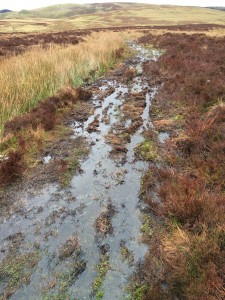 |
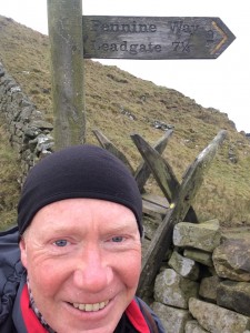
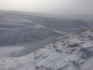
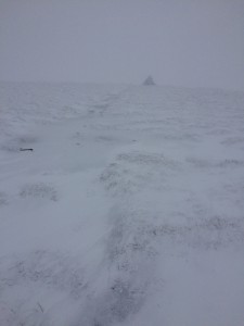
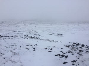
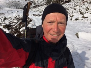
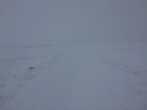
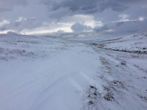
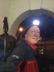
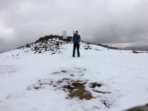
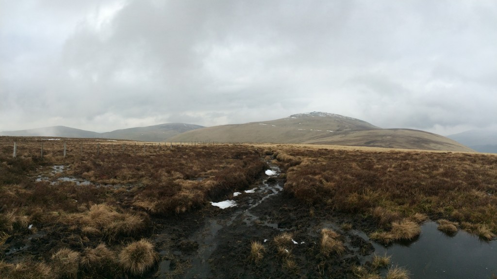
| Dawn start. To my amazement, I slept solidly from 9pm to 5am and was away promptly at 6am | It was like this – or worse (with slush snow) for all but about 0.1 of the 27 miles today. Amazing my feet haven’t dissolved |
 |
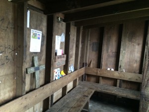 |
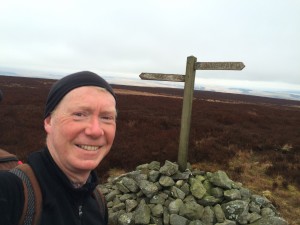
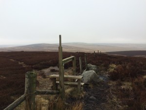
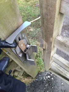
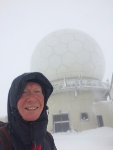
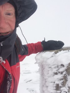
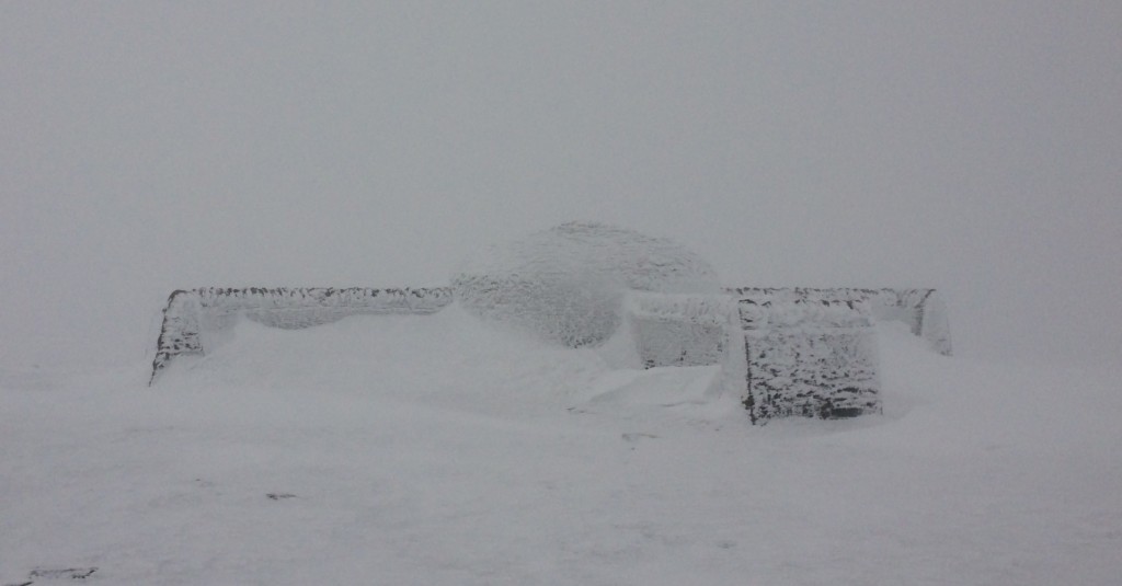
| On the top of Windy Gyle. The weather was so benign, I went up in just a T-shirt | Inside the refuge hut at Auchope. Would be a very welcome port in a storm, if things had gone wrong |
 |
 |
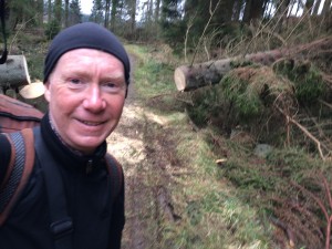
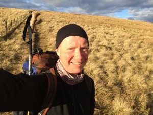
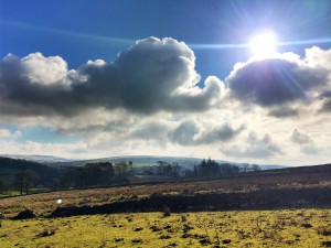
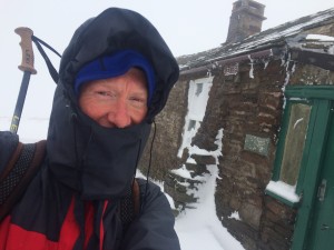
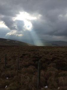
| Someone up there was smiling on me today. I had excellent weather – no wind, a little sun, and no rain. Couldn’t really have been better | Nothing will wipe that grin off my face for two days at least. |
 |
|
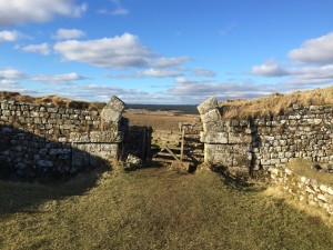
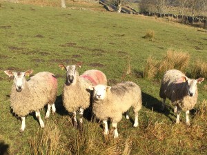
| Just when you have had enough, after 18 miles you discover that there are these four giant bog-filled Tunnocks teacakes still remaining to be scaled. Absolutely the last thing you want to see! | |
 |
|
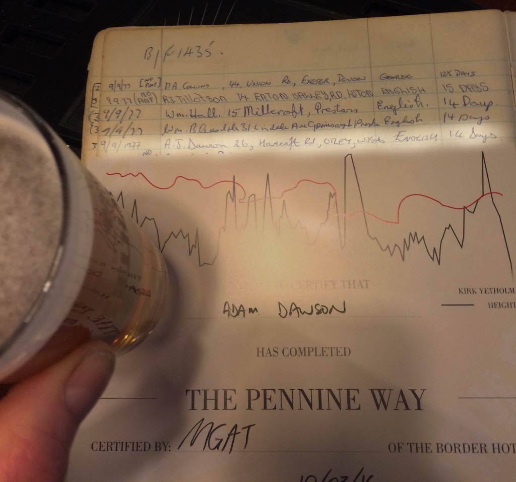
| After I’d finished hiking, had something to eat and a shower, I went to the Border hotel to collect my free beer courtesy of Mr Wainwright, and my certificate. And I also checked out the PW logbook for 1977. So much better this time! | |
The previous day’s blog follows below the blue line
 Save as PDF