Ireland day 0712. Sunday 10 September 2023- Ballycorus2
| Today’s summary | Drove round to Shankill to meet Walking Club friends at Bradys Pub. A short walk up the slopes of Carrickgollogan and back to see the Ballycorus chimney on a very warm and humid day | ||||
| Today’s weather | Overcast with occasional short showers and some sun in the afternoon. Mist patches and very high humidity. Almost no wind. Appx 22c | ||||
 |
 |
||||
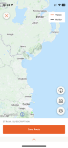
| Today’s overview location (The green mark shows the location of our route) |
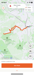
Close-up location (The orange line shows where we walked) (Click button below to download GPX of today’s walk as recorded, or see interactive map at bottom with elevations corrected): Ballycorus walk DWC |
||||
Commentary
(Summary blog only. Last full blog was Day 0368).
I’d made a trip down to Ballycorus on my own last year (16 June, to be precise, if you want to look up the blog), and found it very interesting. So, as Val was at work today and I was otherwise on my own, it didn’t take me long to decide to make a return trip, this time in the company of some friends.
I headed out of the flat just before 10, and my first stop was the petrol station, then on to Donaghmede to pick up one of the other walkers for today’s outing. A quick spin round the M50 – it took under 40 minutes – saw us at Brady’s pub at well before the allocated start time of 11am. Just time for a coffee in fact, but no scone for me, sadly, as I am supposed to be on a healthier diet at the moment.
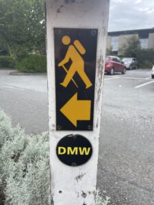
Once the group of 15 had assembled itself and enjoyed the obligatory coffees, we set off directly from the pub along the Dublin Mountains Way – which actually seems to start right from the pub car park. It was an easy walk up Carrickgollogan hill – although this time I didn’t go right to the top, unlike last year. But the weather today was very close and quite warm, which combined with the almost complete absence of any air movement, made it quite a sweaty undertaking.
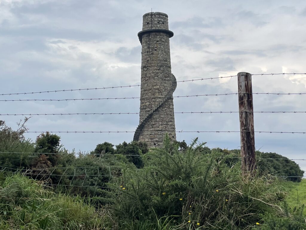
With the spectacular spiral staircase-d chimney at the high point eventually reached around 1:30, lunchtime was decreed and we paused to dine and enjoy the view. In keeping with my new healthier approach to life, I had prepared a meal of lettuce leaves and gerbil food, which was totally unsatisfying but at least made me feel virtuous.
The journey back down was straightforward, and we got back in plenty of time to enjoy a drink in Brady’s – sadly no alcohol for me as I was driving – but a nice sociable gathering anyway.
Eventually we left after about an hour and drove back round the motorway, and after dropping off my fellow-walker in Donaghmede I was back in Malahide by 6pm, not long after Val had returned from work. I rustled up a dinner of cabbage, mashed potatoes and cold chicken left over from yesterday, which I hope was reasonably healthy and tasty and which even with my very rudimentary culinary skills, I managed without to make too much fuss.
Now, at last, there’s space for some down-time and I’m going to try and finish my Iain McEwan book (“Lessons”), which so far has taken me the best part of two months to read. It’s not my favourite literary work, I have to say, and I’m actually quite looking forward to giving it back to the library.
Today’s photos (click to enlarge)
 |
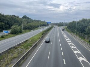 |
| Quite a lot of today’s walk followed the early part of the Dublin Mountains Way. It runs 42km from Shankill to Tallaght and I’d love to give it a go one day | Crossing the M11 |
 |
 |
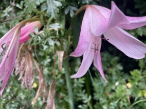
| Crinum Powellii (Swamp Lily) growing in Lordello Road. First time I’ve seen it in Ireland | Looking over Dublin from beside the chimney, with Two Rock hill in the mist |
 |
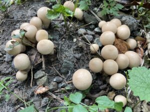 |
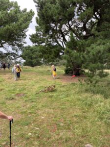
| Mucking about on the tree swing at Rathmichael ring fort | Vigorous looking clump of miniature puff balls growing alongside the path |
 |
|
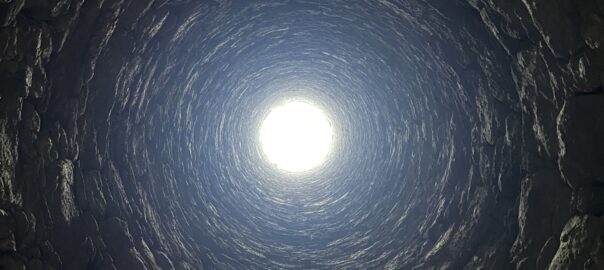
| The Ballycorus Chimney. It’s made of granite and was used to disperse the fumes from the lead smelting works in the valley below. Thankfully for the health of everyone in the area, it was closed down in 1913 | |
Interactive map
(Elevations corrected at GPS Visualizer: Assign DEM elevation data to coordinates )
Max elevation: 242 m
Min elevation: 29 m
Total climbing: 312 m
Total descent: -311 m
Total time: 03:46:52
You can read earlier and later days’ blogs below
Previous day’s blog
Next day’s blog
Ireland home page
 Save as PDF