
Ireland day 0942. Saturday 27 April 2024- Rockabill
| Today’s summary | Went on a boat trip to Rockabill, off the coast of Skerries, organised by the Irish Geological Association and Birdwatch Ireland. After a showery start we had brilliant blue skies and sunshine all day. We spent the day looking a granites and then clearing the tree mallow to make space for the roseate terns, who arrive from Africa next week, to nest. Absolutely fantastic. | ||||
| Today’s weather | Dull with a light shower first thing, then clear blue skies and bright sunshine most of the afternoon. Moderate north easterly wind. Appx 10c | ||||
 |
 |
||||
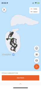
| Today’s overview location (The green mark shows the location of our route) |
Close-up location (The grey line shows where we walked) (Click button below to download GPX of today’s walk as recorded, or see interactive map at bottom with elevations corrected): Rockabill |
||||
Commentary
(Summary blog only. Last full blog was Day 0368).
Spoiler alert. Today was stunning.
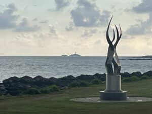
For the third day in a row, Val and I were up bright and early – though this time our mission was a bit different to the norm. After a quick cup of tea and wash and brush up, we drove up the coast and were in the Skerries Sailing Club boathouse by 9:15 am. Here we met up with the rest of our group of 24, with whom we would be travelling over to Rockabill – a remote rocky islet about 8km off the coast of Skerries.
The trip was organised by the Irish Geological Association and Birdwatch Ireland, and it was absolutely fabulous. The day had started windy and overcast, with even a light shower of rain. So the auspices didn’t seem particularly good. But fairly soon after we had set sail on the sturdy Lisín I, the skies began to clear and the sun came out. It remained that way – brilliantly sunny – most of the day. So now I think Val and I are actually feeling a bit weatherbeaten!
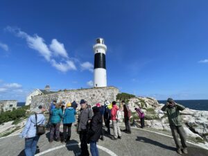
The boat trip across took about half an hour and was certainly memorable. Pretty bumpy and you had to hold on for dear life to avoid being hurled overboard. Once we had safely disembarked on the tiny jetty (and I have to say, getting on and off the boat was the most hazardous part of the expedition), we convened near the old lighthousekeepers’ cottage, and received our instructions for the day.
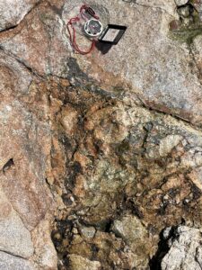
The first aim was to investigate the geology. Rockabill is exclusively granitic but surprisingly little is known about it. It is so remote, it is hard to map. So we spent a couple of hours trying to decipher the quartz intrusions, to examine the chalcedony veins, and to try and find slickensides (we didn’t find any).
Then after our lunch, we started to clear the tree mallow (Malva arborea) which covers the island, in order to make space for the roseate terns (Sterna dougallii), which return from west Africa next week, to nest.
The time flew by and before we knew it, the boat was back to take us away again – we had been there six hours but it went in a flash. We were both sorry to leave as it was a fantastic beautiful gem of solitude, all by itself in the middle of the sea. It was quite a shock to return to the hustle and bustle of Skerries on a sunny Saturday afternoon, with happy punters spilling out of the bars and cafés onto the pavements. Our glimpse of an alternative world was all too brief.
After a quick drink on the lovely sunny balcony of the sailing club, we drove back to Malahide, so now we are sitting in the flat glowing, and reflecting on what was a truly exceptional, once in a lifetime day out.
Today’s photos (click to enlarge)
 |
 |
| Our destination – the pimple of the horizon – as seen from Skerries | Coming ashore with wobbly legs! |
 |
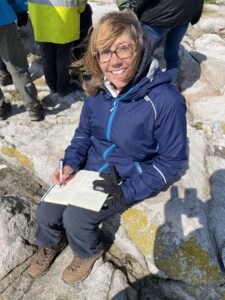 |
| Our group congregating ready to start work | Val took extensive notes as we were geologising. Teacher’s pet (!!) |
 |
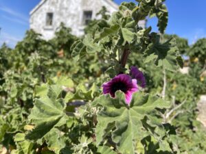 |
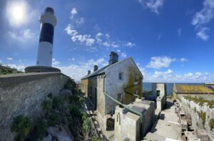
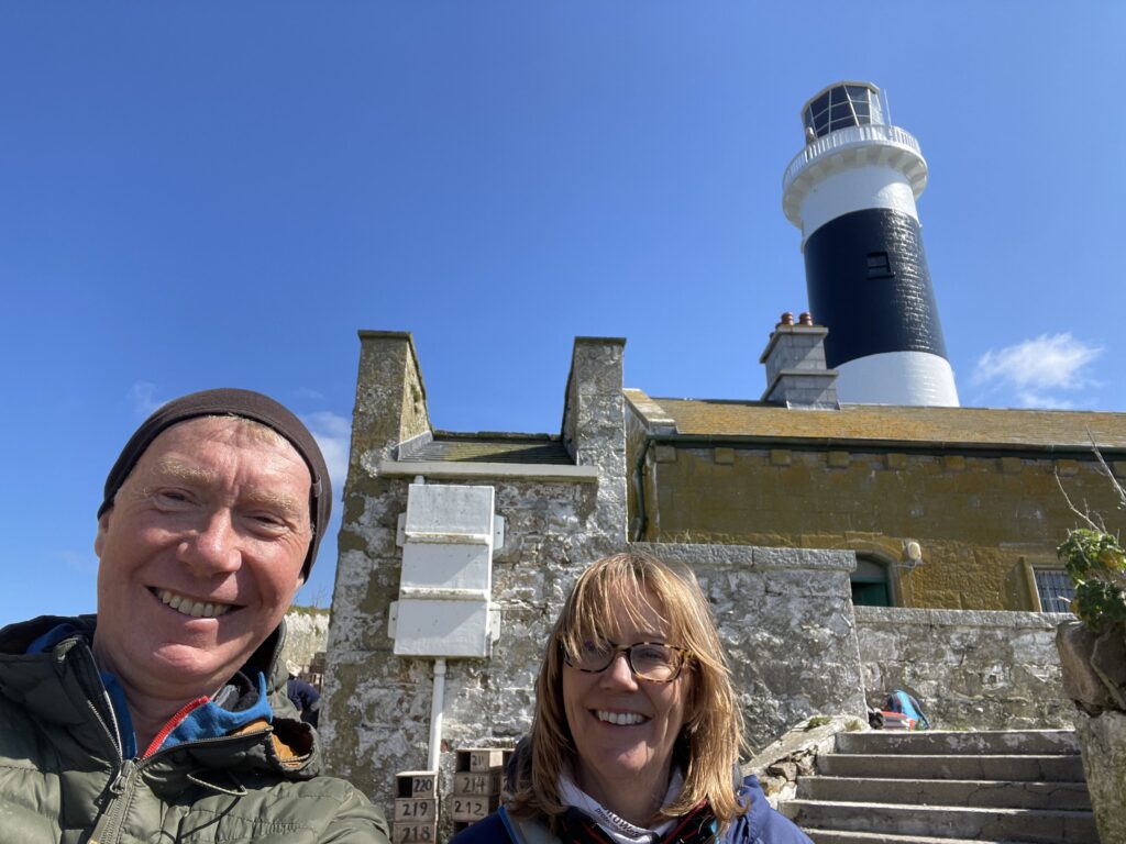
| The lighthouse itself, with the keepers’ cottages. The lighthouse is automated and solarised, so is completely unmanned. There is a small group of Birdwatch Ireland staff who stay on the island from mid April to the end of August, to keep an eye on the roseate terns. What a fantastic job | Tree mallow – It’s pretty but a bit too invasive. It was originally encouraged by the lighthousekeepers because the leaves had antiseptic properties so if they were injured while out at this remote spot, they could self-treat |
 |
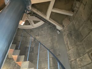 |
| A possible example of explosive brecciation | Inside the lighthouse (sadly you aren’t allowed to go up to the top) |
 |
|
| Lighthouse ahoy! | |
Interactive map
(Elevations corrected at GPS Visualizer: Assign DEM elevation data to coordinates )
Max elevation: -8 m
Min elevation: -8 m
Total climbing: 0 m
Total descent: -0 m
Total time: 04:18:29
You can read earlier and later days’ blogs below
Previous day’s blog
Next day’s blog
Ireland home page
 Save as PDF