Ireland day 0698. Sunday 27 August 2023- Howth Ad Hoc
| Today’s summary | Got a lift from a friend down to Howth then ended up co-leading an ad-hoc Club walk round Howth Head. Very enjoyable and once again the weather was good | ||||
| Today’s weather | Overcast with occasional light rain. Not much sun. Moderate westerly wind. Appx 18C | ||||
 |
 |
||||
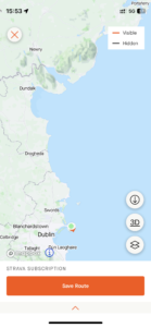
| Today’s overview location (The green mark shows the location of our route) |
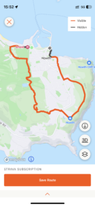
Close-up location (The orange line shows where we walked) (Click button below to download GPX of today’s walk as recorded, or see interactive map at bottom with elevations corrected): Hills of Howth walk |
||||
Commentary
(Summary blog only. Last full blog was Day 0368).
It was a double-bill of Club walks this weekend, with today featuring a “medium” length walk round Howth.
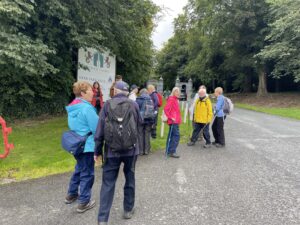
A friend gave me a lift down to the meeting point at the start (inevitably this was a café featuring coffee and scones) and we had a very relaxing half hour catching up on the news and enjoying our refreshments. Eventually we collectively decided we had better get started, at which point it became clear that there wasn’t actually a leader for today’s walk.
Having already led a walk yesterday, I wasn’t mad keen to do another today, but eventually I and one of the other experienced walkers put our heads together and we pulled together a bit of an ad hoc ramble exploring some of the paths and lanes which criss-cross Howth Head. I was pleased that we managed successfully to get everyone up to the Ben of Howth, which is the highest point, and which many of the walkers hadn’t visited before.
After a slightly damp lunch in some birch woodland, we made our way through more lanes and paths to the Howth Summit (not actually the highest point, but probably the best known because the now-defunct tram system used to go there). More views were admired, then we set off back to Howth village via the Upper Cliff Path and the “Eire 6” sign.
Once back in Howth, it was generally agreed that it had been a successful walk, despite being a bit of a last-minute concoction, and a few of the group headed off to buy fish and chips to celebrate. I must admit that by this point I was feeling somewhat worn out by two days solid leading, walking and socialising, so I said my farewells and caught the train back to Malahide.
So now I’m signing off, to go and enjoy my chicken pasta bake, some fresh fruit, and an early night!
Today’s photos (click to enlarge)
 |
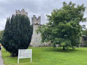 |
| Setting off to enter the Howth castle grounds and deer park | Howth castle. I’m not exactly sure what it is used for nowadays, but I don’t think it’s open to the public |
 |
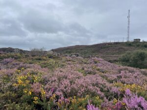 |
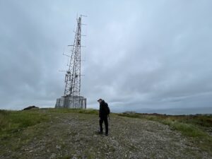
| Approaching the summit of the Ben of Howth | Heather in full purple boom – an amazing sight only a few km from Dublin city centre |
 |
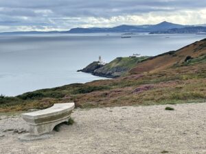 |
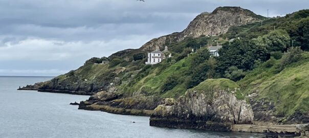
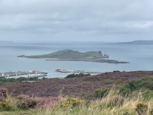
| Looking back over Ireland’s Eye and the westernmost point of Lambay Island. Skies nowhere near as clear as they have been the previous two days. | The view across Dublin Bay to the Sugarloaf, with the Baily lighthouse in the mid-distance |
 |
|
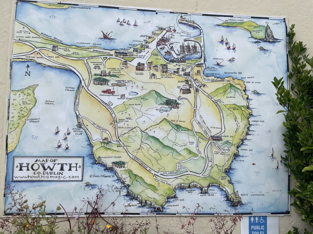
| Ceramic map of Howth (on the wall of the public toilet!) | |
Interactive map
(Elevations corrected at GPS Visualizer: Assign DEM elevation data to coordinates )
Max elevation: 164 m
Min elevation: 1 m
Total climbing: 238 m
Total descent: -241 m
Total time: 03:47:21
You can read earlier and later days’ blogs below
Previous day’s blog
Next day’s blog
Ireland home page
 Save as PDF