Ireland day 0596. Wednesday 17 May 2023- Mullaghcleevaun
| Today’s summary | Walked up Mullaghcleevaun from Ballynultagh Gap with a friend from the walking club, to test out my hip. it went well. Collected Val from the airport in the evening | ||||
| Today’s weather | Mild and dry with long spells of hazy sun. Light westerly wind. Appx 17C | ||||
 |
 |
||||
| Today’s overview location (The blue mark shows the location of our route) |
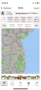
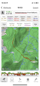
Close-up location (The blue line shows where we walked) (Click button below to download GPX of today’s walk as recorded, or see interactive map at bottom with elevations corrected): Mullaghcleevaun from Ballynultagh gap |
||||
Commentary
(Summary blog only. Last full blog was Day 0368).
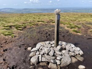
Val is still away in the UK, returning this evening. So while she was away, I decided to celebrate the eleven-week anniversary of my hip operation with a climb up Mullaghcleevaun, which at 849 metres (2,785 ft), is the second-highest summit in the Wicklow Hills. As Val was away, Linda from the Walking Club volunteered to accompany me to make sure nothing went awry.
So we met at the Ballynultagh Gap at 10:30 to start the ascent. (I should add that I made the walk as easy as possible, because the Gap itself is at 443m / 1453ft, so you save quite a lot of climbing at the start – though you do add on 60m of unnecessary up-and-down through the climb of Black Hill on the way to the main top).
The walk went extremely well – we had perfect weather, which helped a lot, and great visibility. My hip felt good – and the climb was much more enjoyable than any I can remember for well over a year, simply because of the absence of pain. The going was quite easy, though the path is a bit thin in places, and there are some peat-hags. But nothing too troublesome. We retraced our steps to the car park and were back by 3:30 pm. There were one or two others about, but generally we had the hills to ourselves (except at the very end when a party of about sixty school pupils came tearing down Sorrel Hill – on the other side of the Gap opposite Black Hill, and ended up in the car park. They were on some sort of outdoor activities day it transpired).
The elapsed time for our walk was 4h38m, our distance was 11.5km (7.1mi), and our total ascent was 510m (1673ft). So I felt pretty pleased with the day altogether, and once again extremely thankful for the miracles of modern medicine.
So now I need to make something to eat, have a shower and generally smarten myself up a bit, before dashing off to the airport to collect Val.
Today’s photos (click to enlarge)
 |
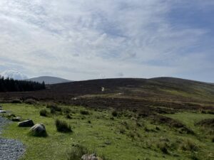 |
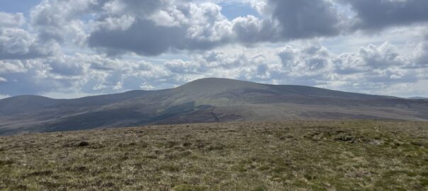
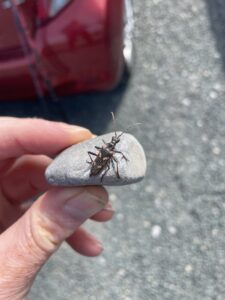
| Rhagium bifasciatum, the two-banded longhorn beetle, lurking in the car park at the start at Ballynultagh Gap. Apparently it lives in pine forests (there is one only a couple of hundred metres away) and drills holes for its larvae in dead wood | From the car park looking south to the intermediate summit of Black Hill, and then south east to the summit of Mullaghcleevaun, on the left-hand horizon |
 |
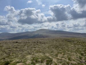 |
| The top of Black Hill – you climb to the top, then have to drop down again to the saddle between it and Mullaghcleevaun | From the top of Black Hill looking across to Mullaghcleevaun. It looks like a boggy wilderness but actually there is a thin track and while there are a few peat hags, they were reasonably dry today so not too tricky to negotiate |
 |
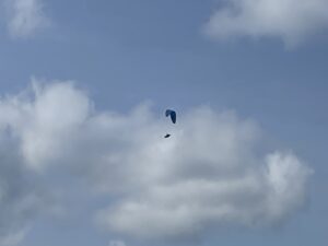 |
| In one of the groughs between a couple of waves of hags | Back on the way down, a parascender appeared. Apparently Ballynultagh Gap is a popular place for this sport – presumably because the wind must be favourable, and there aren’t any cliffs (or electricity pylons) to crash into |
 |
|
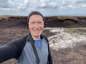
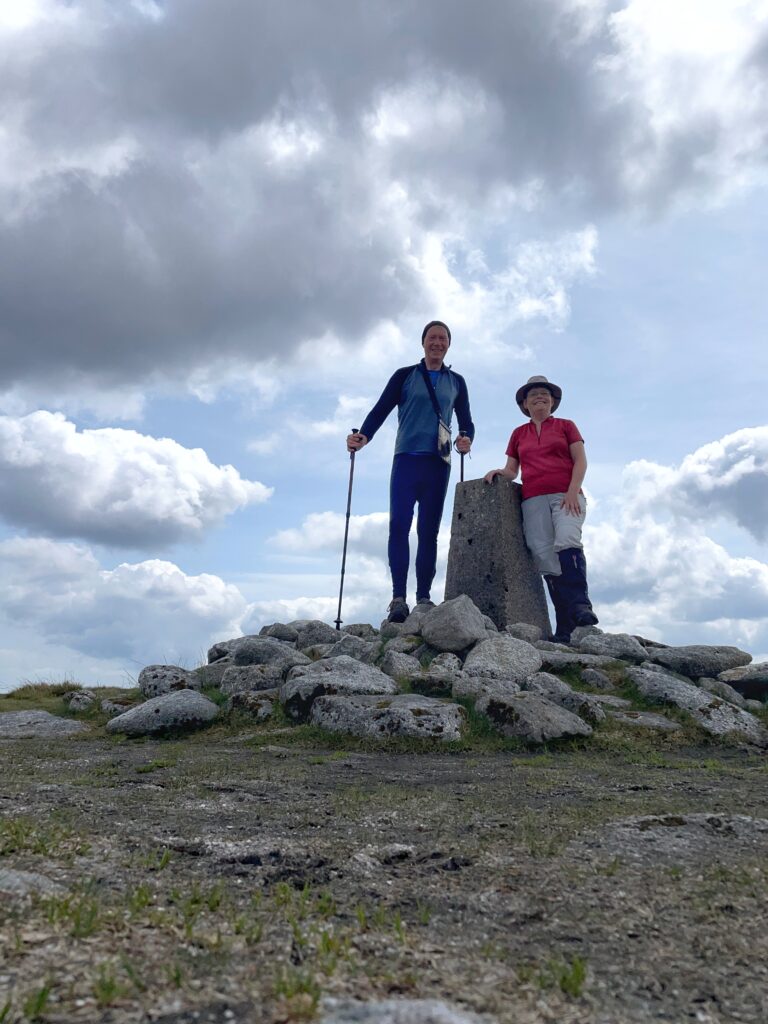
| On the top, with Linda from the walking club. She kept an eye on me and stopped me from doing anything too reckless. | |
Interactive map
(Elevations corrected at GPS Visualizer: Assign DEM elevation data to coordinates )
Max elevation: 845 m
Min elevation: 441 m
Total climbing: 541 m
Total descent: -540 m
Total time: 04:37:42
You can read earlier and later days’ blogs below
Previous day’s blog
Next day’s blog
Ireland home page
 Save as PDF