Ireland day 0627. Saturday 17 June 2023- Donegal 01
| Today’s summary | Drove up to Gortahork in Co Donegal for a short holiday. visited Sligo town, Classiebawn Castle, and Mullaghmore en route | ||||
| Today’s weather | Humid and mild with heavy rain and thunderstorms on and off all day. Light south easterly wind. Appx 20C | ||||
 |
 |
||||
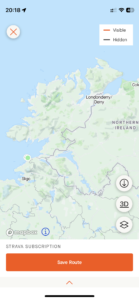
| Today’s overview location (The grey mark shows the location of our route) |
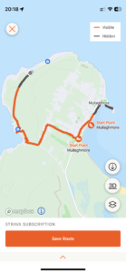
Close-up location (The orange line shows where we walked) (Click button below to download GPX of today’s walk as recorded, or see interactive map at bottom with elevations corrected): Mullachmore |
||||
Commentary
(Summary blog only. Last full blog was Day 0368).
We’re having a short holiday in Co Donegal, staying in a small AirBnB in Gortahork for four nights.
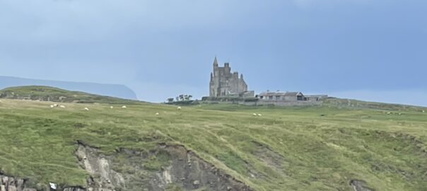
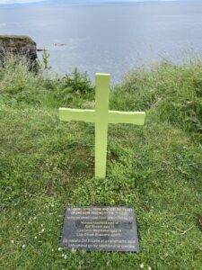
We drove up today, stopping off in Sligo town and at Mullachmore on the way. We really liked Sligo town – neat, tidy, clean and lively. A really nice spot. And the Mullachmore headland was beautiful. It’s where the late Lord Mountbatten’s castle at Classiebawn is situated. Sadly, it’s also the place where, in 1979, he and several friends and members of the family were assassinated by the IRA while out on a fishing trip. Nowadays, the castle is still in private ownership and it’s not open to visitors. But you can get good views from the western side of the headland, opposite Mullaghmore town.
The views were today made even more dramatic by the flashes of lightning and dark black clouds swirling round and threatening to saturate us at any moment.
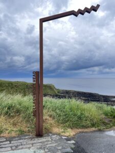
The only downside to this beautiful situation is that it’s on the Wild Atlantic Way, so a bit of a tourist mecca. But hey, we were tourists today too, so I can’t complain too much. We are thoroughly enjoying it up here – one of the nicest of the many nice places we’ve visited in Ireland, actually.
Today’s photos (click to enlarge)
 |
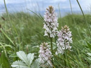 |
| Iconic cast-iron marker for the Wild Atlantic Way | beautiful orchids in abundance right by the roadside |
 |
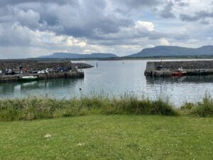 |
| Memorial to Mountbatten et al | Mullaghmore harbour |
 |
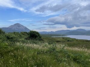 |
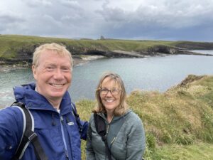
| We were here too! With Classiebawn castle behind | Errigal and Dunlewy Lough |
 |
|
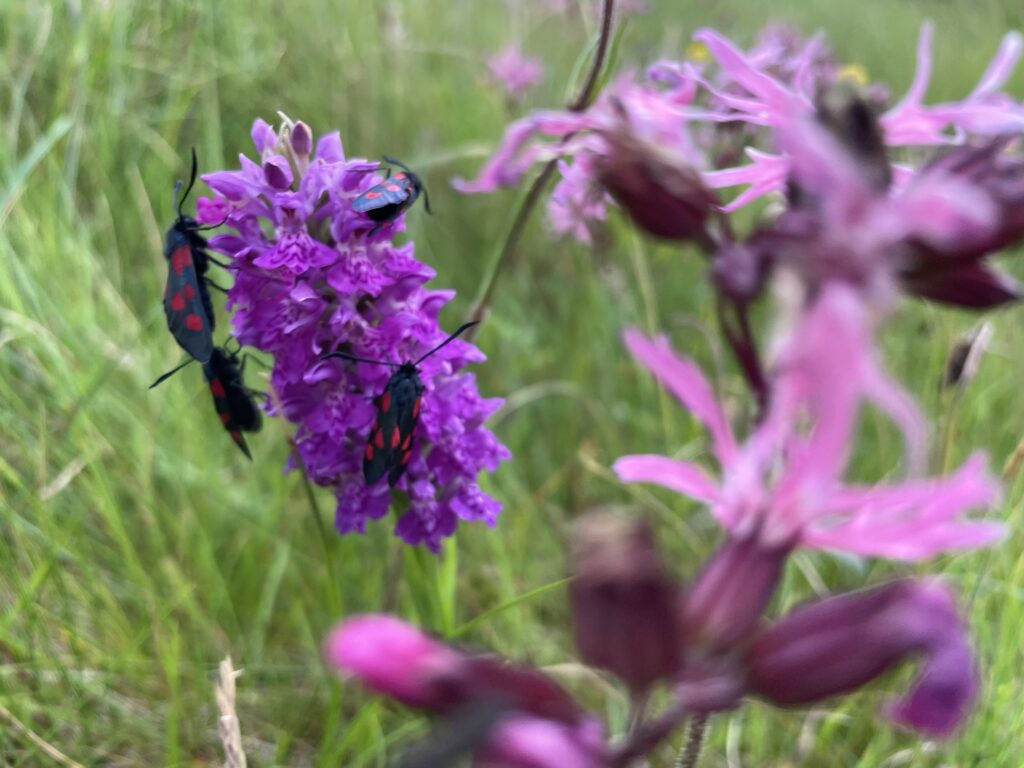
| Six-spotted burnet moths on one of the many orchids in the area | |
Interactive map
(Elevations corrected at GPS Visualizer: Assign DEM elevation data to coordinates )
Max elevation: 48 m
Min elevation: 0 m
Total climbing: 105 m
Total descent: -95 m
Total time: 01:03:30
You can read earlier and later days’ blogs below
Previous day’s blog
Next day’s blog
Ireland home page
 Save as PDF