Ireland day 0718. Saturday 16 September 2023- Leading Slieve Foye
| Today’s summary | Got a lift from a friend up to Carlingford where I led (for DWC) a loop walk to the top of Slieve Foye and then back down Two Mile River. The weather wasn’t perfect but at least dry and I enjoyed it. Val sadly at work today | ||||
| Today’s weather | Overcast and drizzly from time to time all day. Strong to gale force northerly wind. Feeling quite cold at around 11C, thought it warmed up to about 15C by the end of the day | ||||
 |
 |
||||
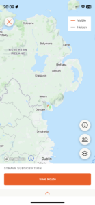
| Today’s overview location (The green mark shows the location of our route) |
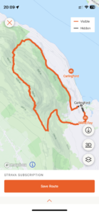
Close-up location (The orange line shows where we walked) (Click button below to download GPX of today’s walk as recorded, or see interactive map at bottom with elevations corrected): Leading Slieve Foye DWC |
||||
Commentary
(Summary blog only. Last full blog was Day 0368).
Val has now slipped back into the 3-on-3-off routine of work at the museum, and unfortunately one of the “on” days coincided with the walk I was leading today – a circular walk from Carlingford, taking in the summit of Slieve Foye.
After the late return last night (I wasn’t in bed until almost 1 am), I wasn’t particularly relishing the prospect of an early start this morning. But a friend had offered to give me a lift from outside our flat, so I couldn’t be late. The alarm went off at 7:30 and I hastily got up, pulled my things together (Val, being the saint she is, had made me a packed lunch already), and set off.
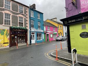
As we drove north up the motorway, the weather over in the Cooleys didn’t look terribly auspicious. Grey, with low clouds and what looked live a serious prospect of rain. Anyway we made it to Carlingford for 10am, and met the other walkers there. There were nine of us in all and we set off promptly, but only got about 200 metres before we spotted the lovely “Finca” café and simply couldn’t resist the temptation of early morning refreshments. We obviously created the right impression with the management, as we were offered free chicken and chipotle tacos to try out, where were delicious.
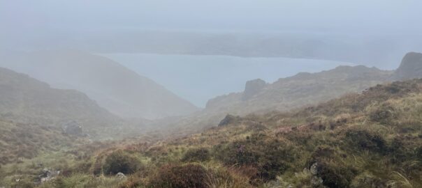
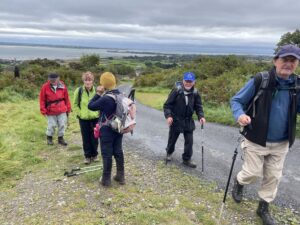
We eventually got properly underway, and plodded up towards Slieve Foye following the same route as we’d used on the recce a few weeks ago. About a third of the way up, a group of three elected to split off from my main group and to do a shorter walk, while the rest of us continued our relentless ascent to the top. Despite it looking threatening, it never actually rained all day – though by the time we got above about 400m we were in mist, and the wind quickly picked up to gale force. It felt pretty cold, actually, and an uncomfortable reminder that winter isn’t far off.
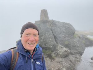
We all made it to the top without incident, and paused briefly for a sandwich and a cup of coffee from the trusty thermos. But it was hard to get out of the swirling wind, so we set off again before we froze solid, and headed into the misty wilderness that defines the summit plateau between Slieve Foye and the Eagle Rock. It needed quite careful navigation to follow the route – the path such as it is, is either vague or non-existent. But we were relatively quickly at the base of the Eagle Rock so turned northeast and carefully picked our way down the slippery and steep side of the Two Mile River as far as the car park and picnic area on the forestry road.
We paused again at this point to finish off the lunches we hadn’t been able to enjoy properly at the top, then followed the new path that runs below and parallel to the forestry road, all the way to Carlingford. On our return, we rapidly ascertained that the splinter party was already back and had installed themselves in McKevitts pub, so we joined them there for a quick drink. As I wasn’t driving today, I was able to enjoy a Guinness, which made nice change and a perfect end to the walk.
We didn’t stay too long, so downed our drinks, returned to the cars, said our goodbyes, and were soon down the M1 and back in Malahide. Val had prepared fish for tea – in keeping with my new healthy eating fad – and it was delicious. Now its time to unpack all my damp walking gear and to start drying off again and to reflect on a “grand day out” as they say, and one when, despite the ominous portents, the weather stayed respectably dry all day.
Today’s photos (click to enlarge)
 |
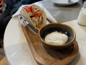 |
| Colourful Carlingford. We couldn’t resist the allure of the Finca café (the brown building on the left) for refreshments before we set off. It’s lovely | We are rapidly becoming regulars here so we were offered a couple of chicken and chipotle tacos to try, free of charge. They were delicious and if the café ever decides their market research was sufficiently positive, don’t hesitate to go in and get one. At €5 each they will be a bargain |
 |
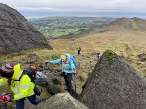 |
| Heading up the road to the trailhead, a few hundred metres to the west of Carlingford | Scrambling up from the bealach (you can see the other side of the pass at Barnavave in the background) and beginning the final ascent of Slieve Foye |
 |
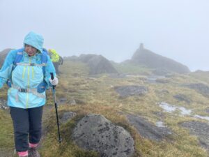 |
| On the top. Well almost – it was too windy to climb up the boulder to the trig point itself | The route from the summit (see trig point behind) to the Eagle Rock where you drop down the Two Mile River is a bit pathless and in mist you need to navigate carefully |
 |
|
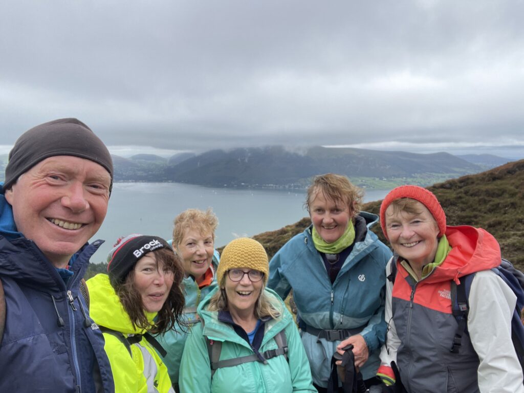
| Here I am with the ladies again. The men, being the weaker sex at this point, decided to take a shorter walk along the Carlingford Loops in the woodland below. Taken from the side of the Two Mile River, with Carlingford Lough and the Land Outside Europe in the background | |
Interactive map
(Elevations corrected at GPS Visualizer: Assign DEM elevation data to coordinates )
Max elevation: 579 m
Min elevation: 6 m
Total climbing: 770 m
Total descent: -770 m
Total time: 05:33:25
You can read earlier and later days’ blogs below
Previous day’s blog
Next day’s blog
Ireland home page
 Save as PDF