Ireland day 0858. Saturday 03 February 2024- Belmont
| Today’s summary | Drove down to Bray (as the Dart was closed for engineering works) to join the DWC for a very enjoyable walk up Bray Head, through the Belmont Estate and up the Little Sugarloaf. Third time (I think) that I have done it but very enjoyable nevertheless. Beshoffs fish and chips for tea | ||||
| Today’s weather | Started dry but then thick mist and rain around noon. Cleared later with a little sun late afternoon. Light westerly wind. Appx 10c | ||||
 |
 |
||||
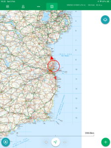
| Today’s overview location (The red mark shows the location of our route) |
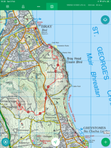
Close-up location (The red line shows where we walked) (Click button below to download GPX of today’s walk as recorded, or see interactive map at bottom with elevations corrected): Bray Belmont Little Sugarloaf and back |
||||
Commentary
(Summary blog only. Last full blog was Day 0368).
I thought something was awry when I checked google maps last night to see what the train times to Bray from Malahide would be on a Saturday morning. Things didn’t seem right when it told me the journey would take over two hours (it’s normally about 45 minutes) and would involve getting on a bus from Dublin. After a quick check on the Iarnród Éireann website revealed the reason why – engineering works south of Dun Laoghaire meant the line was going to be closed for the whole weekend.
So Val and I once more jumped into the Trusty Yaris bright and early this morning and headed off round the M50 to drive to the start of today’s walk with the Club. On the agenda today was a return visit to the Little Sugarloaf, but this time, unlike two weeks ago, we would be approaching it from the east, starting at Bray rather than Kilmacanogue in the west.
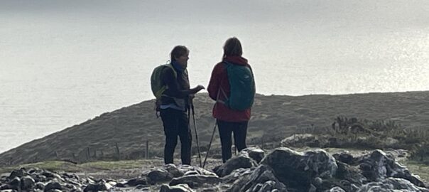
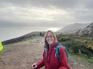
There was a good turn out – though two of the team did have to drop out at lunchtime, which left me the only male of the species for the remainder of the walk. The weather started out dry-ish with a little light rain as we climbed up Bray Head, but it cleared beautifully when we got to the top, revealing extensive views particularly to the north, and a rainbow even put in an appearance to add a splash of colour to the scene.
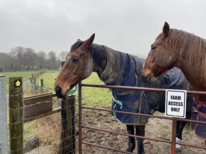
From the summit we descended to Belmont – where there’s a café though we chose to press on today, and enjoy our sandwiches somewhere a bit less commercialised. So we plodded up the second hill of the day, an ascent of Little Sugarloaf – which included crossing a field with a rather large looking bull with a load of calves running loose in it. Needless to say, we stuck together and didn’t hang around to take photos on this leg of the journey.
Lunch was on the flanks of the mountain – a good spot although the view was obscured by a thick bank of fog and drizzle which inconveniently swept across just as we were enjoying our sandwiches. Anyway, it soon cleared and by the time we had finished lunch and completed the ascent of the Little Sugarloaf, it was once again pretty clear.
The return journey more-or-less retraced our steps, though with a couple of short diversions to add a bit of interest. We made it to the car uneventfully just before five pm and still with quite a lot of light left in the sky.
We were starving by the time we got back to the flat so Val nipped down to Beshoff’s fish and chip shop to get a couple of fish suppers which we enjoyed with a couple of bottles of beer that I got at SuperValu, and an episode of the Sopranos. All in all, a great day.
Today’s photos (click to enlarge)
 |
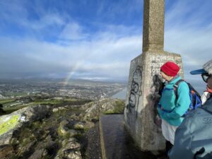 |
| Val enjoying the rarefied atmosphere of Bray Head | By the cross on Bray Head overlooking Bray. A rainbow even put in a brief appearance as we gazed at the view |
 |
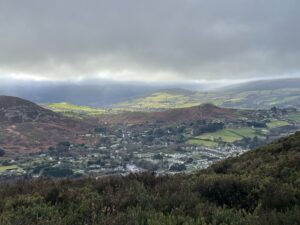 |
| We had a placid equine audience as we started the ascent of Little Sugarloaf | Kilmacanogue from the top of the Little Sugarloaf |
 |
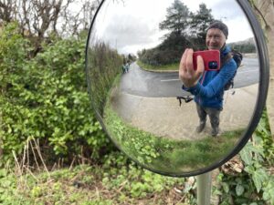 |
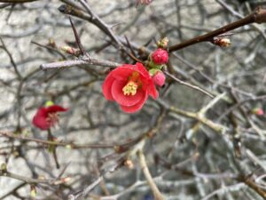
| Early signs of spring just popping up – this was a red flowering quince on the roadside near Belmont. A cheering sight | The man in the mirror |
 |
|
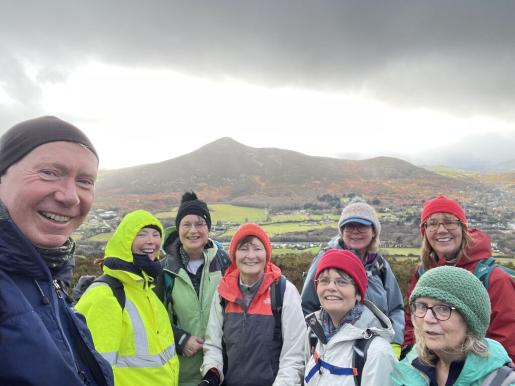
| Happy hikers on the slopes of the Little Sugarloaf this afternoon, with the Great Sugarloaf behind. A bit of a lack of Y chromosomes for the latter part of the walk | |
Interactive map
(Elevations corrected at GPS Visualizer: Assign DEM elevation data to coordinates )
Max elevation: 326 m
Min elevation: 3 m
Total climbing: 768 m
Total descent: -768 m
Total time: 06:39:06
You can read earlier and later days’ blogs below
Previous day’s blog
Next day’s blog
Ireland home page
 Save as PDF