Ireland day 0748. Monday 16 October 2023- Beara day 6
| Today’s summary | Took the ferry from Castletownbere to Bere Island and completed a circular walk up to the western summit and back via the Ardnakinna lighthouse. Roast dinner in the cottage in the evening | ||||
| Today’s weather | Overcast but dry with occasional glimpses of sun. Strong easterly wind. Appx 13c | ||||
 |
 |
||||
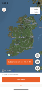
| Today’s overview location (The green mark shows the location of our route) |
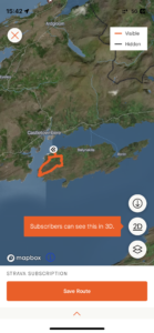
Close-up location (The orange line shows where we walked) (Click button below to download GPX of today’s walk as recorded, or see interactive map at bottom with elevations corrected): Bere Island and Ardnakinna |
||||
Commentary
(Summary blog only. Last full blog was Day 0368).
The day started with a bit of a disappointment- at least for some of our party. The female contingent had decided to make an early start and drive over to the Dzogchen Beara meditation centre to try out a bit of early morning early soul searching. So they were away by 8am, leaving us less reflective men back at the cottage making breakfast. Sadly, though, the session was cancelled, so they spent a few moments relaxing in the centre’s beautiful grounds, and then were soon back at the cottage.
Once they were back, we turned our collective minds towards planning the activities for the day.
Having visited two islands already during our explorations of Beara, we decided to make it a hat-trick and add Bere Island to the list today. It’s the biggest island in Bantry Bay and is easily accessed by ferry (a snip at €8 return for foot passengers) from Castletownbere.
We were aiming for the 11:30 ferry and so, after allowing time for the drive over to the ferry terminal, for car parking, for getting tickets and for general faffing around, that worked well give our already early reveille today. As it turned out, we needn’t have worried as it took us about ten minutes to get there, park and establish that you just walk onto the ferry and pay once you are onboard. So we had plenty of time to spare, which left me just long enough to go into SuperValu to buy some gloves and some jelly babies (which were delicious).
Despite the relatively strong wind, the journey across was pretty smooth and only took 15 minutes or so. The ferry deposited us, a few fellow foot-passengers (including a Dutch family) and one car on the pier, then loaded up, turned round, and disappeared off to the mainland. So we were left to it.
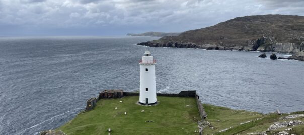
We had planned a circular walk which took in a couple of the many and confusing branches of the Beara Way to lead us up to the top of the island, westwards along the ridge, and then back via Ardnakinna lighthouse. Originally, we had anticipated catching the 6pm ferry back but once we had embarked on our route, we realised that we wouldn’t need anything like that long to complete the walk. So after a quick spot of Googling, we determined that there was a ferry three hours earlier, at 3:15pm, which we would be able to catch if we put our skates on. That would save us hanging about for a protracted period on a cold and windy island with no shop, café or pub on a grey October afternoon.
We very much enjoyed the walk, which offered spectacular, albeit grey, views in all directions. To the south we spied Mizen Head, which is Ireland’s most south-westerly point, while to the north was Dursey Island, with the telegraph tower we visited last Thursday just visible on the skyline. The wind felt thin and cold, so we didn’t linger, although we paused to take in the view from above the Ardnakinna lighthouse, spectacularly situated at a strategic point overlooking the western approaches to Castletownbere (which was, actually, a British Treaty Port after the 1922 Independence settlement, retained until 1938).
We arrived back at the ferry terminal with about 20 minutes to spare, just long enough to enjoy a late lunch in the waiting room. Once back on the mainland, we had time for a cup of tea and piece of cake at a harbour café then some shopping for dinner at the supermarket.
Rather than returning straight to our cottage, we took a detour to have a quick look at the picturesque but quiet village of Eyeries, then returned to start cooking the evening dinner. It’s chicken drumsticks, spareribs and roast potatoes tonight – an eclectic mix if ever there was one – and as it’s my turn to cook, I better get down to the kitchen now. And then we all need to do our packing as sadly we have to leave Beara tomorrow and head back to Dublin. Then it will be time to reflect on what has been, all in all, a great holiday.
Over and out from Beara!
Today’s photos (click to enlarge)
 |
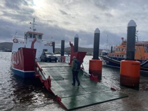 |
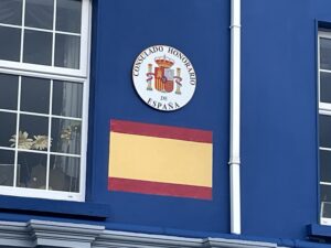
| Apparently a lot of Spanish fishing vessels visit Castletownbere – which probably explains this slightly incongruous signage above Rebecca’s nail bar | Joining the waiting ferry. It’s tiny, but the journey across only takes 15 minutes |
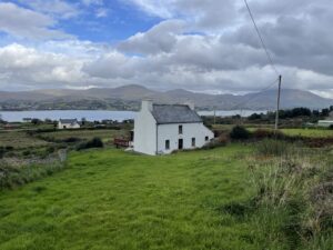 |
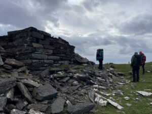 |
| Lots of quite smart farms and dwellings on Bere – but also a lot of derelict cars in various states of decay and definitely well past full running order | At the ruined signal tower on the hill above Derrycreeveen. It was built between 1804 and 1806 as part of the anti-Napoleonic defences, like the one on Dursey Island (which is just visible from the tower). It was still standing as recently as 1959, but since then has suffered lightning and wind damage, and now lies in ruins |
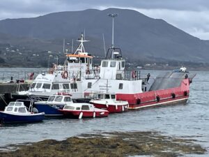 |
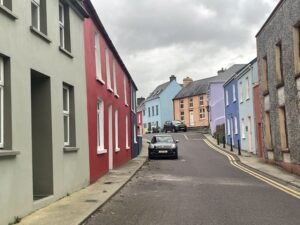 |
| The Bere island west ferry pier – not a lot here except a small waiting shelter (where you can your return the SuperValu shopping trolley that you brought over with you from the mainland), the ferry itself and a couple of fishing boats. | At the end of the day, we took a quick drive through the nearby village of Eyeries – very quiet this evening, but a colourful little town arranged in a ribbon alongside the main through-street |
 |
|
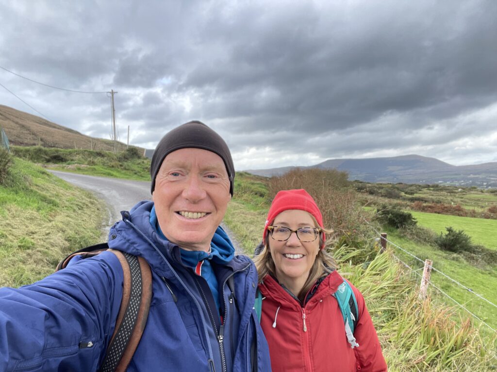
| On the way from the Bere Island west ferry pier and up to the Beara Way at the top of the island. Looking towards the western end of the Beara peninsula in the background | |
Interactive map
(Elevations corrected at GPS Visualizer: Assign DEM elevation data to coordinates )
Max elevation: 207 m
Min elevation: 1 m
Total climbing: 297 m
Total descent: -297 m
Total time: 02:54:06
You can read earlier and later days’ blogs below
Previous day’s blog
Next day’s blog
Ireland home page
 Save as PDF