Ireland day 0782. Sunday 19 November 2023- Trooperstown Again
| Today’s summary | Got a lift from a friend in Portmarnock and we drove down to Laragh to meet the rest of the DWC group for a circular walk from Trooperstown. Weather was a bit disappointing but an excellent walk nevertheless and some new faces too. Val was working in the evening so gave it a miss. | ||||
| Today’s weather | Heavily overcast with periods of rain. Moderate westerly wind. Appx 13c | ||||
 |
 |
||||
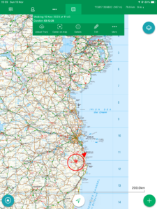
| Today’s overview location (The red mark shows the location of our route) |
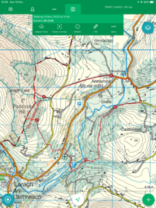
Close-up location (The red line shows where we walked) (Click button below to download GPX of today’s walk as recorded, or see interactive map at bottom with elevations corrected): Trooperstown circuit DWC again |
||||
Commentary
(Summary blog only. Last full blog was Day 0368).
Although I have done the Trooperstown walk at least twice before, I really enjoy it because it’s quite short (but not too short) and perfect for a claggy late autumn day like today when it never really seemed to get properly light. So I was delighted to see it listed for today on the Club walks programme – and even more delighted when a friend in Portmarnock offered me a lift, so I didn’t have to drive.
The only downside was that, in order to give everyone time for the obligatory pre-walk coffee and scones, whilst still leaving a decent amount of daylight for the walk itself, we had an early start. So I got up just after seven and we were on the road by 9 am. We arrived in plenty of time to drop into Lynams at Laragh for refreshments then drove on round to the Trooperstown car park. There was a decent turn out today (sixteen) as well as a couple of new people who I hadn’t met before, which was nice.
The walk was short but very enjoyable. Firstly up into the woods above the western side of the Avonmore river, and then along the Wicklow Way to the Mountain Meitheal hut at Brusher’s Gap. After a relatively brief stop for lunch in the very welcome dry (and recently cleaned) hut, we dropped back down to the bridge at Annamoe. I was disappointed to see that the quirky antique shop by the bridge appeared to have shut down, but excited to see a large deposit of dog sick slime mould (Mucilago crustacea) on the grassy slopes above the river (it was too disgusting to photograph).
From the bridge we returned through the beautiful beech woodlands on the eastern bank of the Avonmore river, and were back at the cars just as dusk was falling. An altogether perfect short walk, ideal for the day.
Val sadly missed the proceedings though, as she had work this evening and elected to have a more relaxing day back at the flat. She will be home from work at about 10pm so now I need to pull a hot meal together for her, as she is bound to be cold and wet. Unbelievable fortitude (but she tells me she enjoys it!)
Today’s photos (click to enlarge)
 |
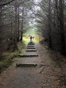 |
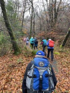
| Heading off out of the car park, past the Mountain Rescue HQ and up Paddock Hill | A bit deeper into the woods – all is quiet and dark (but sheltered from the wind) and the path is stepped |
 |
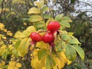 |
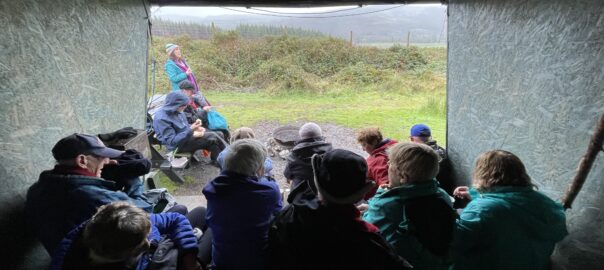
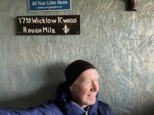
| Lunch stop in the Brusher’s Gap Hut on the Wicklow Way. It was erected by Mountain Meitheal Ireland and is an Adirondack shelter, which means one side is fully open (the side away from the prevailing wind). You can see the view out through the open side in the banner image at the top of this blog | Rose hips always look temptingly juicy and delicious, but they aren’t |
 |
 |
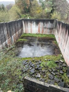
| A disused handball alley curiously situated right by the Avondale river at Annamoe bridge. Apparently handball was all the rage in Ireland in the past and every self respecting community had to have an alley. I never knew until someone explained it to me – I always thought it was some sort of disused water tank | The car park where we started was right by the Avonmore river. The Avonmore Way follows its course (though I’m not sure if it’s on a path or – more likely – on roads). We walked part of it when we walked from Rathdrum to Avondale with the club a few weeks ago |
 |
|
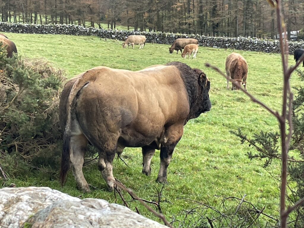
| Keeping a close eye on his hareem. You wouldn’t want to bump into him on a dark night | |
Interactive map
(Elevations corrected at GPS Visualizer: Assign DEM elevation data to coordinates )
Max elevation: 358 m
Min elevation: 149 m
Total climbing: 487 m
Total descent: -488 m
Total time: 04:16:12
You can read earlier and later days’ blogs below
Previous day’s blog
Next day’s blog
Ireland home page
 Save as PDF