Ireland day 0830. Saturday 06 January 2024- Stepaside
| Today’s summary | Joined the Walking Club for a circuit of the Dublin Mountain foothills from Stepaside. A clear, bright and chilly day with lots of people (and mountain bikes) out and about). Went for a meal at the Step Inn afterwards. A thoroughly enjoyable day though sadly Val missed it as she was putting in a shift at the Casino | ||||
| Today’s weather | Dry bright and cold all day with lots of sun and clear blue sky. Light westerly wind, feeling stronger as it was quite cold. Appx 6c | ||||
 |
 |
||||
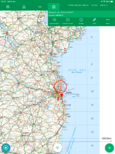
| Today’s overview location (The blue mark shows the location of our route) |
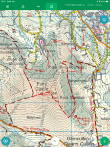
Close-up location (The blue line shows where we walked) (Click button below to download GPX of today’s walk as recorded, or see interactive map at bottom with elevations corrected): Stepaside and Dublin Mountains circuit DWC |
||||
Commentary
(Summary blog only. Last full blog was Day 0368).
There was frost on the roadsides as I left the flat bright and early this morning – the first time I’ve seen it, really, this year. I was heading down to Portmarnock to pick up a friend, while sadly Val had to go and earn a crust at the Casino. We were travelling today to Stepaside, on the south western fringes of Dublin, for a hike in the foothills of the Dublin Mountains with the Walking Club.
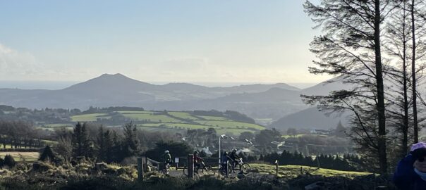
The Club usually chooses Stepaside for an early January walk as it’s easy for everyone to get to. That means we can schedule a reasonably early start, which is important at this time of year as the days are very short and the weather unpredictable. It’s a good choice as the scenery is accessible yet interesting, though the same factors make it a weekend destination of choice for multitudes of Dubliners, which meant that there were quite a lot of people out today. Plus the woodlands are a popular mountain biking centre, which means you have to have eyes in the back of your head to avoid crashing into a bike as they tend to pop out of nowhere and zoom across your path at high speed.
But we successfully dodged all the hazards and had a very enjoyable circular walk up to Two Rock, then down to the megalithic tomb, and back up to Fairy Castle, the highest peak on the walk. We closed off the loop with a visit to the ruined rifle range above Tiknock. But that wasn’t the end of the day, as out walk leader had booked us all into a local pub – the Step Inn – for a late lunch / early dinner afterwards, which was a huge success. A really enjoyable meal which felt specially well deserved after a good day in the hills and as darkness fell outside.
Back in the flat now, and Val and I are going to put our collective feet up and enjoy some light-hearted TV before retiring. A great day all around.
Today’s photos (click to enlarge)
 |
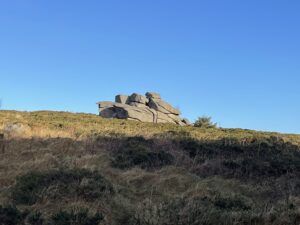 |
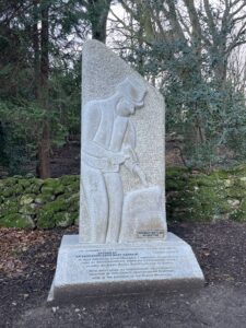
| Near the Stepaside car park – beautifully carved memorial to the stonemasons and miners who worked the granite quarries in the Dublin Mountains. We saw remains of several such quarries on our walk today | Looking like a battleship – the rocks on the top of Three Rock Mountain |
 |
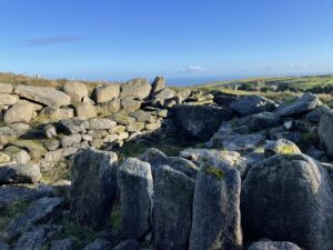 |
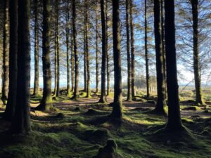
| I like these open pine woods that you can see through – though the path is criss-crossed by a mountain bike trail which bikers whizz down at high speed – so you have to have eyes in the back of your head | The ruins of the Ballyedmonduff megalithic gallery grave – thought to be about 4000 years old |
 |
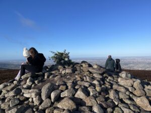 |
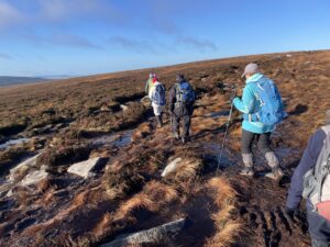
| Heading across the open moorland towards the Fairy Castle summit | Top of the Fairy Castle (536m / 1757ft) |
 |
|
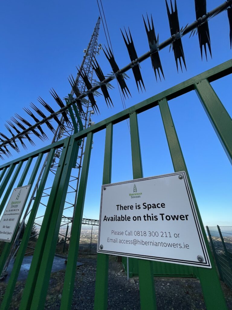
| Well if you ever needed space on a tower – this could be just the spot! | |
Interactive map
(Elevations corrected at GPS Visualizer: Assign DEM elevation data to coordinates )
Max elevation: 533 m
Min elevation: 152 m
Total climbing: 655 m
Total descent: -655 m
Total time: 05:28:12
You can read earlier and later days’ blogs below
Previous day’s blog
Next day’s blog
Ireland home page
 Save as PDF