Ireland day 0928. Saturday 13 April 2024- Mullaghcleevaun DWC
| Today’s summary | Finally managed to make it to the summit of Mullaghcleevaun with the Walking Club. I was supposed to lead this hike a few weeks ago but we were forced to cancel on that occasion because of snow. A good walk today, though the conditions were a bit challenging. Soaking wet peat hags and a vicious squall of icy rain on the top. All safely made it back to the cars and a reflected on a good day out all round | ||||
| Today’s weather | Some sun with occasional brutal squally rain at high levels. Strong to storm force wind. Appx 12c but colder on tops | ||||
 |
 |
||||
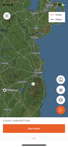
| Today’s overview location (The green mark shows the location of our route) |
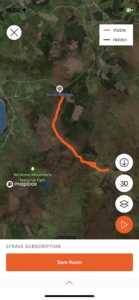
Close-up location (The orange line shows where we walked) (Click button below to download GPX of today’s walk as recorded, or see interactive map at bottom with elevations corrected): Mullaghcleevaun DWC |
||||
Commentary
(Summary blog only. Last full blog was Day 0368).
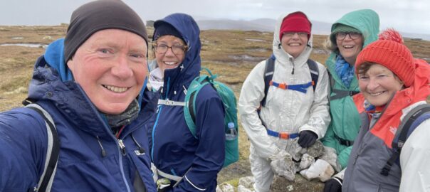
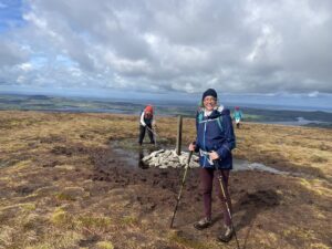
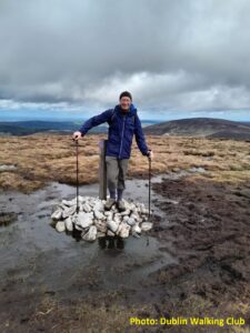
At last! We made it to the summit of Mullaghcleevaun today. I was supposed to lead this Club walk on 2 March but on that occasion, Dublin was hit by a snowstorm so unfortunately I had to cancel it. So today was the first opportunity we had to give it another go.
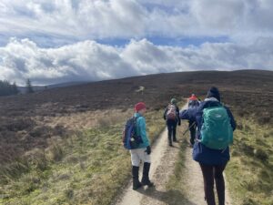
Five of us met up in Blessington then drove up to the car park at the Ballynultagh Gap, which was the start for today’s walk. It’s quite good setting out from there, as it saves you 440m / 1400ft of climbing – though obviously it’s not ideal if you are a mountaineering purist. When we set out, the weather was bright and sunny, with a strong wind and just a few clouds grazing the summits. So we felt pretty confident that we were in for a good day’s walking.
We easily reached the top of Black Hill but the going got significantly harder as we dropped down to the saddle linking Black Hill to Mullaghcleevaun. At this point, the path became absolutely saturated – it was like walking on a sponge – and it only got worse as we reached the peat hags on the lower slopes of Mullaghcleevaun itself. They are treacherous at the best of times, but today after months of endless rain, they were even more difficult to negotiate than usual.
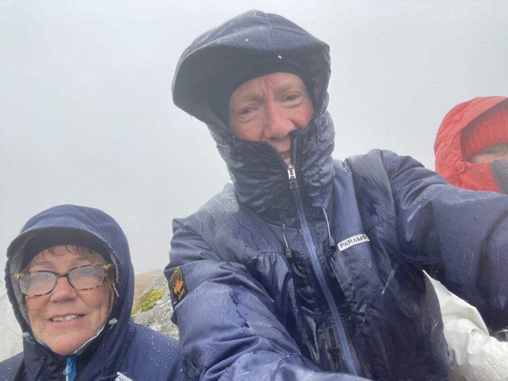
But we got through, and eventually reached the drier ground leading to the top. All seemed well as we approached the trig point, when suddenly and seemingly out of nowhere we got hit by a vicious squall of icy rain driven by a storm force wind. We sought shelter behind a barely adequate boulder and pulled all our waterproofs on and tried to cram down the odd sandwich and some hot coffee while we waited for the storm to pass.
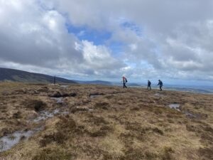
Eventually it eased a little so we set off into the mist and negotiated our way back down, retracing our steps and picking our route carefully through the hags. Finally, once we re-gained Black Hill, the clouds parted and we even had a bit of sun to warm us up as we plodded back to the cars.
We used the shelter of the cars to finish off our abandoned lunches, then went our separate ways home. This time, Val and I drove back via the Ballydonnell Brook and Upper Liffey valleys, which was beautiful and unspoiled. We’d never been there before and it would definitely be worth a longer visit.
We’re back at the flat now and slowly warming up and drying out. On reflection, it was a great day out though at times as we battled through the rain drench peat-hags, it didn’t much feel like it!
Today’s photos (click to enlarge)
 |
 |
| Weather was excellent, if a bit windy, as we set off from the car park at Ballynultagh Gap | Heading to Black Hill – the first summit |
 |
 |
| Val on Black Hill | Me on Black Hill |
 |
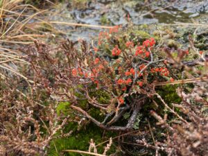 |
| On the lonely uplands. Amazingly just 1 hour from O’Connell Street | Cladonia floerkeana, Devils matchstick, an eye-catching lichen in the muddy undergrowth |
 |
|
| Mid-squall on the summit. Just about hanging on in there! Paramo kept us both completely dry | |
Interactive map
(Elevations corrected at GPS Visualizer: Assign DEM elevation data to coordinates )
Max elevation: 845 m
Min elevation: 441 m
Total climbing: 561 m
Total descent: -562 m
Total time: 04:39:40
You can read earlier and later days’ blogs below
Previous day’s blog
Next day’s blog
Ireland home page
 Save as PDF