Ireland day 0757. Wednesday 25 October 2023- Distant Views
| Today’s summary | While Val was at work I finished off the business proposal I had been working on then walked up Paddy’s Hill. Convinced myself I could see the Welsh mountains from Portmarnock beach. TV in the evening. | ||||
| Today’s weather | Mostly dry with long sunny periods. Light easterly wind. Appx 12c | ||||
 |
 |
||||
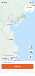
| Today’s overview location (The green mark shows the location of my route) |
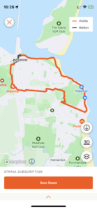
Close-up location (The orange line shows where I walked) (Click button below to download GPX of today’s walk as recorded, or see interactive map at bottom with elevations corrected): Distant views to Wales |
||||
Commentary
(Summary blog only. Last full blog was Day 0368).
Val has been working every day since Saturday this week, and that has given me the perfect opportunity to get on with the business proposal I’ve been working on. But I am a bit out of the habit of work and find it hard to spend all day behind a desk, writing. So I try to leaven the days up with a video call to friends first thing, to get things off on the right foot. So I did the same today, and spent the best part of the morning putting the world to rights with one of my friends in the UK, before settling down to work.
I eventually managed to finish the proposal and sent it off around lunchtime. That gave me the whole afternoon off – and free time seems a lot more precious when you feel as if you have had to work for it. So I took my packed lunch and walked up then hill, and on downwards to Portmarnock where I ate it on the beach.
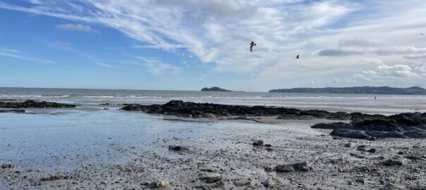
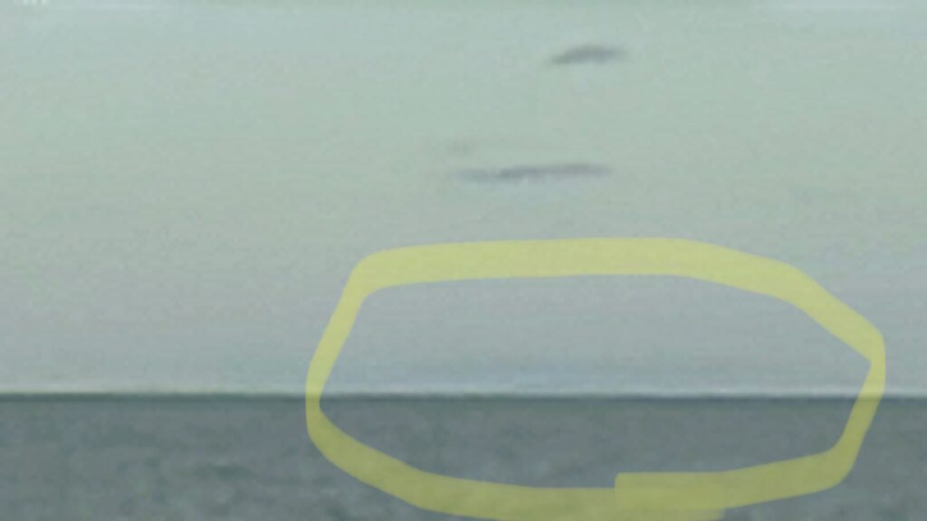
I’d already spied the Mournes from the top of the hill, but as ever the Welsh mountains on the eastern horizon had as ever remained elusive. But while I was sitting on the rocks dining in the sunshine, I am pretty sure that the horizon cleared a little and I think I could just about pick out Holyhead Mountain on the island of Anglesey, 100km / 60 miles away. The smudge was in just the right place, according to my map, and sufficiently indistinct to reflect the distance. Take a look at the photo below and see what you think. I know it’s not very convincing, and that the camera never lies, but you had to be there..
Anyway, after lunch I headed off back round the coast and was back in the flat by 4pm. Val had a short day, so was home momentarily after me. We’re finishing off the roast lamb from yesterday for our dinner now, and Val is settling down to watch “The Crown” on Netflix for the twenty-fifth time. More adventures tomorrow!
Today’s photos (click to enlarge)
 |
 |
| Bright Hypericum growing by Bawn Grove. It almost resembles a daffodil, in size, shape and colour. It won’t be all that long before the real ones are poking their heads up above the winter soil | It’s really annoying that after more than two years there is still no footpath to Jameson Orchard from the top of Seamount Road. A classic case of developers prioritising motorists over pedestrians |
 |
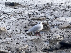 |
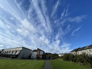
| Big skies over the Jameson Orchard estate | A rather smart looking black headed gull (Larus ridibundus) in its winter plumage came to visit me while I was having lunch on Portmarnock beach |
 |
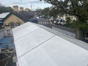 |
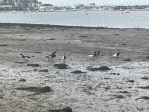
| The Brent Geese (Branta bernicla hrota) are back in Malahide after their peri-Arctic migrations. They are always a welcome sight | The engineers who are doing the massive nocturnal track repair work just south of Malahide station seem to have taken up more or less permanent residence, if this giant tent which appeared a couple of days ago is anything to go by |
 |
|
| I managed to convince myself that the dull smudge on the horizon (circled) which I saw from just above Portmarnock beach, was Holyhead Mountain on Anglesey, Wales. It is 100km away | |
Interactive map
(Elevations corrected at GPS Visualizer: Assign DEM elevation data to coordinates )
Max elevation: 50 m
Min elevation: 0 m
Total climbing: 121 m
Total descent: -121 m
Total time: 03:01:23
You can read earlier and later days’ blogs below
Previous day’s blog
Next day’s blog
Ireland home page
 Save as PDF