Ireland day 0647. Friday 07 July 2023- Slieve Gullion Recce
| Today’s summary | Joined a couple of walking club friends for a recce of Slieve Gullion, Co. Armagh | ||||
| Today’s weather | Mild and sunny over most of Ireland except Slieve Gullion where it was cold windy foggy and very wet. Strong to gale force southerly wind on the top. Appx 21C at sea level, 14C in the rain and wind on top | ||||
 |
 |
||||
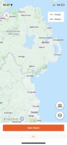
| Today’s overview location (The green mark shows the location of our route) |
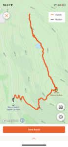
Close-up location (The orange line shows where we walked – out and back the same way) (Click button below to download GPX of today’s walk as recorded, or see interactive map at bottom with elevations corrected): Slieve Gullion Recce |
||||
Commentary
(Summary blog only. Last full blog was Day 0368).
The walking club is beginning to pull together its autumn programme (slightly depressing I know) so Val, a couple of friends, and I, decided to head north of the border, to County Armagh, to check out the possibilities for walks in the Slieve Gullion area – which was completely unexplored to me.
The day started out very promising – it was mild and dry in Malahide – already at nearly 20C when we left at 9am this morning. But by the time we arrived at the Carrickdale Hotel for obligatory pre-walk coffee and scones, the weather out to the West, over Slieve Gullion, was looking distinctly ominous. After refreshments, though, and once we reached the car park at the start of the walk, it had brightened up a lot. But that soon changed once we started walking and by the time we reached the top, it was blowing a whole gale, pouring with cold rain, and we were enveloped in thick mist.
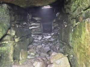
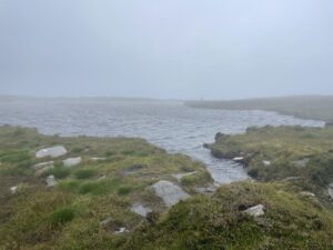
We paused briefly to examine the extremely well preserved passage tomb on the top, then explored a bit further north along the path past Caillagh Beara’s Lough. We had intended pressing on further still, perhaps as far as the road at the north end, but given the weather and mindful of the fact that we would have to retrace our steps to the car park into the teeth of the weather – we turned round and headed back the way we had come.
On the way down, we found a good stone shelter for lunch, but still no views. By the time we arrived at the car, the fog was right down to road-level. There was just time for another cup of tea in the forest park visitor centre (remembering just in the nick of time to pay in £ not €) before heading down the M1 and an uneventful trip to Malahide.
So although the weather was a bit disappointing, it was a fascinating and successful trip. And I was glad that the weather we was the only thing we had to worry about today. Not that long ago, much of South Armagh, including the area we were in today, was pretty much off-limits for walkers, as a result of armed conflict overspilling from the Troubles. I hope those days never return.
Today’s photos (click to enlarge)
 |
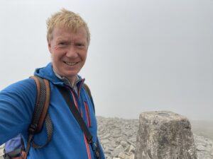 |
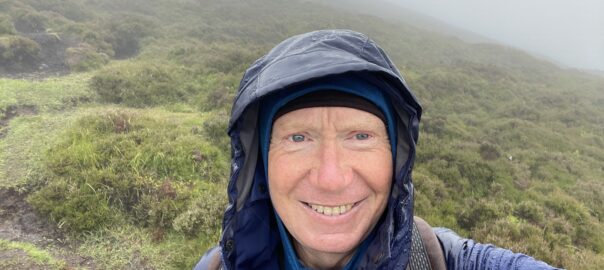
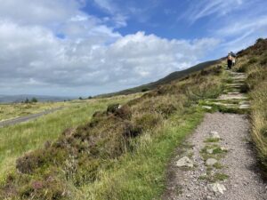
| Path up Slieve Gullion from the top car park. The weatehr was good when we set off – in fact we all even put sun cream on. But it soon deteriorated pretty spectacularly | On the top. Haircut required next week! |
 |
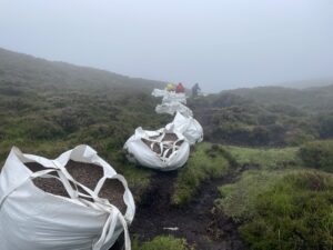 |
| Inside the passage tomb in the South Cairn on the summit. It’s actually remarkably well preserved considering that it’s 5,500 years old | Apparently Slieve Gullion was closed for a week recently, so a helicopter could fly in these dozens of bags of ballast rocks and gravel, which are in the process of being used to reinforce the path down from the north summit to the road |
 |
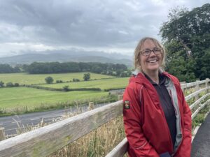 |
| Caillagh Beara’s Lough, slightly remarkably situated on a flattish bit of the summit ridge between the south and north cairns. There’s lots of folklore surrounding this spot – best just to look it up as it’s extremely confusing! | Back down again at the forestry centre car park. Behind Val is southern Armagh, and then the Cooleys (which are actually in the Republic) |
 |
|
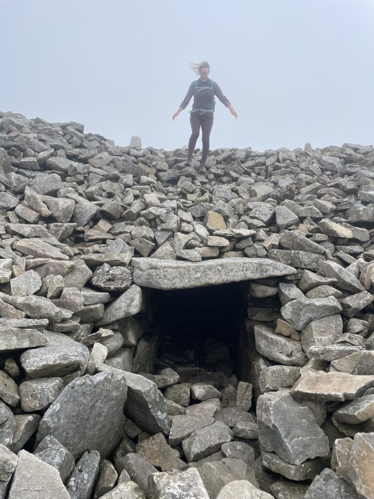
| Val looking like she hasn’t got a care in the world as she skips her way down the south cairn to check out the entrance portal to the passage tomb | |
Interactive map
(Elevations corrected at GPS Visualizer: Assign DEM elevation data to coordinates )
Max elevation: 574 m
Min elevation: 358 m
Total climbing: 401 m
Total descent: -400 m
Total time: 02:58:50
You can read earlier and later days’ blogs below
Previous day’s blog
Next day’s blog
Ireland home page
 Save as PDF