Ireland day 0746. Saturday 14 October 2023- Beara day 4
| Today’s summary | Val and I climbed up Hungry Hill via the steep and rocky south east ridge. Quite an epic but outstandingly satisfying. Good weather too, with clear skies, plenty of sun and moderate winds. Dinner tonight at “Beara Necessities” café in Eyeries | ||||
| Today’s weather | Light shower in the morning then bright and breezy with plenty of sun all day. Moderate to strong north easterly wind. Appx 14c but quite cold on the top | ||||
 |
 |
||||
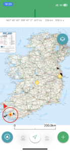
| Today’s overview location (The red mark shows the location of our route) |
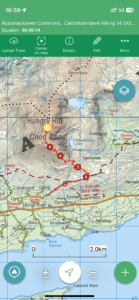
Close-up location (The red line shows where we walked) (Click button below to download GPX of today’s walk as recorded, or see interactive map at bottom with elevations corrected): Hungry Hill |
||||
Commentary
(Summary blog only. Last full blog was Day 0368).
I had been watching the weather forecast carefully all week, hoping for a break in the wind and rain so we could attempt an ascent of Hungry Hill, the highest point in the nearby Caha Hills. Today had always looked like it might be the best chance we would have, and indeed when we got up, the last of the overnight rain had stopped and the sun was shining. It was windy, but not unmanageably so.
Our party of four spilt into two groups – Val and I elected to attempt the ascent, whereas the others decided to stay at a lower level and explore Eyeries and its environs.
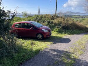
One of the hardest parts of the day was actually working out where the path started, and what the route up the hill was. After a bit of online searching, downloading a few GPX files and recalling conversations with walking club friends, I decided that parking at the end of a narrow boreen just above the settlement of Scart would be the most likely place to try and park and to start the walk. It’s just off the R572 and about half way between Castletownbere and Adrigole. About 20 minutes drive from our cottage in Eyeries. And then we would follow a zig-zagging route up Hungry Hill’s south east ridge.
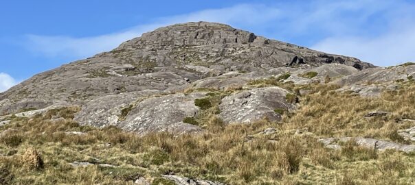
So that basically is what we we did. Hungry Hill is quite a daunting looking mountain, and even though it’s only 685 metres (2,247 ft) high, it’s flanked on all sides by steep slopes, covered in large exposed slabs of rock and I don’t actually think there’s an easy way up. It features, in slightly embellished form, in Daphne Du Maurier’s eponymous 1943 novel. Our route started out from the the top of the boreen, where we left the car, and which quickly rises up to join the Beara Way, which flanks the lower slopes of Hungry Hill at this point.
But our route soon left the easy passage of the Beara Way and veered off to join the steep ascent of the south east ridge. There was no path, and at many points the route ahead looked completely impossible. But I was following a GPX track, recorded by someone who had actually navigated the ridge, so I knew we would make it in the end.
So we took our time, and wove our way through the slabs, finding grassy ledges between the strata that could be joined up to zig zag us up to the summit plateau. Eventually, after about two hours on the ridge, we reached the south summit and from there it was a straightforward, if slightly boggy, 600m walk across the plateau to the main top. It took us two and a half hours to get there, even though the summit is relatively low and we’d only climbed up 600 metres / 2000 ft.
We bumped into two other walkers at the top – we only saw one other on the whole route all day – where we paused briefly for lunch and a chat while we were admiring the view. From the top, we just retraced our steps exactly to get back down. But we weren’t much quicker on the return journey, as we didn’t want to risk accident among these remote steep slabs. We also bumped into a Finnish lady who was out for the day and was just returning from her own ascent of Hungry Hill (much quicker than ours!) But we got back to the car without incident, and then quickly returned to Eyeries.
Tonight we are eating at the “Beara Necessities”(very original!) café in Eyeries, so I need to sign off now and go and make myself look beautiful!
Today’s photos (click to enlarge)
 |
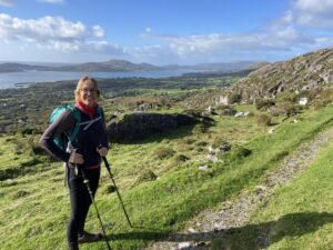 |
| Just managed find a spot off the road to leave the trusty Yaris, towards the top of a narrow boreen | At the end of the “easy” stretch along the Beara Way before heading up the ridge |
 |
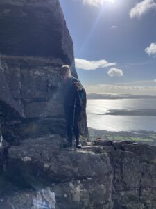 |
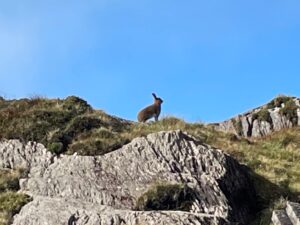
| A mountain hare (and a superbly ruddy brown fox) hopped out to check on who was invading his territory | Val teetering along a particularly exposed section, weaving through the rocky slabs |
 |
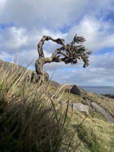 |
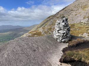
| A brilliant quartzite cairn suddenly pops up, to confirm you are heading the right way. Its curiously placed, with no visible tracks leading to or from it | Windshaped gorse bush, strangely reminiscent of the Sabinar trees on the Canarian Island of El Hierro |
 |
|
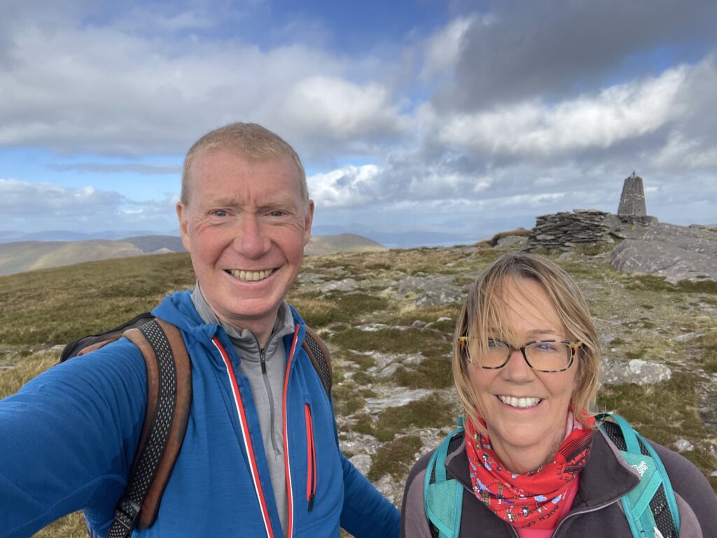
| At the top. It’s a large flat plateau between the south and (higher) north tops, which comes as quite a relieve after the slog up. You can see Carrauntoohill and the Kerry mountains on the horizon between our heads | |
Interactive map
(Elevations corrected at GPS Visualizer: Assign DEM elevation data to coordinates )
Max elevation: 680 m
Min elevation: 89 m
Total climbing: 703 m
Total descent: -703 m
Total time: 05:05:33
You can read earlier and later days’ blogs below
Previous day’s blog
Next day’s blog
Ireland home page
 Save as PDF