Ireland day 0704. Saturday 02 September 2023- Rathdrum
| Today’s summary | A good long hike from Rathdrum to Glendalough in perfect weather with the Walking Club. Superb day out. Best weather yet this year | ||||
| Today’s weather | Foggy and drizzly first thing in Dublin; brilliantly sunny warm and calm for the rest of the day in Wicklow. Very light north westerly breeze. Appx 20C | ||||
 |
 |
||||
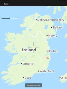
| Today’s overview location (The orange mark shows the location of our route) |
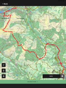
Close-up location (The orange line shows where we walked) (Click button below to download GPX of today’s walk as recorded, or see interactive map at bottom with elevations corrected): Hills of Howth walk |
||||
Commentary
(Summary blog only. Last full blog was Day 0368).
The day dawned grey and misty with a thick drizzle in Dublin today. Not a very auspicious start. Nevertheless, we dragged ourselves out of bed and into the car, and headed off round the M50 to join the walking club down at Glendalough, perhaps with more hope than expectation of a decent day’s walking.
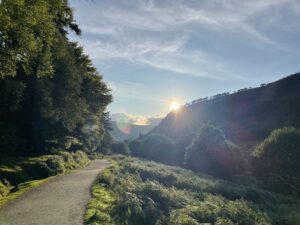
But soon after we left Dublin and headed down the M11, the skies began to clear and by the the time we were winding our way up the Rocky Glen from Kilmacanogue, the sun was fully out and the sky was a clear blue. And it stayed that way all day, giving us perhaps the best day’s walking we have had this year.
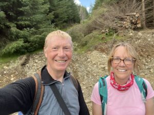
We met up with the rest of the club in Glendalough then did a bit of a car-shuffle to get down to Rathdrum, leaving half the vehicles behind at Glendalough. Once we had all reconvened at Rathdrum, we set off to walk back over the hills to Glendalough.
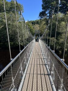
The route started down by the river Avonmore, and it was beautiful. Crystal clear with a magnificent peaty orange hue. An new suspension bridge took us across to the far side, and we walked upstream on the riverbank for a few km before crossing back to the west (after a brief early morning sandwich stop) at Clara bridge.
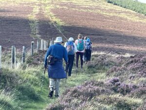
At that point, we left the valley and ascended quite steeply but steadily, up the slopes of Kirikee, reaching the top in time for our “proper” lunch near the summit. At just over half way, and still in full sun, it seemed like a good place to stop.
After a good pause for lunch and to catch our breath, we went on down to the Shay Elliott memorial on the Glenmalure road, and I was back on familiar territory (all the route up to that point had been completely new to me and I thoroughly enjoyed it). A further ascent saw us quite quickly at the top of Cullentragh – and it was nice to be up there in decent weather, as the previous two times I had visited, it was cold, damp and blowing a gale.
The route pressed on over Braigue mountain and branched off to the right in the direction of the Derrybawn Ridge and the end of the walk at Glendalough. We took this section steadily, as it’s quite rough and the descent of the end is quite tricky and slow. But we made it into the Glendalough valley with a couple of hours daylight left, and a few people still out and about enjoying the dying moments of a beautiful day.
At over 22km, it was one of our longer walks and possibly, given the superb weather and memorable scenery, one of our best in Ireland. A quick car shuffle back to Rathdrum and then a spin up the M11, M50 and M1 saw us back in Malahide in not much over an hour, famished, thirsty and ready to crash out and bask in the afterglow of one of our best days out in ages.
Today’s photos (click to enlarge)
 |
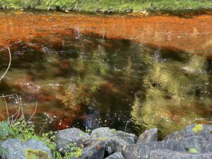 |
| Bridge over the Avonmore rived near Rathdrum at the start. The original bridge was designed by Samuel Hayes, owner of Avondale House. It was based on the “Mathematical Bridge” at Queens College Cambridge | Peat-stained Avondale river catching the sunshine |
 |
 |
| On the ascent of Kirikee mountain | Along the tops near Cullentragh and leading to the Derrybawn ridge, above the Shay Elliott memorial |
 |
 |
| Back in Glendalough, near the Information office between the two loughs | Looking back from above the Lower Lough, towards the setting sun above the Upper Lough |
 |
|
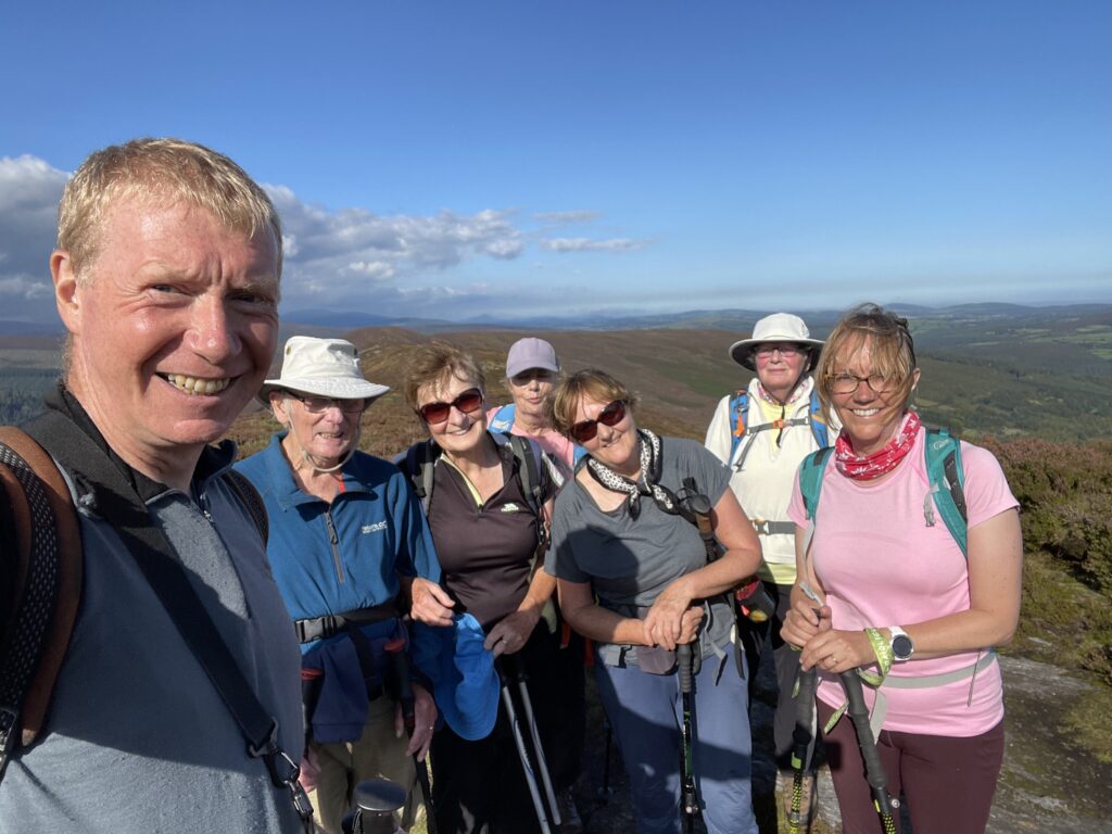
| All of us made it! On the top of Derrybawn Mountain | |
Interactive map
(Elevations corrected at GPS Visualizer: Assign DEM elevation data to coordinates )
Max elevation: 509 m
Min elevation: 77 m
Total climbing: 859 m
Total descent: -856 m
Total time: 08:44:29
You can read earlier and later days’ blogs below
Previous day’s blog
Next day’s blog
Ireland home page
 Save as PDF