Ireland day 0945. Tuesday 30 April 2024- Cairngorms 2
| Today’s summary | Drove down to Ballater with our friends and completed the “Seven Bridges” walk up the banks of the Don. The weather co-operated and we enjoyed fine sunshine for our excursion today. Went to watch the grouse “lekking” (countship dance) in the evening (didn’t see any but lots of other wildlife) | ||||
| Today’s weather | Dry and bright with plenty of sun. Moderate south easterly wind. Appx 11c | ||||
 |
 |
||||
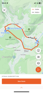
| Today’s overview location (The green mark shows the location of our route) |
Close-up location (The orange line shows where we walked) (Click button below to download GPX of today’s walk as recorded, or see interactive map at bottom with elevations corrected): Seven Bridges Ballater |
||||
Commentary
(Summary blog only. Last full blog was Day 0368).
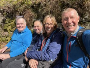
Being high up in the Cairngorms, you never quite now what the weather is going to be like. But today turned out to be perfect. So as soon as we had finished breakfast (which, let’s be honest, wasn’t early), we drove down the Glen to Ballater and embarked on the Seven Bridges walk.
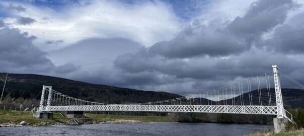
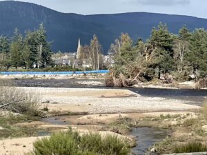
It’s an excellent loop walk which follows the bank of the River Dee upstream as far as the Polhollick suspension bridge – though today it was diverted slightly inland as a result of flood damage to the riverbank. We paused after crossing the bridge for a brief refreshment break then headed back down the other river, through the forest and into Ballater again. We arrived just after 4pm so all the cafés were closed, so we returned to base for tea and cakes instead.
In the evening, the local gamekeeper took us out in his Landrover to to see if we could see the grouse “lekking” a courtship (dance). Sadly they had all decided to stay at home tonight but we saw lots of wildlife instead – buzzards, a golden eagle, kestrel, mountain hares and a brown hare, a few black grouse and a lamb who popped into the world just as we drove by. A real privilege. What a day!
Today’s photos (click to enlarge)
 |
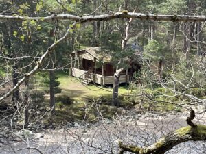 |
| Setting out from Ballater | Riverside lodge where Prince Andrew and Jeffrey Epstein (allegedly) went fishing |
 |
 |
| Lunchtime! (almost) | Korean fir (Abies koreana) with young cones |
 |
 |
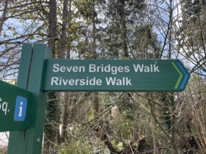
| Looking across the flood defences (in blue) to Ballater | New signage! |
 |
|
| Towards Ben Avon from Carn Ealasaid this evening. Sublime | |
Interactive map
(Elevations corrected at GPS Visualizer: Assign DEM elevation data to coordinates )
Max elevation: 237 m
Min elevation: 195 m
Total climbing: 225 m
Total descent: -225 m
Total time: 02:44:17
You can read earlier and later days’ blogs below
Previous day’s blog
Next day’s blog
Ireland home page
 Save as PDF