Ireland day 0919. Thursday 04 April 2024- Devils Recce
| Today’s summary | Val and I and two friends from the Portmarnock area drove down to Co Wicklow to recce the Devils Glen and Seamus Heaney walks for a Club outing in May. An excellent day out despite a slow drive back. Perfect weather interlude between the rain in the morning and more rain later in the evening | ||||
| Today’s weather | Rain overnight and again in the evening but dry and bright with some sun during the day. Light easterly wind. Appx 9c | ||||
 |
 |
||||
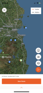
| Today’s overview location (The green mark shows the location of our route) |
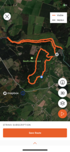
Close-up location (The orange line shows where we walked) (Click button below to download GPX of today’s walk as recorded, or see interactive map at bottom with elevations corrected): Devils Glen Seamus Heaney recce |
||||
Commentary
(Summary blog only. Last full blog was Day 0368).
Today we were pretty lucky. We had pencilled in a recce for a Club walk that I am co-leading in May, and were sincerely hoping for good weather. It didn’t look great, I have to admit, when we left the flat at 9am today, heading to Portmarnock to pick up our two co-explorers. Thick drizzle and heavy cloud gave every appearance of being settled in for the day, so we braced ourselves for a day in plastic.
Anyway, by the time we were round the M50 and heading south, it had brightened considerably and once we reached our goal for today – the Devil’s Glen car park – there was actually a glimmer of sun in the sky.
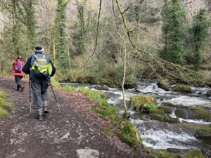
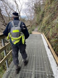
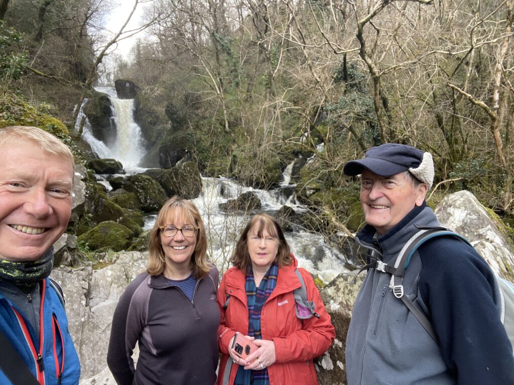
We’d been down this way once before – in July last year – so the terrain was familiar. We set out on the Devil’s Glen walk first. It was a slightly tricky descent to the river, on account of the numerous fallen trees blocking the path. But the waterfall at the end of the glen was in full spate and rewarded us with a magnificent tumultuous cataract. We returned on the higher level side of the glen – which was quite a lot easier – then had our lunch at a picnic table by the car park.
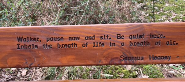
After a fairly brief break, we set off again to complete the Seamus Heaney walk which was relatively straightforward with fewer fallen trees but plenty of mud. The views from the seat overlooking Wicklow halfway round were magnificent.
We made it safely back to the car without getting wet at all and then drove down to Ashford to get some refreshment in the café at the Mt Usher Garden. Very enjoyable though I think I got a lifetime’s dose of cholesterol in one slice of chocolate cake.
The journey back to Portmarnock and Malahide was straightforward but slow. Google showed a 35 min delay on the M50 so I decided to go straight through Dublin across the East Bridge and through the tunnel. I’m not really sure that it was a good decision, as it was also very slow and it took us nearly two hours to get back (the journey down had taken just 63 mins).
Anyway, an excellent and successful recce and I think the May walk will go well. Though we may need to modulate the route a little, depending on the Group’s activities.
Time to stop now, to go and enjoy some more of Val’s excellent tomato curry!
Today’s photos (click to enlarge)
 |
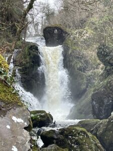 |
| Down in the Devil’s Glen, heading upstream alongside the Vartry River | Impressive waterfall in full spate today at the head of the glen |
 |
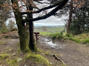 |
| On the upper level walkway back from the waterfall, with excellent views across the glen – another of those impressive periglacial features, similar in origin to the Glen of the Downs (i.e. eroded by high pressure meltwater from the deglaciation at the end of the last Ice Age about 12,000 years ago) | Seat with a view – across the County to Wicklow and the coast, from the Seamus Heaney walk |
 |
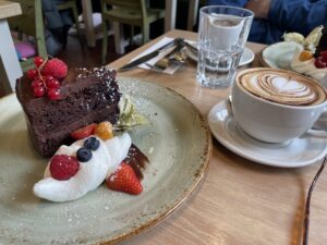 |
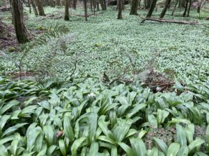
| Acres of wild garlic. I don’t think I have seen quite so much in one place before. It was just coming into flower and it tasted delicious! It would be called “Ramsons” in the UK but that’s an unknown word here in Ireland | Quite possibly the biggest piece of chocolate cake I have ever eaten – in the café at Mt Usher Gardens after the walk. I probably won’t need to eat for a week |
 |
|
| Expeditionary force at the waterfall in the Vartry River at the head of the Glen. In full spate today – the photo hardly does it justice | |
Interactive map
(Elevations corrected at GPS Visualizer: Assign DEM elevation data to coordinates )
Max elevation: 234 m
Min elevation: 57 m
Total climbing: 734 m
Total descent: -734 m
Total time: 04:12:18
You can read earlier and later days’ blogs below
Previous day’s blog
Next day’s blog
Ireland home page
 Save as PDF