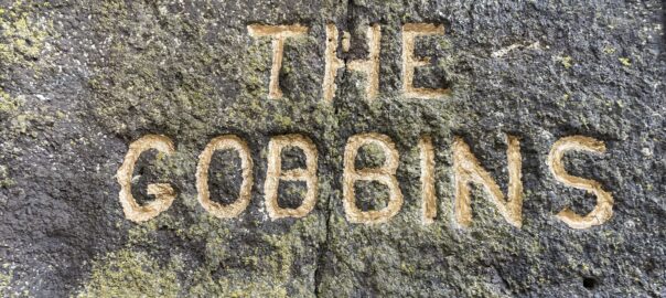
Ireland day 0920. Friday 05 April 2024- The Gobbins
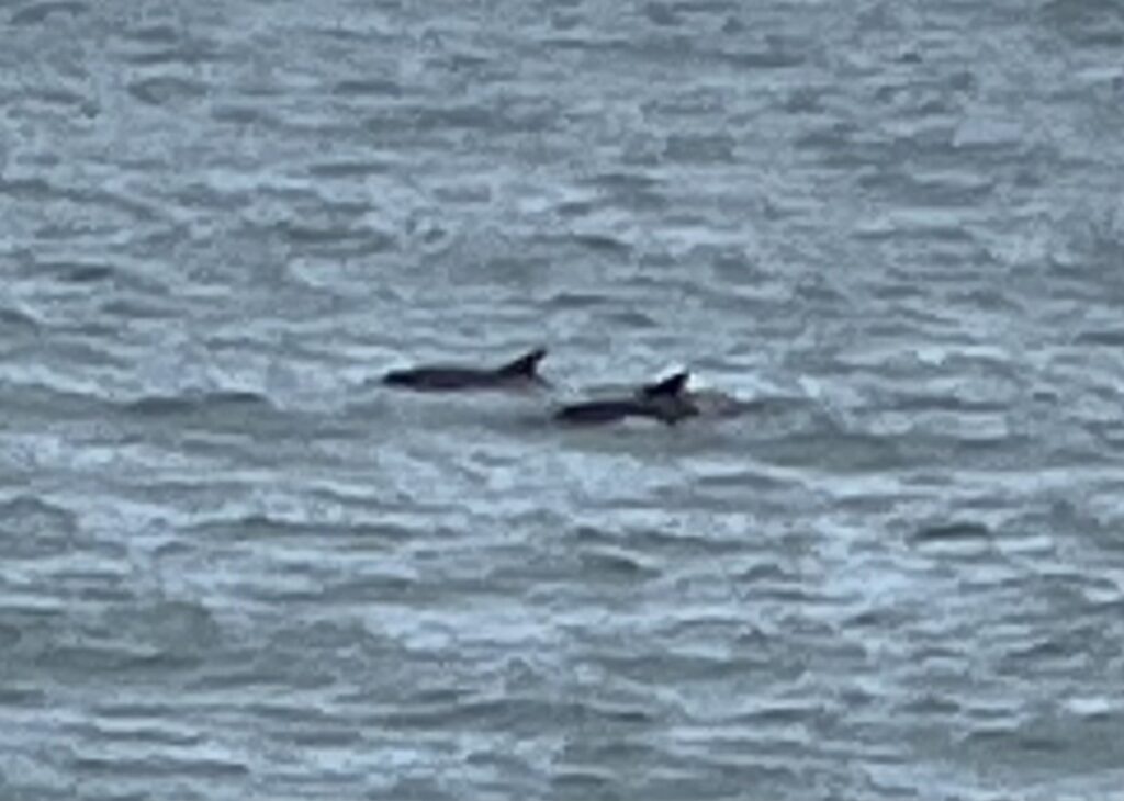
| Today’s summary | Drove 2½ hours up to the North to visit the Gobbins cliff walk in Co. Antrim. Absolutely excellent and well worth the long drive. The walk was exhilarating and exciting, up steel ladders, over bridges above the ocean, and through water-filled tunnels. And we were accompanied by a pod of some 20 dolphins, which made the day perfect. | ||||
| Today’s weather | Occasional showers but mostly dry. More persistent rain in the evening. Moderate southerly wind. Appx 14c | ||||
 |
 |
||||
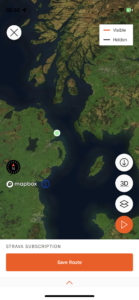
| Today’s overview location (The green mark shows the location of our route) |
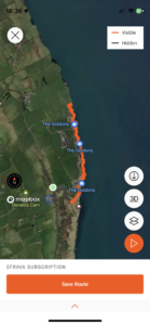
Close-up location (The orange line shows where we walked) (Click button below to download GPX of today’s walk as recorded, or see interactive map at bottom with elevations corrected): The Gobbins |
||||
Commentary
(Summary blog only. Last full blog was Day 0368).
Superb. That’s the only adjective to describe our day out today, way up in the North, exploring a part of the Antrin Coast known as the Gobbins.
OK it’s a long-ish (2½ hour) drive from Malahide, but pretty straightforward and absolutely worthwhile. The Gobbins (which is said to mean “Mouth of the Mountains”) is a metal walkway bolted to the cliffs just outside the village of Ballycarry. It was built in 1902 by the celebrated railway engineer Berkeley Deane Wise (he also built the tunnels on the Bray to Greystones railway) and it had no purpose other than as a tourist attraction to try and increase the use of the rail network at the weekends.
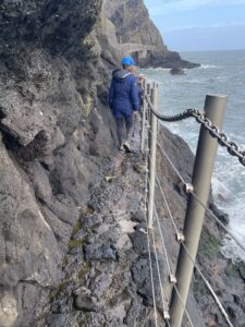
It proved successful and is even more so now 122 years later (though it was closed for extended periods between then and now). The “path” such as it is takes you along narrow rock terraces, through tunnels and across bridges, all just a few metres above the raging Irish Sea below. It’s fantastic but what made this a 10/10 experience today was the appearance of a pod of some twenty dolphins, close offshore, who seemed to follow us up and down the coast as we walked. They were truly impressive, though I did slightly feel for our tour guide, who struggled to hold our attention as these magnificent creatures gracefully arced through the ocean just over his shoulder.
The clamber to the end of the walkway and back took 2 hours though it felt like five minutes, it was so interesting. You congregate before and afterwards at the nearby visitor centre for a safety briefing then get driven to the actual start in a minibus. There’s a decent café at the visitor centre, which of course we had to make full use of for refreshments at the end.
A straightforward journey back to Malahide afterwards, and now it’s time to rustle up some dinner, get a beer, and sit back to reflect on a truly memorable day out.
Today’s photos (click to enlarge)
 |
 |
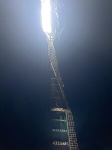
| Typical hiking terrain. The walkway is an out-and-back linear route about 2.5 km each way and you walk in a guided group of 15. | The Tubular bridge, built, apparently, to show how rail tunnels were lined for strength |
 |
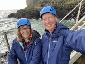 |
| In the tunnel. The bottom is actually below sea level so you get wet feet! | At the far end of the walkway, before turning on our heels and returning the way we had just come. Note the elegant headgear |
 |
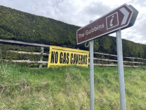 |
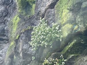
| Scurvy-grass growing on the cliffs. It is rich in Vitamin C and was chewed by sailors in days gone by to ward off – unsurprisingly – scurvy | The Gobbins are in a part of Antrim called Islandmagee. There is a geological feature known as a salt dome underlying part of the region and there is a proposal to leach out some of the salt to create caverns to store gas. It would be natural gas at first, used to provide a strategic reserve in the event of supply interruptions, but possibly hydrogen produced from renewable electricity at a later date. As is often the case with big infrastructure projects, it’s not popular with the local population |
 |
|
| Perhaps the most magical feature of our adventure today was the appearance of a pod of about twenty dolphins just offshore. They seemed to follow us up and down the coast as we clambered about on our perilous journey. Truly spectacular. | |
Interactive map
(Elevations corrected at GPS Visualizer: Assign DEM elevation data to coordinates )
Max elevation: 82 m
Min elevation: 0 m
Total climbing: 829 m
Total descent: -822 m
Total time: 02:04:55
You can read earlier and later days’ blogs below
Previous day’s blog
Next day’s blog
Ireland home page
 Save as PDF