Ireland day 0620. Saturday 10 June 2023- Carrigllineen etc DWC
| Today’s summary | Went on a Walking Club hike from Glenmalure up Mullacor and Carriglineen. Collected Val from the airport in the evening | ||||
| Today’s weather | Thick murky overcast day with only occasional sun in the evening. A few drops of rain on a couple of occasions. Very light south easterly wind. Appx 18C | ||||
 |
 |
||||
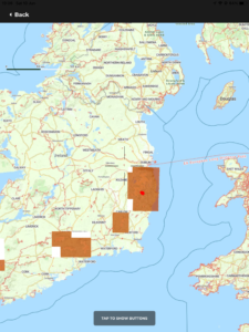
| Today’s overview location (The red mark shows the location of our route) |
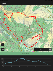
Close-up location (The red line shows where we walked) (Click button below to download GPX of today’s walk as recorded, or see interactive map at bottom with elevations corrected): Carrigllineen loop via Mullacor DWC |
||||
Commentary
(Summary blog only. Last full blog was Day 0368).
Val was still away in the UK today (though returns this evening) so I decided to join the walking club for a loop walk starting at Glenmalure, in the Wicklow hills. It’s quite a long drive to Glenmalure, with long stretches of winding narrow road (which I don’t especially like) so I had to leave before 8:30 this morning to be sure of getting there by 10 (though I was already wide awake, as a fire alarm went off at 6am somewhere in the building and catapulted me out of my slumber).
A group of 8 of us met in the car park by the Inn and headed off up in the Wicklow Way, onto the slopes of Mullacor (which we have climbed in the past). Much to my surprise, it started to rain almost as soon as we had set off, and it did so again later in the afternoon. Though on neither occasion did it last long enough to require waterproofs. Which was a good thing as it was an extremely close and humid day, as well as being quite warm, and I was already sweating buckets. I would probably have melted if I’d had to put on a cagoule as well.
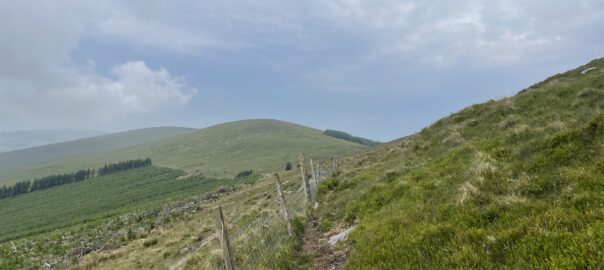
We skirted round the flanks of Mullacor, which made an interesting change, then down the broad ridge to the Shay Elliott car park, by way of Braigue Mountain and Cullentragh. Once across the road, we headed straight up to the summit of Carriglinneen (we had been to the slopes before, but never the top), which was a short but enjoyable climb. We scouted round at the top to see if there was a direct way down, but in all directions except the one we had come, the bracken, heather and gorse were too thick. So we retraced our steps as far as a fence halfway back to the road.
From there, we followed a path, which became a track and then a road, which led us round the back side of Carriglinneen, and eventually to the cars at Glenmalure. All in all, it was another thoroughly enjoyable outing, and I’m beginning to be able to fill in some of the gaps in my knowledge of the geography of the Wicklow mountains now. It’s a lovely part of Ireland and I’m thoroughly enjoying exploring it.
But I must stop now, as a I need to make some dinner then head off to the airport to meet Val. It’s all go!
Today’s photos (click to enlarge)
 |
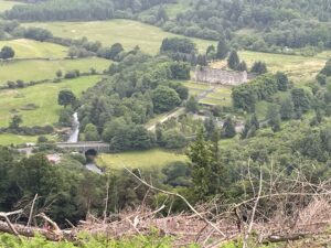 |
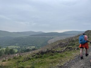
| Heading up the Wicklow Way above the Dwyers Chair outcrop | Looking down onto the ruined Glenmalure Military Barracks – now a caravan park, of all things |
 |
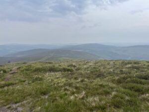 |
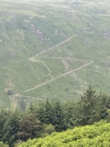
| The zig-zags leading up to Lugnaquilla, on the other side of the valley. Sadly closed now, as a result of the incident with the dog-owner a couple of months ago | On the slopes of Mullacor looking east towards where the sea should be. The heavy haze blurs everything in the distance, though the views were still pretty decent |
 |
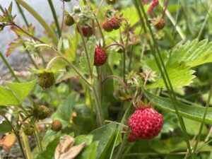 |
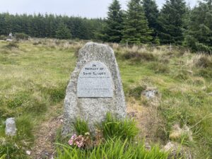
| The Shay Elliott memorial at the top of the pass between Laragh and Glenmalure. Shay Elliott was one of Ireland’s most successful competitive cyclists. The Laragh-Glenmalure road is popular with cyclists because of its steep climbs and tight bends. Presumably he used to train on these roads too. Shay Elliott died in 1971 age 36 from gunshot wounds inflicted in mysterious circumstances. | Wild strawberries growing at the roadside on the way back into Glenmalure. They were extremely tasty (though you didn’t want to think too hard about what might have walked down the verge as they were ripening) |
 |
|
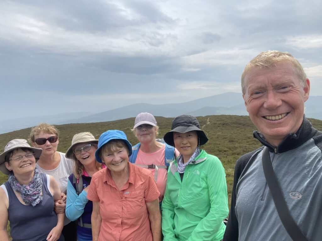
| On the top of Carriglinneen. I was the only representative of the Y chromosome today | |
Interactive map
(Elevations corrected at GPS Visualizer: Assign DEM elevation data to coordinates )
Max elevation: 605 m
Min elevation: 131 m
Total climbing: 676 m
Total descent: -677 m
Total time: 06:29:01
You can read earlier and later days’ blogs below
Previous day’s blog
Next day’s blog
Ireland home page
 Save as PDF