Ireland day 0756. Tuesday 24 October 2023- Indoors
| Today’s summary | Another day spent mostly indoors, working on a proposal related the consultancy work I may be undertaking. Just time for a short walk up to the top of Church Road while dodging torrential downpours. Spanish in the evening | ||||
| Today’s weather | Cloudy most of the day with torrential showers in the afternoon. Clear later. Moderate south easterly wind. Appx 13c | ||||
 |
 |
||||
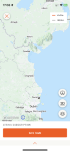
| Today’s overview location (The grey mark shows the location of my route) |
Close-up location (The orange line shows where I walked) (Click button below to download GPX of today’s walk as recorded, or see interactive map at bottom with elevations corrected): Up to the top of Church Road between the downpours |
||||
Commentary
(Summary blog only. Last full blog was Day 0368).
Today was a bit of a carbon-copy of yesterday. Val was at work and I was stuck behind a desk staring at a computer screen. I have been trying to write a proposal paper and have been suffering a bit from writers block – it’s one of those days when you decide to tidy the flat and clean the oven as a viable alternative to work.
Anyway I eventually managed to make some progress, after a video chat with a friend in the UK and a less cheerful chat with my accountant warning me about the various tax implications of my new assignment. Hey ho. Rome wasn’t built in a day!
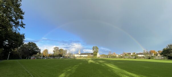
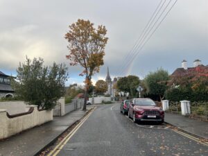
Anyway, eventually by about 4:30 I felt I’d done enough for the day so I stopped work and headed out into the fresh air for a short walk up to the top of Church Road. I was quite fortunate in my timing, actually, as my need to get outside coincided with a brief break in the torrential downpours which have been hitting Malahide. And there was the bonus of a nice rainbow to decorate the way, too.
Well, that’s enough. Now time to head out and subject myself to more mental anguish in the form of Spanish classes. Sometimes I just want the world to stop so I can get off – but then I have to remind myself that it’s all self-inflicted!
Today’s photos (click to enlarge)
 |
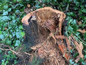 |
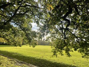
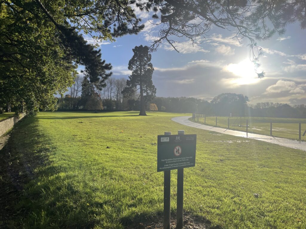
| Up in the demesne. I love the way it glows in the sun after rain | Rapidly decaying tree-stump. I was struck by the vivid orange colour |
 |
|
| Returning to the town centre via St Margaret’s Road | |
 |
|
| It’s my favourite tree again, looking stunning in the low angle post-deluge sun | |
Interactive map
(Elevations corrected at GPS Visualizer: Assign DEM elevation data to coordinates )
Max elevation: 34 m
Min elevation: 8 m
Total climbing: 46 m
Total descent: -44 m
Total time: 00:35:46
You can read earlier and later days’ blogs below
Previous day’s blog
Next day’s blog
Ireland home page
 Save as PDF