Ireland day 0886. Saturday 02 March 2024- Camino 2
| Today’s summary | Had to cancel the planned Club walk I was supposed to be leading today up Mullaghcleevaun because yesterday’s adverse weather would have led to access problems. So Val and I decided to walk the 26km Boyne Valley Camino from Drogheda to Mellifont and back, as an alternative. Very enjoyable though quite a lot of road-walking. Weather mostly held up. | ||||
| Today’s weather | Plenty of bright sunshine with occasional sharp showers of sleet and hail. Moderate north westerly wind. Appx 7c | ||||
 |
 |
||||
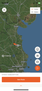
| Today’s overview location (The grey mark shows the location of our route) |
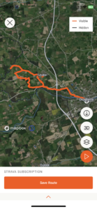
Close-up location (The orange line shows where we walked) (Click button below to download GPX of today’s walk as recorded, or see interactive map at bottom with elevations corrected): Boyne Valley Camino 2 |
||||
Commentary
(Summary blog only. Last full blog was Day 0368).
Today didn’t work out as I had planned, though in the end it was good.
I had planned to lead a Club walk up Mullaghcleevaun from Blessington via the Ballynultagh Gap today. But after yesterday’s horrible weather, with dire warnings of snow, ice and flooding today, I concluded that access to the Gap would be difficult if not impossible, and even getting to Blessington itself might be difficult. So I took the tough decision to cancel the walk, in the interests of prudence. A disappointment but I will lead it again as soon as the programme permits.
So we unexpectedly had a free day today and didn’t want to waste it. At Val’s suggestion, we decided to return to Drogheda to walk the Boyne Valley Camino again – a walk we last did soon after we arrived in Ireland, back in October 2021. It’s a decent 26km round trip from St Peter’s Church in Drogheda to Mellifont Abbey and back but as it’s relatively low-level, it wouldn’t suffer the same access difficulties as Mullaghcleevaun.
The main challenge with the walk, actually, turned out to be finding somewhere to park in Drogheda. In the end we settled on the Haymarket car park which was fine except it closes at 7pm (and isn’t open on Sundays) so we couldn’t take for ever over the walk. But the Camino itself was mostly pretty straightforward. Part of the route back (from Oldbridge to Drogheda via the Ramparts path) is inaccessible because the Obelisk bridge is closed (scheduled to reopen in May). That means you have to retrace your steps for part of the way back, which isn’t too much of a hardship though it means you cover quite a lot of the same ground twice.
The modified route is more or less the same length (about 26km) as the “proper” path which we did last time, though today we completed it 15 minutes faster (at 6h34m) than before. It’s a reasonably decent route, though it was blocked pretty comprehensively by a fallen tree just past the Obelisk bridge, which required some careful negotiation. I think it probably came down in yesterday’s storm, because there were no sign of any other footprints going round it. There’s quite a lot of muddy path through some of the woodland, and rather too much road-walking for my liking. But hey, that’s very much the norm here, and we were both very grateful to be able to get out even though quite a lot of it was along pavements.
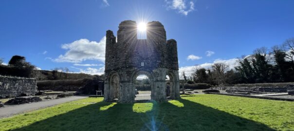
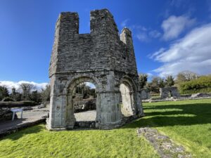
Mellifont was beautiful, as ever – especially the lavabo (pictured in the featured image at the top, and also below), where the Cistercian monks washed their hands before eating. The walk back was straightforward, and we diverted into Tullyallen to stop at the Centra shop to get a cup of tea and a cake by way of sustenance en route. We were back at the car park well before it closed, and in the flat again in next to no time.
Altogether a successful day out, despite the disappointments of Mullaghcleevaun. Now it’s time for a shower, some Lough Avalla beef casserole (from the vast batch that I froze a few weeks ago) and a nice glass of red wine.
Today’s photos (click to enlarge)
 |
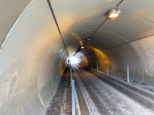 |
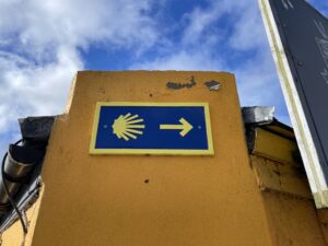
| Characteristic scallop showing us the way | The road-and-path tunnel under the M1 motorway |
 |
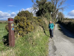 |
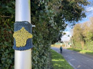
| The knitted Camino signs, which looked charming in 2021, were beginning to appead a bit bedraggled by today | Lots of beautiful open countryside near Lynch’s Cross. Sadly, like much of Ireland, it’s more or les completely off-limits to walkers so you have to share the road with cars |
 |
 |
| That stunning lavabo again. The weather today was almost exactly the same as it had been in 2021 – brilliant blue skies and occasional heavy downpours (which we mostly successfully avoided) | Taking a look at the Morning Star (thatched) pub in Tullyallan on the way back |
 |
|
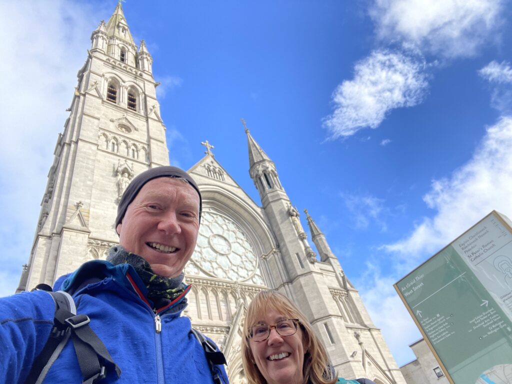
| At the start – St Peter’s Church, Drogheda. The finish of the walk is at the same place | |
Interactive map
(Elevations corrected at GPS Visualizer: Assign DEM elevation data to coordinates )
Max elevation: 111 m
Min elevation: 2 m
Total climbing: 471 m
Total descent: -472 m
Total time: 06:23:11
You can read earlier and later days’ blogs below
Previous day’s blog
Next day’s blog
Ireland home page
 Save as PDF