Ireland day 0865. Saturday 10 February 2024- Mullaghcleevaun Recce
| Today’s summary | Met up with Marie from the Walking Club in Blessington then car-shared up to the Ballynultagh Gap. We climbed Mullaghcleevaun as a recce for a walk I’m leading in March. Very enjoyable despite the rain and poor visibility in parts. Some pretty spectacular bog along the way! Val still in London – back tomorrow. | ||||
| Today’s weather | Overcast with occasional brief glimpses of sun. Rain and thick mist around lunchtime. Moderate to strong easterly wind. Appx 7c but colder on the top | ||||
 |
 |
||||
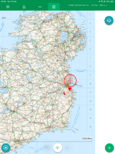
| Today’s overview location (The red mark shows the location of our route) |
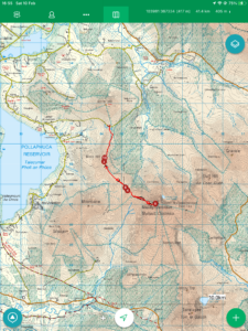
Close-up location (The red line shows where we walked) (Click button below to download GPX of today’s walk as recorded, or see interactive map at bottom with elevations corrected): Mullaghcleevaun Recce |
||||
Commentary
(Summary blog only. Last full blog was Day 0368).
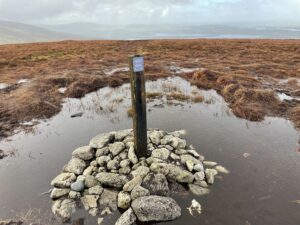
Mullaghcleevaun is actually a rather unspectacular whaleback of a hill – even though, at 849 metres (2,785 ft), it is the second highest summit in Co. Wicklow. But I quite like it as I have happy memories of climbing it back in May last year, when it was the first hillwalk I’d done since my hip operation a couple of months earlier. So I was glad to be back again today, doing a recce for a walk I’m leading in March.
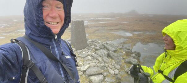
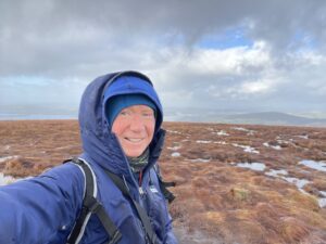
I didn’t particularly want to do a remote mountain walk on my own in February, and as Val was away, I asked for volunteers from the Walking Club to come along and keep me company. Fortunately, Marie agreed to do the honours so we met up in Blessington and left her car there. We car-shared up the the start of the walk at Ballynultagh Gap (the car park up there only has limited space) then togged up in water- and wind-proofs for what promised to be a stormy climb to the summit itself.
As you start the walk at 440m (1450 ft), half of the work is done for you by the car, so the walk to the top isn’t challenging. The only downside of the route from Ballynultagh Gap is that you have to ascend and descend Black Hill along the way (and the same on the way back, as this is an out-and-back route). Oh and yes – the bog. Mullaghcleevaun is notorious for its peat hags, and as far as I can tell there isn’t a route to the top which doesn’t involve clambering in and out of the black mud.
So it was a bit of a slog today, and the weather which had seemed quite favourable when we set off soon deteriorated into wind, mist and rain. But we kept on going and covered the 6km to the top in about 2 hours. I’d planned to have lunch by the trig point, but there is absolutely no shelter up there, so we descended a little and sought shelter in the peat hags.
The return walk was wet but straightforward, and just right for a short February day. We saw only three other people on the walk today, which isn’t altogether unusual as Mullaghcleevaun is one of the less-frequented Wicklow hills.
I thoroughly enjoyed the day out and think it will make a good Club walk in three weeks time. Hopefully it might dry up a bit between now and then – otherwise, I might have to invest in a pair of wellies!
Today’s photos (click to enlarge)
 |
 |
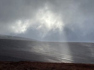
| Top of Black Hill was inaccessible unless you were prepared to get wet feet | A bit of blue sky put in an appearance from time to time. The weather was best at the start and the end of the walk. We had rain, wind and fog for the middle section |
 |
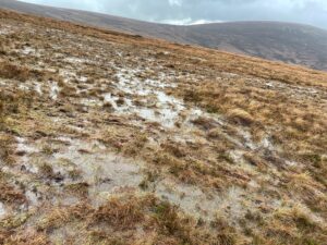 |
| It’s fantastically empty up there – yet unbelievably less than an hour from Dublin city centre | Water literally everywhere. I think only wellies would be sure to keep your feet dry in these conditions. Mine were soaked within about ten minutes of setting off |
 |
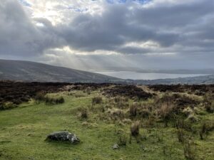 |
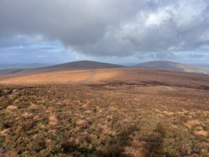
| Looking back the way we had come. Black Hill is centre left, Sorrel Hill is on the right | Back at the end of the walk – the skies cleared again and we could see Poulaphouca reservoir, down by Blessington, once more |
 |
|
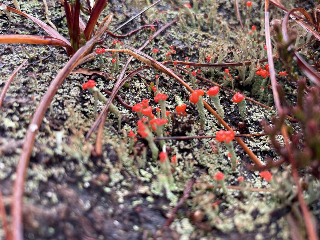
| Cladonia cristatella or “British Soldiers Lichen” (I’ve no idea how it got this name) putting on a vivid display in the bog. I only saw it in one spot – it didn’t seem to be very widespread | |
Interactive map
(Elevations corrected at GPS Visualizer: Assign DEM elevation data to coordinates )
Max elevation: 844 m
Min elevation: 441 m
Total climbing: 552 m
Total descent: -553 m
Total time: 04:48:31
You can read earlier and later days’ blogs below
Previous day’s blog
Next day’s blog
Ireland home page
 Save as PDF