Ireland day 0677. Sunday 06 August 2023- Kiltipper and Hellfire
| Today’s summary | Drove to Kiltipper Park for a walk with the DWC after meeting at the Old Mill pub in Oldbawn. A few of us went up to the Hellfire Club afterwards | ||||
| Today’s weather | Bright sunshine alternating with heavy showers. Moderate westerly wind. Appx 17C | ||||
 |
 |
||||
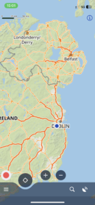
| Today’s overview location (The blue mark shows the location of our route) |
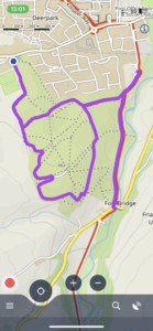
Close-up location (The purple line shows where we walked) (Click button below to download GPX of today’s walk as recorded, or see interactive map at bottom with elevations corrected): Kiltipper Park DWC |
||||
Commentary
(Summary blog only. Last full blog was Day 0368).
We thought we’d never been to Kiltipper Park before – but it turned out that we had. But we only discovered this when we got there, as we joined the rest of the Walking Club for a short stroll through the grasslands on the south western edge of Dublin.
After the slight disappointment of yesterday’s walk cancellation, we were looking forward to meeting up with walking club friends again today. Especially as we weren’t scheduled to start the walk until 12:00, which meant that we could have a bit of a lie-in. So just before 11, we set off to pick up a friend in Clongriffin then drove round to the Old Mill pub in Oldbawn to join everyone else.
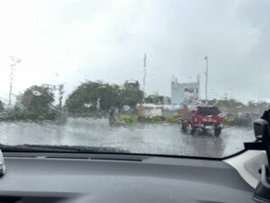
It was pouring with rain when we got there, so we beat a hasty retreat to a nearby coffee shop and waited for it to stop. Eventually it dried up, so we ventured out and drove a few km further to the Kiltipper car park where the walk-proper started. At first, we thought that we hadn’t been to this part of Dublin before, but when we were about halfway round, we saw a “Dublin Mountains Way” signpost and realised that we had in fact been here a couple of times before (once when we went gold-panning last year) – we had just approached it from a different side.
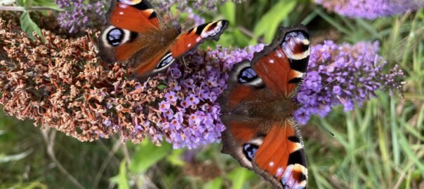
We had a good look round the park – and in fact today had it pretty much to ourselves, as the rain had put off pretty much all the other potential visitors. The shifting skyscapes and drifting billowy white clouds shone against an iridescent blue sky in the sunny intervals which punctuated the downpours. It was all very atmospheric and fortunately there were enough trees to afford decent shelter for whenever the rain did start to come down. And for the first time this year, butterflies put in a proper appearance, peacocks decorating the Buddleias with splashes of vivid red and black.
Once we’d completed a circuit of the park and were back at the car park, we drove back to the pub where a few of the crowd went in for refreshments. A sub group of us, rather virtuously, decided to forgo the drinks and drive a bit further up into the hills to take a look at the ruin of the notorious Hellfire Club.
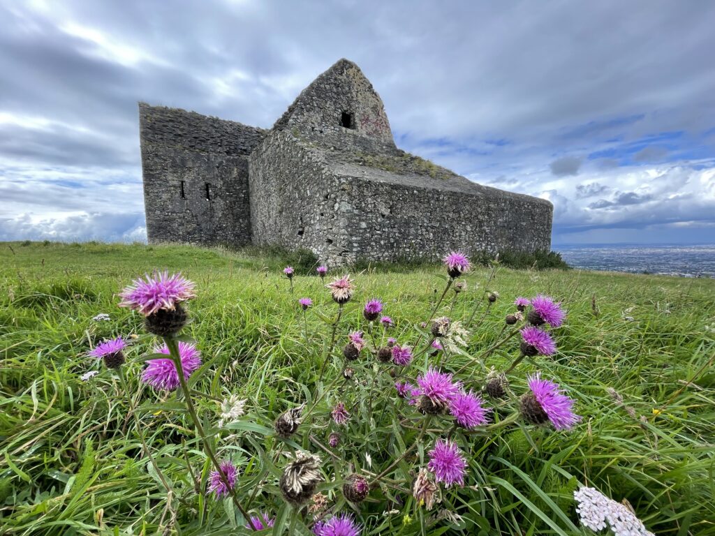
The Hellfire Club is an old ruin on the top of Montpelier Hill, on the southern flanks of Dublin. It was originally built as a hunting lodge on the top of the hill by William Connolly (of Castletown House) in 1725. It was later sold to the Irish Hellfire Club in around 1735 and all sorts of debauched and unpleasant activities were supposed to have happened there. Nowadays it’s a ruin, and a popular walking site for Dubliners. there are superb views over the whole of Dublin, which we took time to enjoy.
After having a good look round, we drove back to Dublin, dropped off our friend in Clongriffin, and enjoyed more caponata for dinner and a good glass of red wine to wash it down. Another excellent day out.
Today’s photos (click to enlarge)
 |
 |
| Waiting for the rain to stop so the walk could start – in the car park of the Old Mill pub at Oldbawn | Heading off into Kiltipper park. |
 |
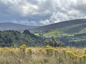 |
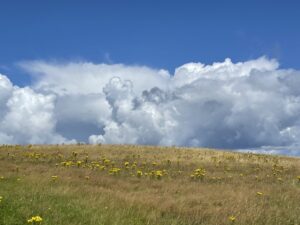
| Beautiful cloudscapes when the sun shone | Looking into the Dublin Mountains with Kippure (with the mast) on the left horizon |
 |
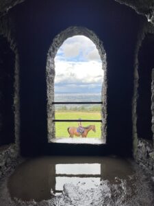 |
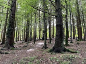
| Woodlands on the way up Montpelier Hill to the Hellfire Club | Chance shot of a passing horse-rider, taken through a window while exploring the interior of the Hellfire Club ruin |
 |
|
| The Hellfire Club, with Dublin behind | |
Interactive map
(Elevations corrected at GPS Visualizer: Assign DEM elevation data to coordinates )
Max elevation: 157 m
Min elevation: 111 m
Total climbing: 111 m
Total descent: -111 m
Total time: 02:21:30
You can read earlier and later days’ blogs below
Previous day’s blog
Next day’s blog
Ireland home page
 Save as PDF