
Ireland day 0615. Monday 05 June 2023- Cycling Visitor
| Today’s summary | Joined a webinar about Norwegian Hydrogen first thing, then collected a friend’s cyclist son from the airport prior to his long bike ride. Short walk in the afternoon and vegetarian dinner once Val was back from work | ||||
| Today’s weather | Same as yesterday (and the day before and the day before…)! Dry bright and sunny all day. Light north easterly wind. Appx 18C | ||||
 |
 |
||||
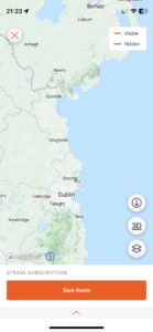
| Today’s overview location (The grey mark shows the location of our route) |
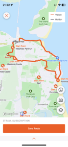
Close-up location (The orange line shows where we walked) (Click button below to download GPX of today’s walk as recorded, or see interactive map at bottom with elevations corrected): Paddys Hill and coast usual route |
||||
Commentary
(Summary blog only. Last full blog was Day 0368).
A busy day today.
I started off by joining a 2 hour webinar, starting at 7:30 am, about Norwegian hydrogen capabilities. I was joining on behalf of Geoscience Ireland, and it was actually quite interesting.
Then pretty much as soon as that was finished, I headed over to the airport to pick up the son of a friend of ours who had flown over from Zurich. He brought his bike with him, and he’s doing a “Derry to Cork” challenge bike ride starting on Thursday. 2400km in 8 days. Impressive. He’s taking the bus up to Derry from the airport tomorrow lunchtime.
Val was out at work so once our visitor and I had had lunch, we took a leisurely stroll over the hill and back up the coast from Portmarnock. It was a brilliant sparkling day and Ireland was putting on a fine show for our guest. It was a bank holiday today as well, so the beaches were crowded with holidaymakers making the best of the sunshine and good weather. Although there was, as ever, a persistent breeze blowing which pegged the temperatures back a bit.
Once we had returned, Val was back from work so we had a vegetarian dinner together, chatted and discussed the merits of different language-learning apps. A very rewarding day, despite the ungodly early start.
Today’s photos (click to enlarge)
 |
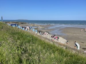 |
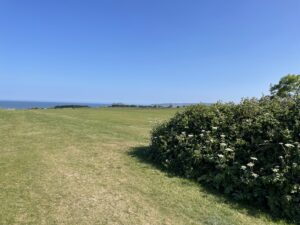
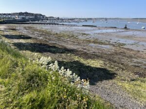
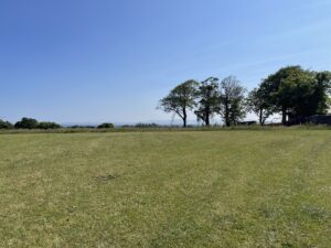
| Heading towards the playing fields on Paddy’s Hill | Bank holiday crowds making the most of the good weather on the coast |
 |
 |
| White valerian above the foreshore at Malahide | On the top of the hill, by the Jameson Orchard |
 |
|
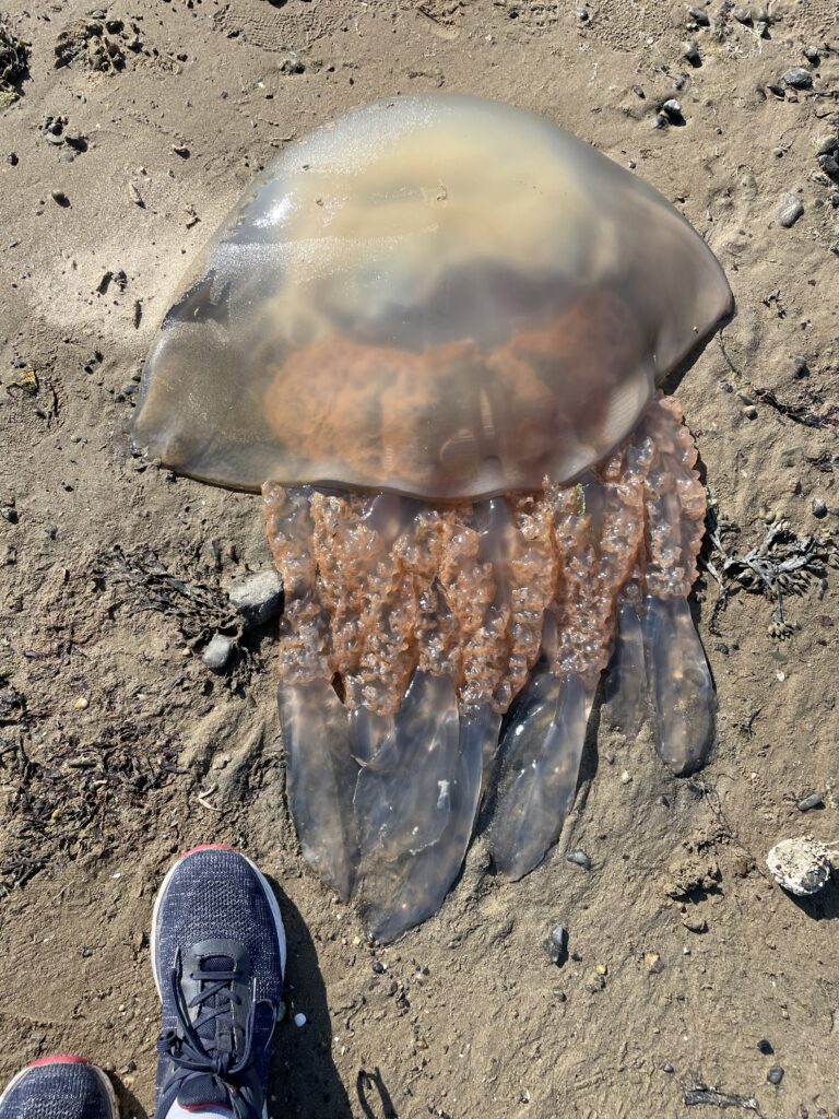
| A barrel jellyfish washed up on the Malahide beach. Apparently they can grow up to 1m in diameter and are relatively common in the Irish Sea | |
Interactive map
(Elevations corrected at GPS Visualizer: Assign DEM elevation data to coordinates )
Max elevation: 50 m
Min elevation: 0 m
Total climbing: 134 m
Total descent: -134 m
Total time: 02:03:03
You can read earlier and later days’ blogs below
Previous day’s blog
Next day’s blog
Ireland home page
 Save as PDF