
Ireland day 0963. Saturday 18 May 2024- Vancouver 4
| Today’s summary | After a quick breakfast at Purebread in Vancouver, drove with the family to Horseshoe Bay to get the ferry to Bowen Island. Once there, got some sandwiches for lunch then hiked up to the top of Mt Gardner, the Island’s highest peak (727m / 2385ft). Quite a scrambly route with ropes to hold onto in parts. Fabulous views from the top and brilliantly rewarding. Poutine, calamari and beer in the pub at the end then drove back as night was falling. Fantastic | ||||
| Today’s weather | Rain overnight and in the morning then brilliant sun with boiling white clouds later. Light westerly wind. Appx 14c | ||||
 |
 |
||||
| Today’s overview location (The green mark shows the location of our route) |
Close-up location (The orange line shows where we walked) (Click button below to download GPX of today’s walk as recorded, or see interactive map at bottom with elevations corrected): Bowen Island Gardner Summit |
||||
Commentary
(Summary blog only. Last full blog was Day 0368).
Today was one of those days that is sure to linger in the memory.
We’d always wanted to pay a visit to Bowen Island – one of the forest-covered specks of land in the Howe Sound, to the west of Vancouver. Today we got the chance to correct that omission in our library Canadian explorations. But first – an essential breakfast stop was made at Purebread – a fabulous bakery near where we are staying and which sells the most amazing (but not cheap) almond croissants and coffee. From there we joined the family in the truck to drive over to Horseshoe Bay and after a short wait, caught the ferry for the 20 minute sail over to Bowen Island.
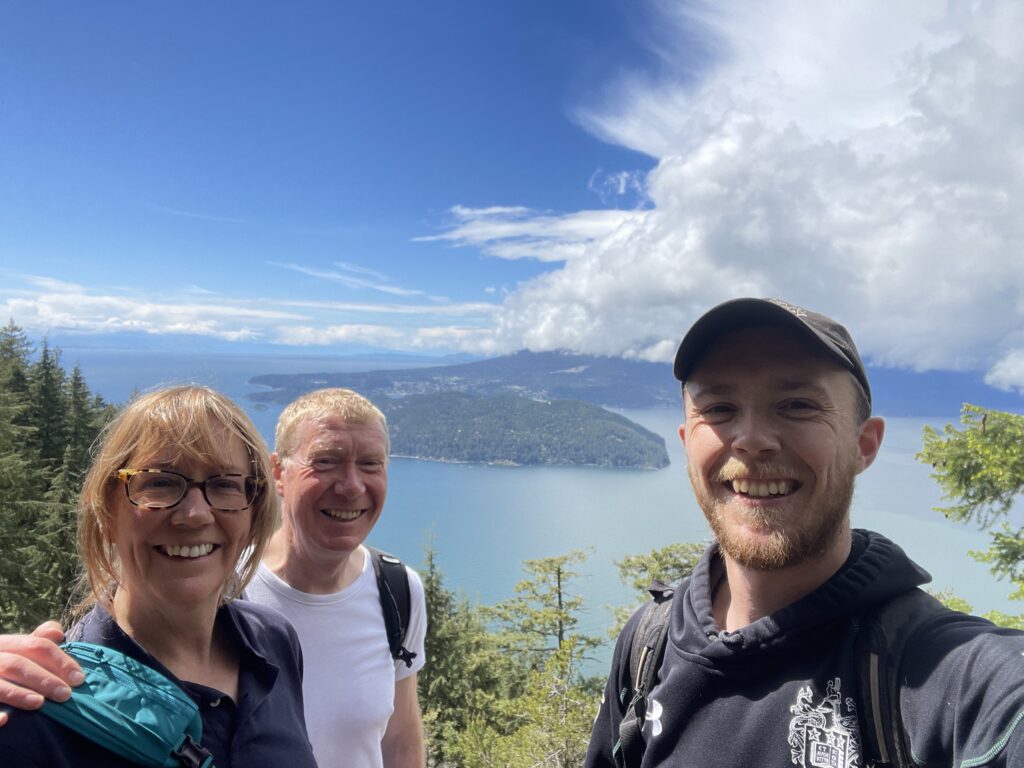
Once safely on dry land again, we dropped into the local grocery store and picked us some lunch then set out on the next of our challenges – a hike to the summit of Mt Gardner, Bowen Island’s highest peak, at 727m / 2385ft.
The climb was sublime – through beautiful seemingly unspoiled rainforests of fir and fern, filled with a rich deep silence that blotted out the 21st century whenever you paused for breath. It wasn’t too difficult though there were a couple of scrambly sections towards the top which demanded a bit of care (and haulage up the handily-placed guide-rope).
Eventually we pushed out through the forest to reach the clearing at the north top (actually slightly lower than the south top) to be greeted by a helipad, a tangle of aerials and other miscellaneous items of telecoms equipment. But most importantly, the summit offered stupendous views in all directions, and particularly back to Vancouver.
The hike was pretty quiet through a few other walkers crawled out of the woodwork as we paused on the top for our (surely well-earned) lunch. We were in brilliant sunshine for lunch (and indeed were all day, despite ominous black clouds to the north which never quite managed to give us a soaking) – though the air temperature did feel quite low. I think if there had been any real wind blowing, the wind chill would have made it feel quite uncomfortable.
We completed the loop track down, via the south top, successfully avoiding retracing our steps, and arrived in the tiny town at the ferry terminus just in time to drop into the pub for beers, poutine (basically chips and gravy, a Canadian delicacy) and calamari.
Eventually, just as it was getting dark, it was time to catch the ferry back to the mainland and to rejoin our path through the 21st century. Now we’re back at our guest house, it’s time to digest our poutine and our memories – surely a day in a million, and one which will go down in the record books as one of the very best.
Today’s photos (click to enlarge)
 |
 |
| Not really my thing, these slugs. Though I suppose in a sort of gruesome way they are quite fascinating | Scrambling up the final section to the summit |
 |
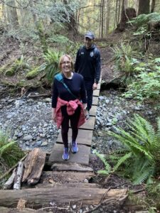 |
| Penstemon in flower on the summit. Felt like were trespassing in a beautiful botanical showhouse | Crossing one of the creeks on the way down the mountain |
 |
 |
| Leeches in Killarney Lake. Well I never | Poutine, calamari and beer. A proper balanced meal in the pub at the end |
 |
|
| With Rob at the lookout just below the north summit | |
Interactive map
(Elevations corrected at GPS Visualizer: Assign DEM elevation data to coordinates )
Max elevation: 729 m
Min elevation: 69 m
Total climbing: 1036 m
Total descent: -1037 m
Total time: 04:40:52
You can read earlier and later days’ blogs below
Previous day’s blog
Next day’s blog
Ireland home page
 Save as PDF