
Ireland day 0681. Thursday 10 August 2023- Mt Leinster
| Today’s summary | Visited Co. Carlow today. Drove down after breakfast and walked up Mt Leinster, took a look at Brownshill Dolmen and finished up at Carlow castle | ||||
| Today’s weather | Overcast, drizzly and windy all day. Strong to gale force south easterly wind. Appx 20C (colder on top) | ||||
 |
 |
||||
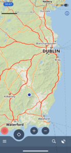
| Today’s overview location (The blue mark shows the location of our route) |
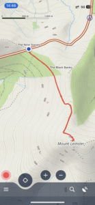
Close-up location (The orange line shows where we walked – out and back along the same route) (Click button below to download GPX of today’s walk as recorded, or see interactive map at bottom with elevations corrected): Mt Leinster |
||||
Commentary
(Summary blog only. Last full blog was Day 0368).
Our list of unvisited counties is shrinking fast. But one county stood out on the list because it was relatively close and easily accessed from the motorway network, as well having plenty of interesting things to see. That was County Carlow, so we decided to make that our target for today’s exploration.
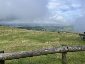
As soon as breakfast was despatched, we set off down the M50, M7 and M9 to see what we could find. Our first stop was Mt Leinster. It’s the highest summit in the Blackstairs mountains and occupies a commanding position with impressive views, so we were told, over the whole of the south east of Ireland. We got to the car park at Nine Stones which was swathed in wraiths of mist which swept in and out in the strong breeze. We had decided we would walk up to the top of the hill, which is actually quite easy because the car park is at 435m and the top is less than 400m higher. Also, as there is a giant transmission mast at the top, with a private access road leading all the way up to it.
So we set off up the road and were soon enveloped in thick mist and getting soaked by the penetrating drizzle. It’s a very easy walk – just follow the road straight up and you get to the top. Although it has to be said that today the numerous huge and fascinating caterpillars trundling about on the road’s slick surface were quite distracting
We were up in about an hour. You are supposed to be able to see eight counties – plus the Welsh coastline – from the top. Well we couldn’t actually see anything at all – not even the giant 120m mast which crowns the mountain (it’s the highest transmission site in Ireland). We had a quick look at the trig point and cairn but didn’t even stop for lunch. Rather, we headed straight back down and enjoyed our lunch in the shelter of the trusty Yaris.
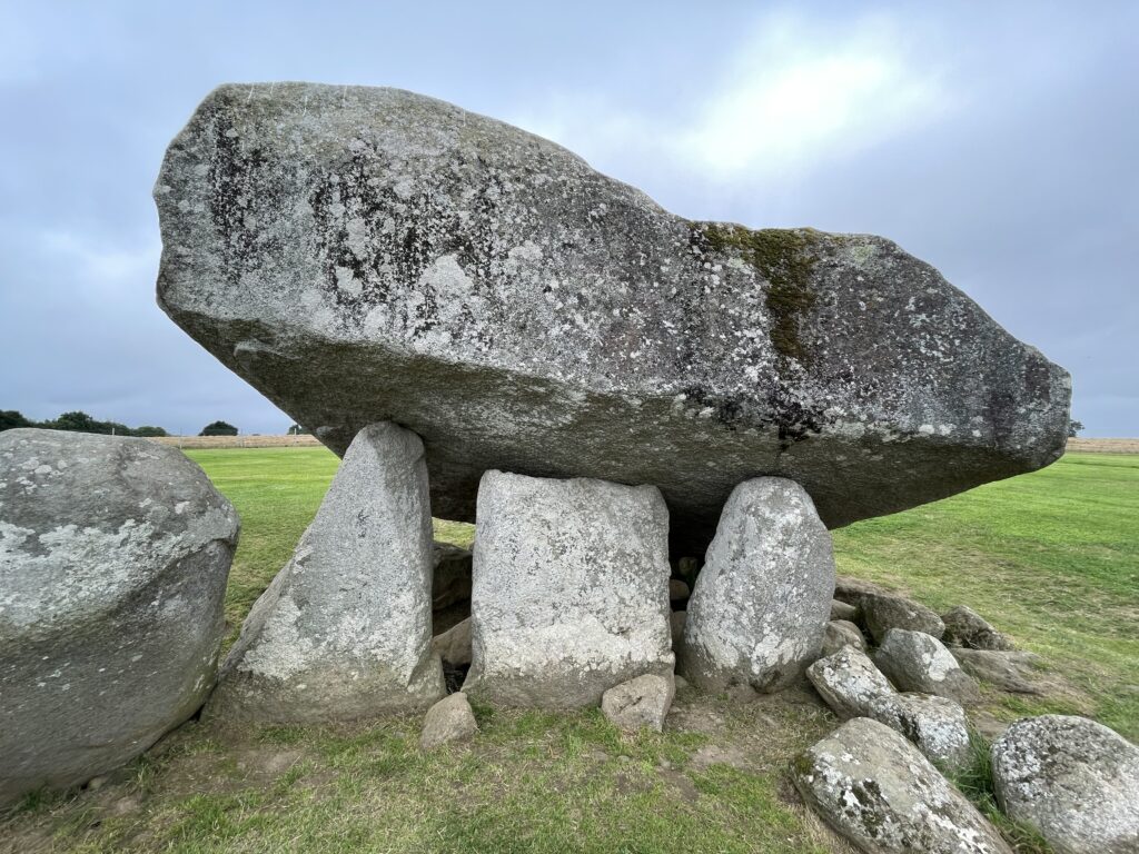
Instead of going straight back to Malahide from there, we went on to have a look at the Brownhill dolmen – one of the largest in Europe. It is just outside Carlow town and is indeed impressive. Although the modern Peugeot garage which overlooks it rather spoils the atmosphere.
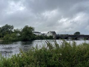
While we in the area, we thought we ought to have a look at Carlow town itself, as it was only a couple of minutes’ drive away. To be honest, it was a fairly unremarkable medium-sized town, although the castle was quite impressive, despite the 1814 mishap (see photo caption below).
The drive back to Malahide afterwards was straightforward so now we are enjoying spaghetti bolognaise with the remains of the cheap Armagh wine. Now it’s time to see what Netflix has to offer to crown off the day.
Today’s photos (click to enlarge)
 |
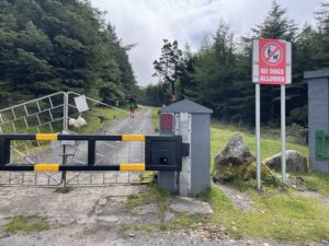 |
| Pretty much the only view we got the whole way up Mt Leinster was from the car park at Nine Stones. Looking west over Co. Carlow | There is an RTE mast at the top of Mt Leinster and a private access road all the way up to it. So it’s a very easy, if steep, short (2.5km) walk to the top and you can’t get lost |
 |
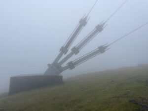 |
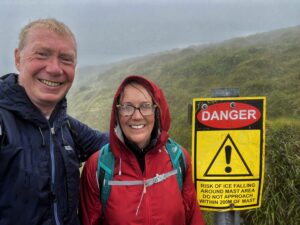
| Our summer holidays. Beware of the falling ice! | On the top of the hill is a giant TV transmission mast. There are massive stay-wires holding it up, but the mast itself was invisible in the fog, despite being 122m tall. (In fact, Mt Leinster itself is 794m so the top of the mast, at 916m / 3005ft, is technically an “Irish Munro”) |
 |
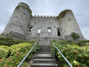 |
| Carlow town lies on the River Burrow (pictured). It is the second-longest river in Ireland, after the Shannon | Carlow Castle. It used to be much bigger but in 1814 a Dr Middleton accidentally blew most of it up while trying to convert it into a lunatic asylum. Ah well, these things happen, I suppose. |
 |
|
| The Brownshill dolmen. It was built about 2000-3000 BC and the capstone weighs some 150 tonnes, most likely making it the largest in Europe. | |
Interactive map
(Elevations corrected at GPS Visualizer: Assign DEM elevation data to coordinates )
Max elevation: 790 m
Min elevation: 435 m
Total climbing: 401 m
Total descent: -401 m
Total time: 01:46:48
You can read earlier and later days’ blogs below
Previous day’s blog
Next day’s blog
Ireland home page
 Save as PDF