Ireland day 0894. Sunday 10 March 2024- Vartry Again
| Today’s summary | Val and I got a lift with a friend down to the Vartry Lakes to do a circular walk round the upper lakes with the Club. As the official leader was off sick I had to step in and lead it. Very enjoyable despite the rain and murk. Stopped off at the “Turquoise” café/pub/restaurant/health shop/vegetable market to get a coffee and some rhubarb on the way back | ||||
| Today’s weather | Dull and heavily overcast all day with rain until mid afternoon. Moderate easterly wind. Appx 8c | ||||
 |
 |
||||
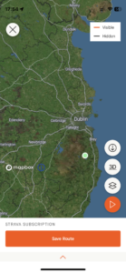
| Today’s overview location (The green mark shows the location of our route) |
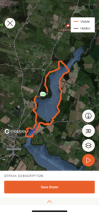
Close-up location (The orange line shows where we walked) (Click button below to download GPX of today’s walk as recorded, or see interactive map at bottom with elevations corrected): Upper Vartry Reservoirs DWC |
||||
Commentary
(Summary blog only. Last full blog was Day 0368).
It was a bit of a miserable wet sort of a day today when we got up, and I think it was only because we had committed to lift-sharing with a friend in Portmarnock that we actually stirred ourselves to get our gear together and join the Club walk this morning.
Even more unbelievably, Val went made bacon blaas and went on a run before our friend picked us up at 09:45. Very impressive – especially as it’s Mother’s Day today so she is supposed to be having a rest.
Nevertheless, we all headed out and joined the rest of the walkers in the Vartry Trails car park near Roundwood in time for an 11 am start.
By this time, it was raining hard, and we got a message saying the official walk leader had been taken ill and wouldn’t be able to make it today. So I was asked to step in instead, which was fine as I had recorded a few walks in the area from previous visits so was able to pull a clockwise circular route together that I thought would work for the group.
Despite the rain and general murk, it was a surprisingly enjoyable leg-stretch, and with a fun group of just 8 of us we were able to make decent progress. We headed off north round the upper lake then stopped for lunch at the dam between the upper and lower lakes. We continued a bit further south after lunch (of bacon blaas of course) then crossed the bridge and headed back to the car park up the other side of the lakes.
All in all it was a very successful walk despite the poor weather and lack of a leader. By the time we were back at the cars, it had stopped raining, so a few of us dropped in to the “Turquoise” pub on the way back to Dublin for some refreshments. As luck would have it, there was also a fresh fruit and vegetable market in full swing when we got there, so Val picked up some extremely fresh and delicious-looking Wexford rhubarb which we’re going to have for dinner tonight.
We just have 2 more episodes of The Sopranos left to finish now so those, along with the rhubarb, should round off our day nicely.
Today’s photos (click to enlarge)
 |
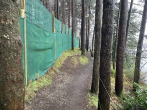 |
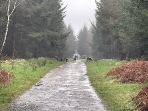
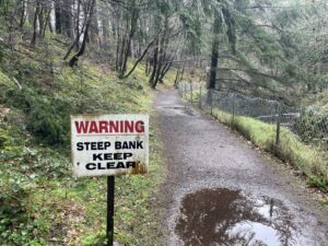
| A herd of “skia” deer nonchalantly blocking our path close to the start. “Skia” deer are sika / red deer hybrids and are common in Wicklow. As soon as we got too close, they sprang off silently and invisibly into the forest | The path alongside the paintballing centre was reinstated last year after a successful campaign by the “Keep Ireland Open” organisation |
 |
 |
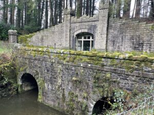
| Lunch stop under the dam between the upper and lower reservoirs | A deep chasm has been hewn out of the rock for the overflow channel below the upper and lower reservoirs. You wouldn’t want to fall in, as I doubt if you would ever get out |
 |
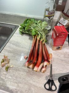 |
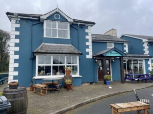
| The “Turquoise” pub which, among many other things also hosted an excellent fruit and vegetable market where Val was able to pick up some delicious looking rhubarb… | …which found its way to the kitchen as soon as we got back! |
 |
|
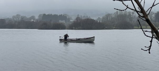
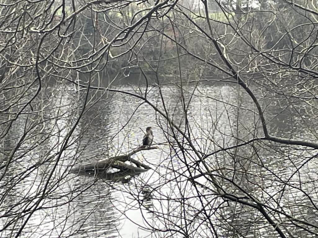
| This odd looking bird was perched on a branch in the middle of the lake. It looked like a cross between a cormorant and a heron but after a good deal of googling we concluded it was probably a sub-adult cormorant. It actually most closely resembled a white-chested cormorant but as they are really only found in Nigeria, we thought that was pretty unlikely. | |
Interactive map
(Elevations corrected at GPS Visualizer: Assign DEM elevation data to coordinates )
Max elevation: 239 m
Min elevation: 206 m
Total climbing: 193 m
Total descent: -194 m
Total time: 03:12:53
You can read earlier and later days’ blogs below
Previous day’s blog
Next day’s blog
Ireland home page
 Save as PDF