Ireland day 0747. Sunday 15 October 2023- Beara day 5
| Today’s summary | Drove over about 45 minutes to Lauragh to meet up with some friends for a walk up Knockatee – a small hill above the village. Then to friends’ house for lunch followed by a walk into the picturesque town to Kenmare. We returned via the Healy Pass, a spectacular evening drive | ||||
| Today’s weather | Red sky in the morning but nevertheless stayed dry and bright all day with plenty of sun. Moderate easterly wind. Appx 11c | ||||
 |
 |
||||
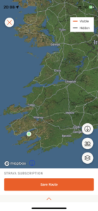
| Today’s overview location (The green mark shows the location of our route) |
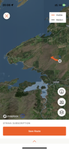
Close-up location (The orange line shows where we walked) (Click button below to download GPX of today’s walk as recorded, or see interactive map at bottom with elevations corrected): Knockatee |
||||
Commentary
(Summary blog only. Last full blog was Day 0368).
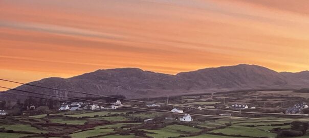
When we woke up this morning, there was a stunning orange glow in the sky which, whilst looking impressive, I took as a harbinger of rain to come – well at least if the shepherd could be believed.
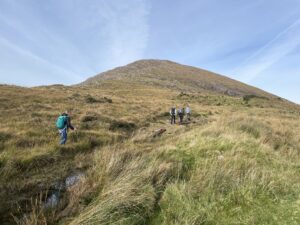
Anyway, setting aside concerns for the longer term weather forecast, after a leisurely breakfast we set out east along the north coast of the Beara peninsula towards the village of Lauragh, about 45 minutes away. Our objective today was to meet up with friends-of-friends who live in Kenmare, and to start the day with a short hike up the nearby hill of Knockatee. We successfully made the rendezvous and then drove a little further up one of those grass-in-the-middle of-the road boreens which Ireland does so well, to find a parking spot which afforded a decent climb to the top of the hill, whilst avoiding the tedious road walk up through the forestry.
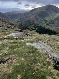
We clambered up to the top through the largely pathless grassy and rocky scrub, and made it to the top in an easy 40 minutes or so. We were fortunate in having chosen another superb day for our outing, because we reached the summit in bright sunshine, and with only a light breeze blowing. Although it has to be said that the weather has turned much cooler recently, with temperatures struggling into double digits today. The views from the top were superb, with Macgillycuddy’s Reeks and Carrauntoohil looking so clear and so close that you felt you could almost reach out and touch them.
Once safely back down, we retreated to our new friends’ house for lunch – a lovely cottage in a very quiet valley not too far from Kenmare. It was really nice to have lunch made by someone else, I must admit, and we all thoroughly enjoyed it. But we didn’t let the grass grow under our feet, and after a suitable pause, set off again to go and have a look round Kenmare. Neither Val nor I had been before, so the town came as a really pleasant surprise. It felt prosperous and lively, with pubs, cafés, restaurants and shops lining the streets. Despite being an out-of-season Sunday afternoon, everywhere was open for business and seemingly busy.
From the town centre, we walked down to the river and had a look at the quay and a park which runs alongside the north bank of the estuary. We saw a number of feline-looking heads popping up above the water and couldn’t decide if they belonged to nearby otters, or slightly further away seals. As none of us had ever seen an otter in the wild, we concluded that this is what they were, though I think we all sneakily suspected that really they were seals.
By this stage evening was beginning to fall so we said our goodbyes and drove back to our cottage via the Healy Pass, with just enough light remaining to see some of the scenery. It really is a breath-taking place, with massive views over the huge valley below on the right as you approach the summit from the north. Then once you are over the col, the road snakes away below you via a series of rocky hairpin bends, back down to the valley below. The scenery up there wouldn’t look out of place in the Alps and it really doesn’t feel like it belongs in the Emerald Isle at all.
Now we’re in back in the cottage and time for a bit of down-time. Except that before kicking back my heels, I need to try and tackle a particularly difficult Spanish audio comprehension. Yes, no matter where you go you can’t escape your deberes.
Today’s photos (click to enlarge)
 |
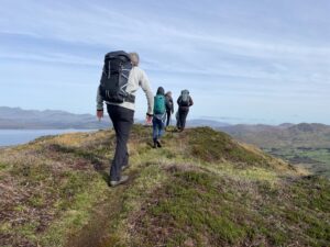 |
| A short morning walk up the small hill of Knockatee, just above Lauragh | At the top. It’s about 40 minutes from the small road where we parked to the viewpoint in the summit |
 |
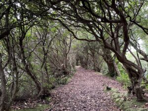 |
| On the Kenmare River. It’s actually a tidal estuary but apparently during the Famine, local landowners had it designated as a river, so they could legally prevent the starving locals from fishing for salmon there. Abhorrent. | Strangely reminiscent of the Dark Hedges (of Games of Thrones fame) in Ulster – Rhododendron woodlands along the estuary shore |
 |
 |
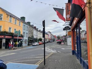
| The high street in Kenmare – a lively town with lots going on and a wide range of boutiquey shops and restaurants | From the top of the Healy Pass, just before it got fully dark. It’s a spectacular drive across from Lauragh to Adrigole – surely one of Ireland’s most scenic routes |
 |
|
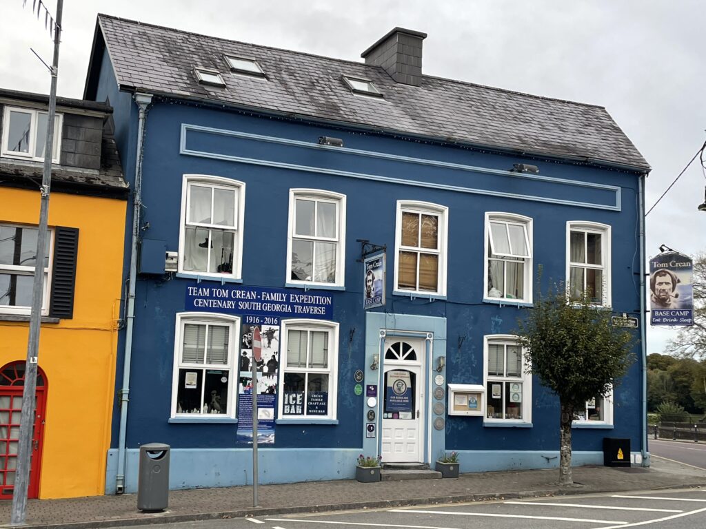
| Tom Crean was a member of Shackleton’s epic 1914-1916 Antarctic expedition and he came from the Kenmare area. His grand-daughter ran this restaurant in Kenmare until very recently – though sadly it’s closed at the moment | |
Interactive map
(Elevations corrected at GPS Visualizer: Assign DEM elevation data to coordinates )
Max elevation: 317 m
Min elevation: 150 m
Total climbing: 214 m
Total descent: -213 m
Total time: 01:51:04
You can read earlier and later days’ blogs below
Previous day’s blog
Next day’s blog
Ireland home page
 Save as PDF