Ireland day 0679. Tuesday 08 August 2023- Monaghan
| Today’s summary | Drove up to Monaghan to have a look round the town. Really lovely. Then on to Glaslough village which was charming | ||||
| Today’s weather | Bright and dry with plenty of sun. Light southerly breeze. Appx 17C | ||||
 |
 |
||||
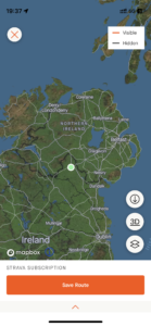
| Today’s overview location (The green mark shows the location of our route) |
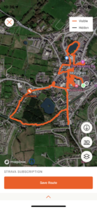
Close-up location (The orange line shows where we walked) (Click button below to download GPX of today’s walk as recorded, or see interactive map at bottom with elevations corrected): Monaghan |
||||
Commentary
(Summary blog only. Last full blog was Day 0368).
We continued on our project to visit all of the island or Ireland’s 32 counties today. There are only a handful left now, but our closest unvisited neighbour was Co Monaghan, which is about 90 minutes up the M1. So as soon as we’d had breakfast, we set off on our travels, and were parked up in Monaghan town car park by lunchtime. We had a quick look round a local shopping centre (I wanted to get some new reading glasses) then found a picnic bench in Church Square to have our sandwiches.
We walked right round the town centre and its immediate environs and quickly concluded that we liked it. It was clean, friendly and attractive. The horrors of the 1974 bombing seem a long way off now, though not completely forgotten. The only Celtic part of the town still remaining is supposed to be a crannog (fortified house on an island in a lake) somewhere in the middle of Convent Lake (the rest of the town is a relic of an English Plantation in 1613). But the lake is fenced off and in the grounds of a nunnery, so even though we had a good look, we failed to find it.
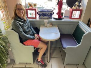
We ended up in a friendly back-street café with the improbable name of “Missy A’s” on Park Street where we enjoyed tea, coffee, cakes and a great chat with the owner Seamus. He suggested that before we went back to Malahide, we should drive a little further north to the village of Glaslough, to take a look round the village itself and also at Castle Leslie, where Paul McCartney and Heather Mills got married.
So once we’d paid and said our goodbyes, we paid the recommended village a call and thoroughly enjoyed it. Castle Leslie itself is in a private walled off demesne and is now a luxury hotel. But what we could see of it looked very smart. Then we had a wander round the village, which was indeed interesting and even had a restored signal box and other railwayana on display (the rail line was sadly closed in 1957).
Eventually we left about 5:30 and headed south for the easy and quick journey back to Malahide. A thoroughly excellent day out, and another county ticked off!
Today’s photos (click to enlarge)
 |
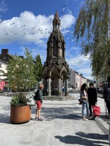 |
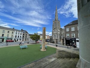
| Church Square from the steps of the courthouse. The pillar in the centre is a memorial to the seven victims killed in the car bombing of Monaghan in 1974 | Rossmore Monument in the Diamond. A Victorian drinking fountain |
 |
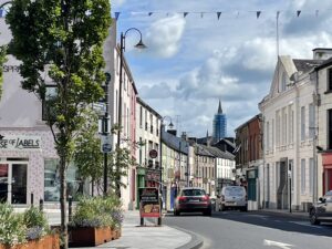 |
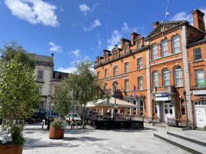
| In The Diamond square, feeling almost French in the sunshine | Looking down Dublin Street from the Diamond |
 |
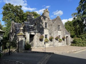 |
| Taking a pew in the wonderful “Missy A” Café. The chatty owner recommended that we took a side-trip up to Glaslough village, which we did next | The gatehouse for Castle Leslie in Glaslough. Nowadays it’s an upmarket hotel |
 |
|
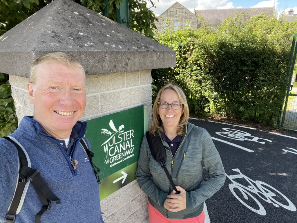
| The Ulster Canal Greenway will eventually run all the way from Lough Neagh to the Shannon but today we only explored a short section of it, which forms a useful shortcut round the back of Monaghan. The canal is silted up and overgrown almost to the point of invisibility. A real shame as it could be a great visitor asset | |
Interactive map
(Elevations corrected at GPS Visualizer: Assign DEM elevation data to coordinates )
Max elevation: 71 m
Min elevation: 53 m
Total climbing: 113 m
Total descent: -113 m
Total time: 03:29:11
You can read earlier and later days’ blogs below
Previous day’s blog
Next day’s blog
Ireland home page
 Save as PDF