Ireland day 0648. Saturday 08 July 2023- Tonelagee Loop DWC
| Today’s summary | Circular walk up Brockagh ridge, Tonelagee, Wicklow Gap, Turlough Hill and Camaderry with the walking club | ||||
| Today’s weather | Defying all expectations, it was dry, sunny and reasonably warm all day. Strong to gale force southerly wind to start with, moderating later. Appx 20C in the valleys, cooler on the summits | ||||
 |
 |
||||
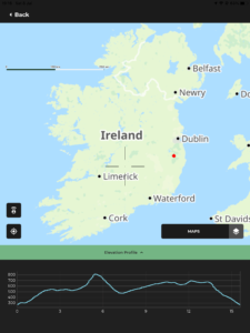
| Today’s overview location (The orange mark shows the location of our route) |
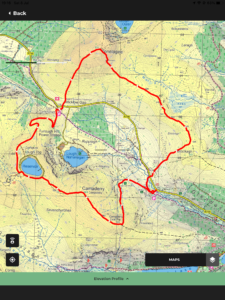
Close-up location (The orange line shows where we walked) (Click button below to download GPX of today’s walk as recorded, or see interactive map at bottom with elevations corrected): Brockagh Tonelagee Turlough and Camaderry DWC |
||||
Commentary
(Summary blog only. Last full blog was Day 0368).
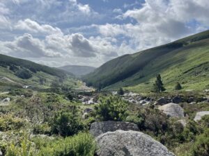
After yesterday’s bone-chilling epic on Slieve Gullion, Val wisely decided to give today’s Club walk above the Glendasan Valley a miss. You can have too much of a good thing, after all.
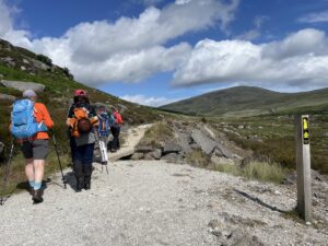
So I set out on my own “bright” and early at 8:30 am to make the trek down to Laragh, pausing briefly at the Applegreen station on Mountgorry Way for fuel. The group convened in the free car park at Laragh and then drove a bit further up the valley towards the Wicklow Gap where we left the cars and started the walk.
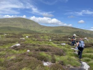
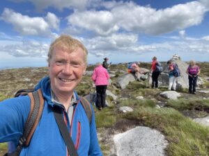
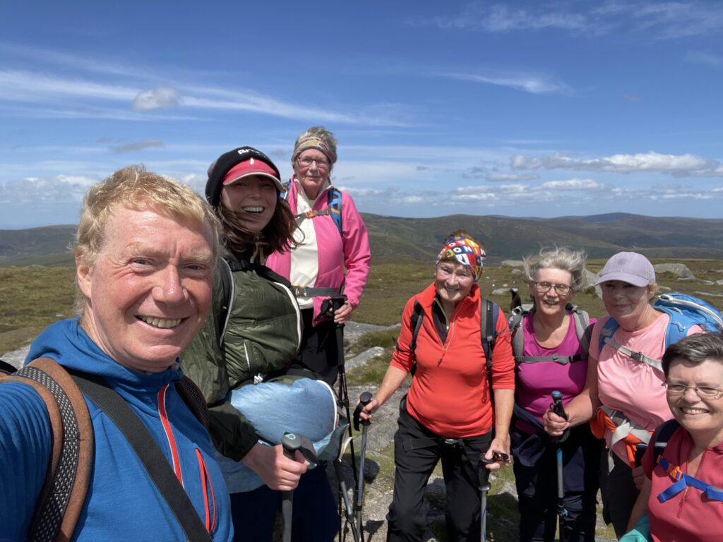
We struck out more or less straight from the car park and up the slopes of Brockagh, eventually to reach the thin track along the top. But it was quite hard work as the slope was pathless and the heather deep. The Brockagh ridge is one of my favourites – broad, expansive and desolate. Then there’s another steep slog up to the top of Tonelagee from the end of the ridge.
I thoroughly enjoyed the hard work and it felt good to get my heart rate elevated for a bit. We sheltered behind a convenient boulder for lunch, then dropped quickly down to the Wicklow Gap and, barely pausing for breath, swept straight up the hydro road to the top of Turlough Hill. A brief walk along the Camaderry Ridge – with a couple more climbs along the way, then we found an old miner’s track which we followed back to the car park.
On return to the cars, we all agreed that it had been a thoroughly excellent walk, especially as it was one of the longest we’ve done lately, at 17km / 900m / 7h. We said our goodbyes and I hot footed it round the M50 and was back in Malahide just before 7. Val had had a good, relaxing day, so now we’re just settling down to enjoy a chicken and noodle stir fry that she’s prepared while I was away. It’s delicious!
Today’s photos (click to enlarge)
 |
 |
| Looking down Glendasan from the car park near the lead mines where we started the walk | Heading up the valley with Tonelagee on the centre-right horizon |
 |
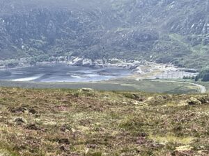 |
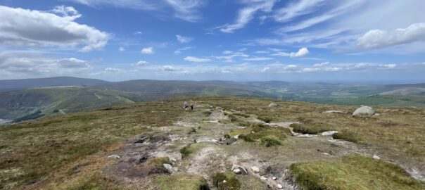
| On the Brockagh ridge. It’s a bit of a wilderness up there (though there is a faint path) and I love it! | Looking down on Lough Nahanagan from the top of Tonelagee. The two terminal moraines left in the Younger Dryas stadial 11,000 years ago are visible towards the right |
 |
 |
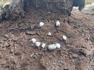
| The Bog Monster of Camaderry | On the top of Camaderry. Only time for a momentary pause for a cup of coffee from the trusty Thermos before progress was resumed |
 |
|
| Tonelagee summit. I could definitely do with a haircut! (And possibly also with a bit of weight-reduction) | |
Interactive map
(Elevations corrected at GPS Visualizer: Assign DEM elevation data to coordinates )
Max elevation: 812 m
Min elevation: 276 m
Total climbing: 917 m
Total descent: -917 m
Total time: 06:51:31
You can read earlier and later days’ blogs below
Previous day’s blog
Next day’s blog
Ireland home page
 Save as PDF