Ireland day 0823. Saturday 30 December 2023- New Route
| Today’s summary | It was the weekend so I wasn’t working though Val had Wonderlights in the evening. We spent our free time beforehand thinking about a possible holiday for sometime in 2024. Nice to day dream. While Val was at work in the evening I pioneered a new walk over an undiscovered hill between Seamount and Seapark right in the middle of Malahide | ||||
| Today’s weather | Heavy rain overnight but dry and mostly bright during the day. Strong southerly wind. Appx 9c | ||||
 |
 |
||||
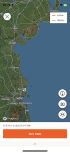
| Today’s overview location (The grey mark shows the location of my route) |
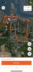
Close-up location (The orange line shows where I walked) (Click button below to download GPX of today’s walk as recorded, or see interactive map at bottom with elevations corrected): New walk in Malahide |
||||
Commentary
(Summary blog only. Last full blog was Day 0368).
2023 has been a pretty full-on year for both of us, so this morning before Val headed off to Wonderlights just before 3pm, as well as having lunch we also started thinking about whether we might treat ourselves to a bit of a holiday to somewhere warm and sunny. We’re pencilling in something for after I have finished my contract in February, but haven’t reached any firm conclusions yet. It’s definitely something to look forward to and for me at least the planning and anticipation beforehand is almost as enjoyable as the holiday itself.
But we soon had to drag ourselves out of our reverie so Val could get ready for Wonderlights – not many more nights to go now – leaving me contemplating the afternoon and feeling guilty that I wasn’t working too. Anyway I am going to give myself a break as it’s a bank holiday weekend and I need to be firing on all cylinders when I go back on Tuesday.
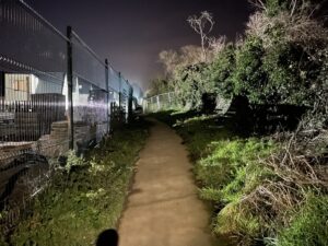
I made a couple of phone calls in the afternoon, then headed out for my usual evening leg-stretch. Today, as I was heading up Seamount towards Robswall, I noticed an intriguing-looking path heading off to the left, running alongside some temporary fencing by a building site. On impulse, I decided to divert away from my Robswall plan and see where it went.
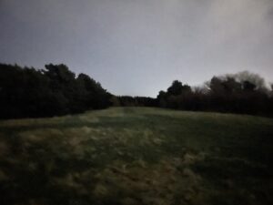
I had assumed that, like many paths in Ireland, it would eventually lead into an area which was closed off to the public. But to my surprise, it didn’t seem to. The path left behind the buildings and went through some gates (which I have to admit did look like they were normally locked) into a large grassy area, surrounded by trees, and with a hill in the middle. I walked up to the top of the hill, from where there was a spectacular view, and I could also see that the grassy area around and about was quite extensive. But it was very dark up there, and I couldn’t see much, so rather reluctantly I decided to drop back to the path and see how far it want.
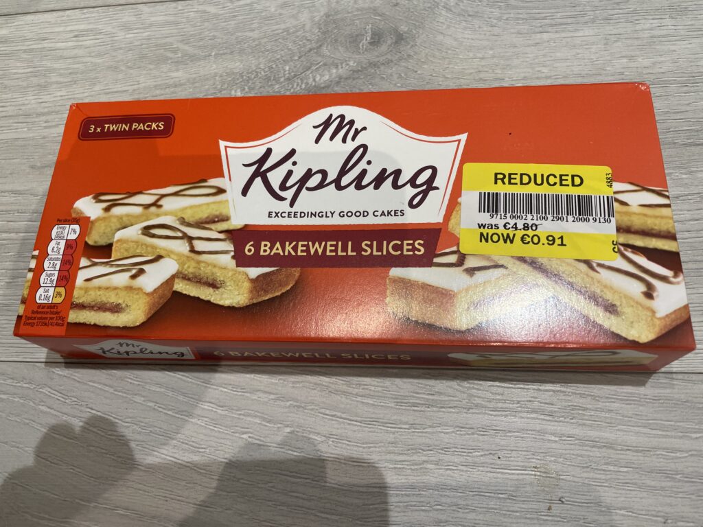
It was another pleasant surprise to discover that the path didn’t just peter out, but ran on as far as a second gate, which led into the top of the Seapark estate. I’d never been to this part of Malahide before but I soon figured out how to escape the estate and get down to the Coast Road. From there it was only a short walk back to the flat – though I did extend it slightly by dropping in to Tesco to pick up a couple of bargains 🙂
So it was an extremely interesting evening’s excursion – not what I had expected at all – and I will definitely have to pay a return visit in the daylight. I remain amazed that I could have overlooked such a large feature right in the middle of Malahide for so long. Still, better late than never!
Today’s photos (click to enlarge)
 |
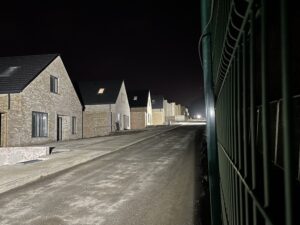 |
| At the start of the new path. It sets off running alongside the new estate of large houses being built on the north side of Seamount Road | These are the new houses. They look quite nice – and the ones at the top of the hill have a great view westward towards Swords – but I have no idea what the build quality is like |
 |
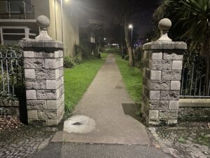 |
| On the top of the new hill I “discovered”. It was very dark when I was up there so couldn’t see much. But there did seem to be quite a large green area which appeared to be publicly accessible | The far end of the new path, on the Coast Road. I’m quite surprised I hadn’t noticed it before |
 |
|
| I do like a yellow sticker bargain. Especially when it’s over 80% off! | |
Interactive map
(Elevations corrected at GPS Visualizer: Assign DEM elevation data to coordinates )
Max elevation: 55 m
Min elevation: 2 m
Total climbing: 99 m
Total descent: -99 m
Total time: 01:08:07
You can read earlier and later days’ blogs below
Previous day’s blog
Next day’s blog
Ireland home page
 Save as PDF