Ireland day 0852. Sunday 28 January 2024- Family Guests 02
| Today’s summary | Drove up to Termonfeckin and aimed to walk up the coast to Port Oriel but got blocked by a high tide halfway to Clogherhead town. Avoided the tide by walking along the road for a couple of km. Made it successfully to over Clogher Head to Port Oriel, refreshments in the Beach House in Clogherhead on the way back, then made it successfully back down the beach to Termonfeckin in the evening. Curry in the flat for dinner | ||||
| Today’s weather | Heavily overcast all day with light rain in the evening. Strong southerly wind. Appx 12c | ||||
 |
 |
||||
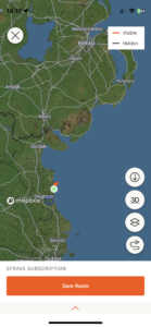
| Today’s overview location (The blue mark shows the location of our route) |
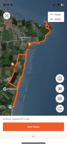
Close-up location (The blue line shows where we walked) (Click button below to download GPX of today’s walk as recorded, or see interactive map at bottom with elevations corrected): Avalonia to Laurentia |
||||
Commentary
(Summary blog only. Last full blog was Day 0368).
Another good day out today. Drove up the M1 to Termonfeckin with the aim of repeating a walk up the coast to Port Oriel via Clogherhead (town) and Clogher Head (headland) that we have done a couple of times in the past.
Early on, though, we hit an unexpected obstacle. The tide was exceptionally high (a Spring tide and we hit it at exactly high tide – to the minute) so the section of the beach where it goes round a rocky promontory – was under water. There was no easy way to round (and the higher level walk through the caravan park was blocked) so we had to do a 2km walk along the busy R166. Not to bad but we were glad to get to a road down to another caravan park where we could access the beach where the sandy section was a bit wider and not flooded by the tide.
The rest of the walk was straightforward and even the rain which threatened to pour down all day, more or less held off. We eventually made it to Port Oriel, after traversing the Iapetus Suture on Clogher Head and crossing from Avalonia to Laurentia. We had a quick look at the seals and then paused for a cup of coffee from the trusty Thermos and a snack of some over pains aux chocolat left over from breakfast.
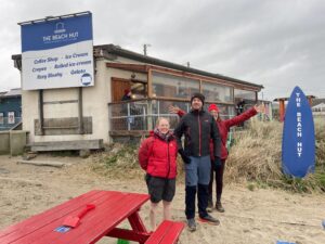
Once back in Clogherhead village, we dropped into the Beach House for a cup of tea and another cake, and then it was a straightforward walk back to the car at Termonfeckin, as the tide was out so we could stick to the coast all the way.
An excellent day out, and now it’s time for curry in the flat that Val has pulled together. It smells delicious and I’m hungry!
Today’s photos (click to enlarge)
 |
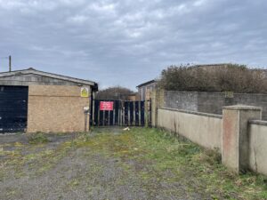 |
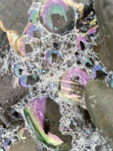
| All the colours of the rainbow on the foam-flecked beach | Annoyingly the route through the caravan park avoiding the high tide section, is closed off at the end, only about 50 metres from where you could get back into the dunes and walk along to Clogherhead. So we had to backtrack and go along the road |
 |
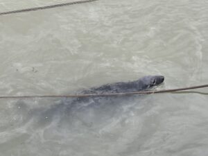 |
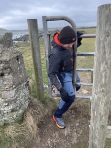
| Tiny gate on the way up Clogher Head! | Sidney the seal checking us out in Port Oriel |
 |
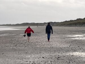 |
| Just time for refreshments in the Beach Hut in Clogherhead on the way back | Bravely barefoot on the beach |
 |
|
| We walked on the east coast of Ireland, where the red line crosses from the Irish Sea to the mainland | |
Interactive map
(Elevations corrected at GPS Visualizer: Assign DEM elevation data to coordinates )
Max elevation: 34 m
Min elevation: 0 m
Total climbing: 222 m
Total descent: -223 m
Total time: 03:50:25
You can read earlier and later days’ blogs below
Previous day’s blog
Next day’s blog
Ireland home page
 Save as PDF