Ireland day 0599. Saturday 20 May 2023- Portrane on Foot
| Today’s summary | Val was at work and I walked round the Lagoon and then to Portrane via the Corballis Road. Caught the train back from Donabate then made dinner and we both went into town to see the “Eight Mountains” at the IFI | ||||
| Today’s weather | Overcast but bright all day. No sun or rain. hardly any wind. Appx 15C | ||||
 |
 |
||||
| Today’s overview location (The blue mark shows the location of my route) |
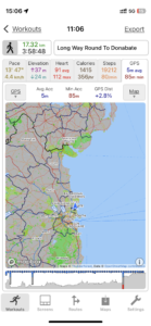
Close-up location (The blue line shows where I walked) (Click button below to download GPX of today’s walk as recorded, or see interactive map at bottom with elevations corrected): Coast walk to Donabate via Portrane |
||||
Commentary
(Summary blog only. Last full blog was Day 0368).
As Val was at work today, and as I’m mostly on top of all the domestic chores at the moment, I decided to push the boundaries of the area around Malahide that I’d explored previously.
So today I walked round the Broadmeadow estuary – as I’ve done many times before – but instead of heading up to the Newbridge demesne, I continued on to the Corballis Road and walked further round the coast, under the railway embankment, and on to the back of the Portrane peninsula. It’s a pity you can’t walk right round the peninsula – the golf clubs have put paid to that idea – but there is a path through one of the courses, up towards the top of the peninsular, and it does give you quite a nice shortcut through to the beach.
The walk went very straightforwardly, and despite a slightly tedious stretch at the end along the roadside back to Donabate station from the beach, I very much enjoyed it. It also turned out to be my longest post-op walk at 17.2km / 10.7mi. I’m not sure I’d do the Corballis extension again – on reflection I think the Newbridge route is more pleasant – but it was interesting to see somewhere new.
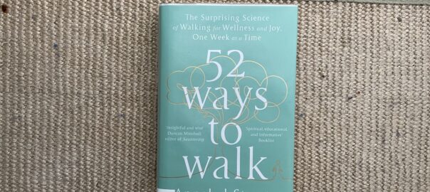
Now I’m back in the flat, and getting ready to make tea. It’s jacket potatoes again – which will be quick as I cooked them yesterday – then as soon as Val is home and we’ve eaten, we are off out again to see the film “The Eight Mountains” at the Irish Film Institute. I’ll report back tomorrow! Oh and by the way in case you were wondering about the book in the banner image – it was recommended to me by a friend in France. Seeing as it is relevant and topical to me at the moment, I shall look forward to reading it. I just need to find some time!
Today’s photos (click to enlarge)
 |
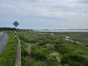 |
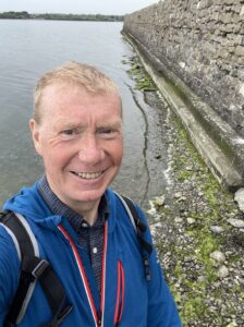
| I was slightly confounded at this point. My theory is that the water level in the lagoon is only low enough to allow you to walk round with dry(-ish) feet for a brief window a couple of hours after low tide on a neap tide in the outer lagoon. But today it was nowhere near a neap tide (in fact I think it was probably closer to a spring tide than a neap tide), and at the very moment I took this photo, the tide was at its highest point. Ah well – whatever the reason I got round with dry feet today, which I was pretty pleased about | In the hitherto unexplored coastal hinterland along Corballis road, to the east of the railway embankment and heading to the Portrane peninsula |
 |
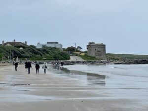 |
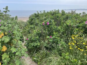
| There’s a rather nice grassy and sandy path leading through the golf course to the beach halfway up the Portrane peninsula (sometimes called “The Island”). I wish there were more paths like this in ireland | The Martello tower, by the Coast Hotel, on Donabate beach |
 |
 |
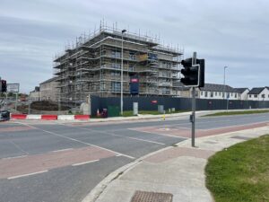
| On the new Donabate Distributor Road. When we first arrived here in 2021, this was all fields and grassland. Now it is a huge housing estate. Progress, before our very eyes! | We are off to see this film in the IFI this evening. It’s highly acclaimed, apparently, and I’m very much looking forward to it |
 |
|
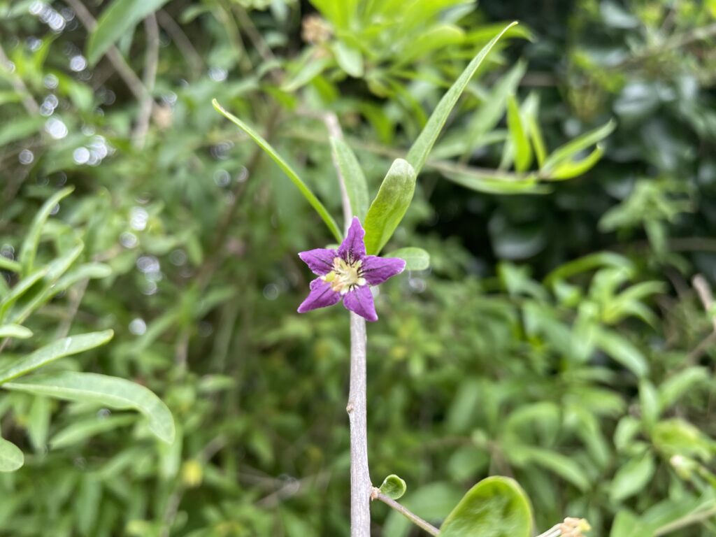
| If it hadn’t been for Google, I doubt very much that I would ever have worked out what this unremarkable climbing shrub growing in a hedgerow near Portane was. In fact it is the flower of the Goji Berry, Lycium barbarum. It’s a distant relative of the tomato and is native of China. Apparently it is quite widely naturalised in England, but I’ve not come across it in Ireland before. | |
Interactive map
(Elevations corrected at GPS Visualizer: Assign DEM elevation data to coordinates )
Max elevation: 16 m
Min elevation: -4 m
Total climbing: 217 m
Total descent: -217 m
Total time: 03:58:45
You can read earlier and later days’ blogs below
Previous day’s blog
Next day’s blog
Ireland home page
 Save as PDF