Ireland day 0887. Sunday 03 March 2024- Burrow Beach
| Today’s summary | Val was working at the museum and so I drove up to the Shoreline Hotel at Donabate to join the Walking Club for a stroll up the coast as far as the Burrow beach at Portrane. The tide was coming in quickly so we only had a brief pause for lunch before coming back. Dropped a few friends off at Donabate station at the end then joined Val for a walk around the demesne. Val out at a colleague’s leaving do at a restaurant in Malahide in the evening | ||||
| Today’s weather | Bright and dry with a fair amount of sun. Light westerly wind. Appx 8c | ||||
 |
 |
||||
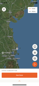
| Today’s overview location (The grey mark shows the location of our route) |
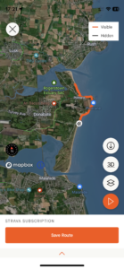
Close-up location (The orange line shows where we walked) (Click button below to download GPX of today’s walk as recorded, or see interactive map at bottom with elevations corrected): Donabate to Portrane and Burrow Beach DWC |
||||
Commentary
(Summary blog only. Last full blog was Day 0368).
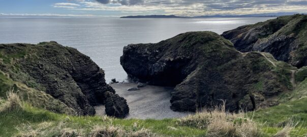
Confusingly, there are two Burrow beaches on the east coast of Ireland near where we live. The southernmost one is at Sutton, near Howth, and the northern one is near Portrane, on the Rogerstown estuary. Today, I was heading north, to join a Club walk from Donabate to Portrane.
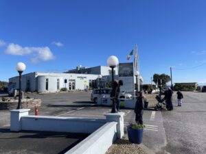
Val had to put in a shift at the museum today, so I went on my own. But the noon start meant there was no rush to get going early this morning (hooray!) so I pottered off after a couple of cups of tea and a leisurely morning. I arrived at the start point at the Shoreline Hotel just in time to get a cup of coffee. The sun was shining brightly and if you could get out of the wind, it was actually quite pleasant.
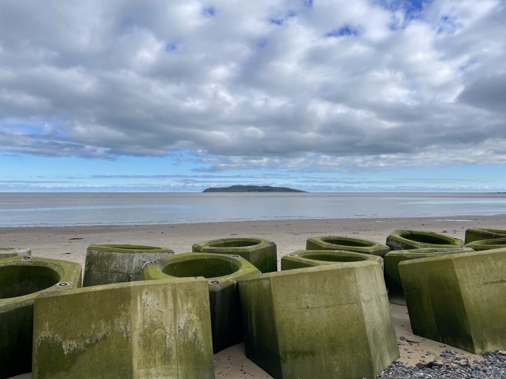
But it was soon time to set off, and we headed off north up the coast, through Portrane, passing the hospital with the follies on our left, and the two new pop-up saunas which have appeared just by the coast at Tower Bay. By the time we reached Burrow Beach, everyone was feeling the need for lunch so we picked a sheltered spot behind the Seabee coastal defences to enjoy our sandwiches.
We soon noticed, however, that the sea was coming in alarmingly fast, so we cut our dining short and retraced our steps back to the firmer territory of the Quay Road before the tide well and truly cut us off.
We were back at the start not long after 3pm, so it really was a short and sweet outing. I drove a few friends back to Donabate Station then dashed back to the flat just in time to bump into Val who had finished work and was about to go on a walk round the Demesne. I joined her for that then after a cup of tea she set off again, to go to a colleague’s leaving do at a Thai restaurant in Malahide. Time for me to make dinner now (it’s roast beef sandwiches) then perhaps treat myself to a couple of YouTube videos about walking holidays in warm sunny places. Dream on!!
Today’s photos (click to enlarge)
 |
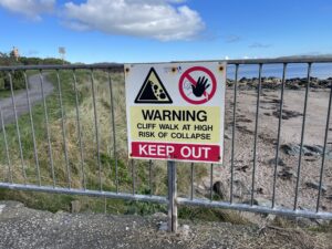 |
| The Shoreline Hotel. Obligatory cup of coffee required before setting off | Luckily there is a newer path which avoids the collapsed bit |
 |
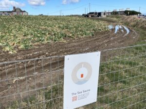 |
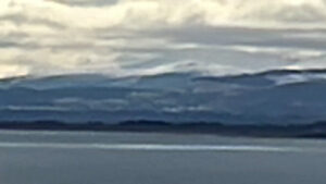
| You can just about make out the snowy Dublin Mountains on the horizon in this blurry telephoto shot | A massive field of cauliflowers lies alongside the path. Sadly, many of them seem to have been left un-harvested and were going to waste. But the enterprising farmer has recently installed two pop-up coastal saunas in the field – perhaps there’s more money in beauty than in brassicas |
 |
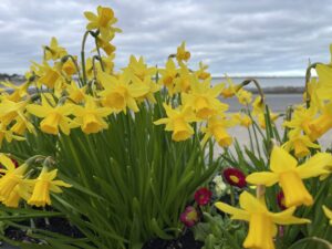 |
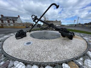
| Anchor of the RMS Tayleur, on display in Portrane town. She was wrecked on Lambay Island in January 1854 with the loss of 350 lives from the 650 on board. The vessel was owned by the White Star line – of Titanic notoriety – and like the Titanic was on her maiden voyage – in this case from Liverpool to Melbourne | Cheery miniature daffodils on the seafront at Portrane |
 |
|
| Seabees! As these coastal defences on Burrow beach are known. It’s a bit of a hopeless Canute-ish task, though, as the coast is rapidly eroding behind them and gardens and trees are falling into the sea. As far as I can tell the sand is being deposited at Bull Island, which appears to be growing as fast as Portrane is shrinking | |
Interactive map
(Elevations corrected at GPS Visualizer: Assign DEM elevation data to coordinates )
Max elevation: 15 m
Min elevation: 0 m
Total climbing: 161 m
Total descent: -161 m
Total time: 03:01:33
You can read earlier and later days’ blogs below
Previous day’s blog
Next day’s blog
Ireland home page
 Save as PDF