Ireland day 0872. Saturday 17 February 2024- Djouce Circuit
| Today’s summary | Val and I drove down to Enniskerry to join the Walking Club for a “Circuit of Djouce” walk. A new walk for us, and we thoroughly enjoyed it, despite poor weather. Nice to get back to the flat and a hot shower! | ||||
| Today’s weather | Heavily overcast with rain or drizzle most of the day. Moderate southerly wind, much stronger higher up. Appx 12c but colder on the tops | ||||
 |
 |
||||
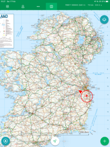
| Today’s overview location (The red mark shows the location of our route) |
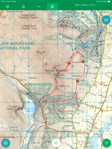
Close-up location (The red line shows where we walked) (Click button below to download GPX of today’s walk as recorded, or see interactive map at bottom with elevations corrected): Djouce Circuit DWC |
||||
Commentary
(Summary blog only. Last full blog was Day 0368).
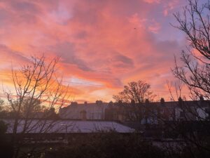
I was up bright (well relatively speaking) and early this morning – mainly to bring the washing in from the balcony before anyone spotted that it had been lurking there overnight. The view as I struggled out was spectacular – a magnificent sunrise, which I must have caught at exactly the right time (about 7:25 am) as it had completely faded just five minutes later. But the dawn red sky certainly was a warning. Because by the time we had driven down to Enniskerry to meet up with the Walking Club (in, of course, the Kingfisher café), it had started raining and it didn’t really stop all day.
A new route, for me, was on offer today. A circular loop round the flanks of Djouce, following the Wicklow Way for part of the route. The previous two times the Club has run the walk, I have missed it for one reason or another – though to be fair on both occasions it was partly or totally thwarted by bad weather (hurricane force winds two years ago, and rain last year).
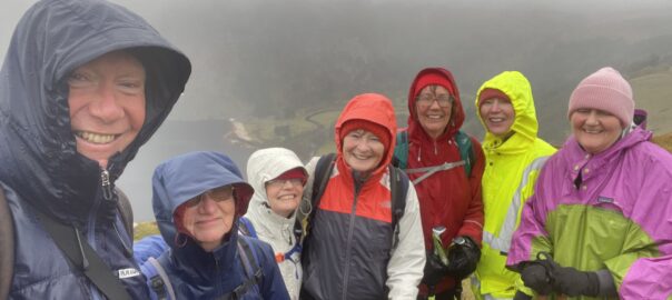
The weather today wasn’t great either – the lack of views was a bit disappointing – but once we were wrapped up in our waterproofs, the wind and rain weren’t too challenging and in fact being enclosed in our little bubbles, cut off from the outside world, was quite therapeutic. And, unlike the previous two years, we did manage to complete the walk today.
We contemplated going up to the top of Djouce, but it was unpleasant enough where the summit path bifurcates from the Wicklow Way, and the thought of even worse weather at the top didn’t fill us with inspiration. So we stuck to the lower level Way, and fortunately soon managed to find a semi-sheltered spot for lunch. We shovelled down our sandwiches and moved on pretty quickly, as we were still getting wet even though we were out of the rain.
We climbed a little further and quickly gained the boardwalked section running along White Hill towards the JB Malone memorial. We paused at that point to admire the view, such as it was, then descended back through Ballinastoe woods to the cars. By this stage, the weather had brightened up considerably, though that might in part at least have been to the descent in altitude.
We were back in good time – it was only about 3:30 pm – so we had plenty of daylight left. But at that point, we said our goodbyes and then drove uneventfully back to Malahide, stopping briefly at Tesco Swords en route to pick up some milk and other essentials.
Now we’re back, and it’s time for some beef casserole liberated from the freezer, and then a bit of Netflix. But first – hot showers!!
Today’s photos (click to enlarge)
 |
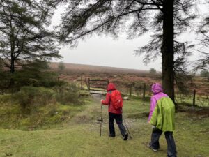 |
| “Red sky at morning – Shepherd’s warning” – never was a truer word spoken! | Heading out from Ballinastoe Woods onto the “blasted heath” leading, eventually, to Powerscourt Paddock |
 |
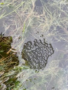 |
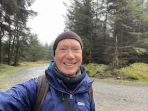
| Looking un-naturally fresh faced in Ballinastoe Woods – though this was only the start of the walk | It’s spring!! |
 |
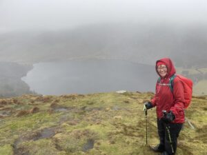 |
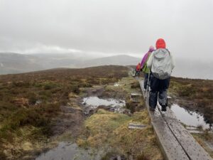
| On the Wicklow Way boardwalk over White Hill, just below the summit of Djouce. The boardwalks are great in theory by extremely slippery when wet (which is almost always). So you have to take care. | Val overlooking Lough Tay (aka the Guinness Lake). Luggala is the mountain in the mist behind it – I’d really like to climb it, but access is severely restricted as it’s all privately owned land |
 |
|
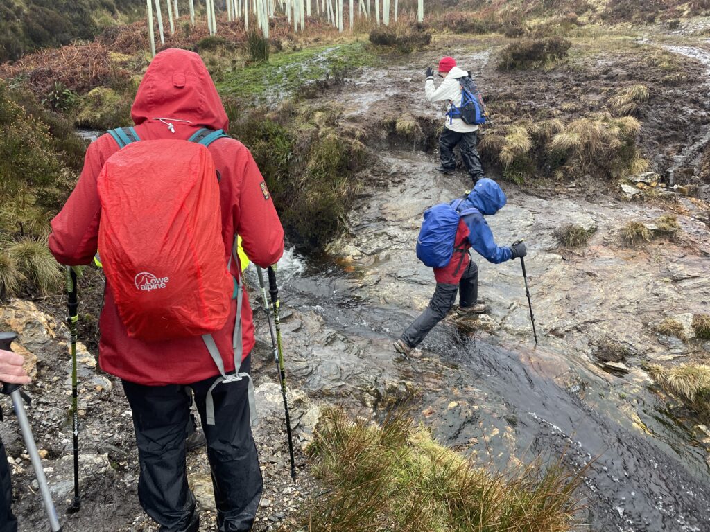
| Care required in crossing the Glasnamallen stream | |
Interactive map
(Elevations corrected at GPS Visualizer: Assign DEM elevation data to coordinates )
Max elevation: 629 m
Min elevation: 314 m
Total climbing: 556 m
Total descent: -551 m
Total time: 04:35:06
You can read earlier and later days’ blogs below
Previous day’s blog
Next day’s blog
Ireland home page
 Save as PDF