
Ireland day 1004. Friday 28 June 2024- Glenealo Recce
| Today’s summary | Val still away in London so I took advantage of another free day to drive down to Glendalough to recce a walk I’m planning to lead when a couple of friends come over to visit us from Houston in September. Did a 10km / 6mi loop up the Spinc, into the Glenealo Valley and back round the Upper Lough. Very enjoyable indeed, and the weather co-operated for once | ||||
| Today’s weather | Breezy, dry and bright with some sunny intervals. Moderate westerly wind. Appx 17c | ||||
 |
 |
||||
| Today’s overview location (The green mark shows the location of my route) |
Close-up location (The orange line shows where I walked) (Click button below to download GPX of today’s walk as recorded, or see interactive map at bottom with elevations corrected): Glenealo Recce |
||||
Commentary
(Summary blog only. Last full blog was Day 0368).
While Val is away for a couple of days, I’m taking the opportunity to make the most of the summer weather (such as there is!) and do a bit of walking. I quite enjoy not having to be back at any specific time, and also without really having to worry about it getting dark early.
So today fitted into the same pattern as yesterday – albeit with a much shorter walk in store. But before I trundled off, I fitted in a morning video call back to a friend in the UK. There was lots to catch up on and 90 minutes passed surprisingly fast.
Anyway, once we had put the world to rights, I made a couple of sandwiches, dug out my waterproofs (I’m not taking any chances, after yesterday) and set off in the Trusty Yaris.
After filling up with petrol at the local Applegreen, my destination today was Glendalough. It’s a reasonably long (90 minute) drive for what was to be a relatively short walk. But I had a specific purpose in mind. We have a couple of friends coming over from Texas in September, and they have expressed an interest in doing a short walk to get a flavour of the Irish countryside. I wanted to recce a suitable route.
I’d asked around with my Walking Club friends and the general consensus was that a loop of the upper Glendalough lake, via the Spinc and Glenealo valley, would make a good choice. It’s only 10km / 6mi round but there’s a decent climb and some excellent scenery.
So once I’d parked at the Upper Lough carpark, I set off and followed a route that I’d downloaded from the AllTrails app. It turned out to be a good choice. I was lucky with the weather, but I think that even if it was poor, it would make a good leg-stretch. I particularly enjoyed having a look at the disused Van Diemens Land lead mine workings in the desolate and relatively recently de-glaciated Glenealo valley, which hangs above the western end of the Upper lough.
I decided not to stop on the way round, but when I returned to the car I got a coffee (and, I have to admit, a doughnut) and enjoyed my lunch by a pop-up cafe in the car park.
The drive back was slow – over 2 hours – as I hit peak rush hour. But I listened to a couple of podcasts as I drove, so the time passed quickly enough.
Once back, I got myself another pop pop curry with some salad for dinner, and then followed it up with some semolina for pudding. Now I’m going to read another chapter of my climate book. Tonight, I think, it’s the turn of the Milankovitch cycles, which I shall enjoy while Shania Twain warbles away up at the castle. Watch this space for further developments.
Today’s photos (click to enlarge)
 |
 |
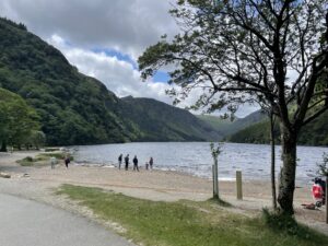
| On the east shore of the Upper lough | From the top of the Spinc looking back down to the Upper (in the foreground) and Lower loughs (in the distance) |
 |
 |
| Narrow boardwalk from the top of the Spinc into the Glenealo valley – requires care where you put your feet so you don’t wander off | Very tame sika deer at the head of the Glenealo valley |
 |
 |
| Substantial footbridge over the Glenealo river near the van Diemen’s Land lead mines (Van Diemen’s Land is what is now Tasmania and the mines were so named because of their Tasmanian-like remoteness) | Down the zigzags to the western end of the Upper lough. The boulders here were popular with rock-climbers today |
 |
|
| Poulanass waterfall, leading out of the Glendalough valley up onto the Spinc | |
Interactive map
(Elevations corrected at GPS Visualizer: Assign DEM elevation data to coordinates )
Max elevation: 505 m
Min elevation: 134 m
Total climbing: 560 m
Total descent: -561 m
Total time: 02:16:17
You can read earlier and later days’ blogs below
Previous day’s blog
Next day’s blog
Ireland home page
 Save as PDF