Ireland day 0113. Wednesday 19 January 2022- Recce
| Today’s summary | Took the DART all the way from Malahide to Bray, then recce’d the Bray Head Loop walk that I have volunteered to in February. An absolutely excellent day out with great weather and superb views. | ||||
| Today’s weather | Brilliant cloudless morning, clouded over a bit in mid-afternoon. Strong breeze higher up, still quite windy on the promenade in Bray. About 9C | ||||
 |
 |
||||
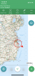
| Today’s overview location (the red cross in a circle shows where Val and I are at the moment) |
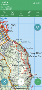
Close-up location (Click button below to download a gpx of today’s walk, or see interactive map at bottom): Bray Head Recce |
||||
Commentary
I had a bit of a rush of blood to the head last weekend when we attended the AGM of the Dublin Walking Club, and accidentally volunteered to lead a walk in February. This is quite a daunting undertaking as I haven’t led a walk in a foreign (to me) country before and I want to make sure it goes well. So I had given quite a lot of thought to possible routes over the last few days, and after a lot of consideration concluded that Bray Head would be a good place to start.
When Val and I walked from Greystones to Bray on New Years Day, we had passed below Bray Head itself on the Cliff Path. I’d noticed at the time that there were signs about a looped walk you could do, starting and finishing at Bray and taking in the summit of Bray Head. I remembered thinking that it would be a good walk to come back and do at a future date. So that sounded like the basis for a good “Medium” walk to start out with. It’s quite short, quite easy to get to, and quite hard to get lost on. But the secret to success is good planning, so I thought that we better go and walk the whole route in advance, to make sure there weren’t any hidden pitfalls on the way.
So we got up bright and early – and it definitely was bright, with brilliant winter sunshine streaming in through the windows as we opened the blinds. We had a quick breakfast, made packed lunches, then crossed over to the station and caught the 0930 DART direct to Bray. It’s a nice, leisurely, train ride and I couldn’t help thinking to myself – once again – that we are fortunate to be living in Malahide. The easy, direct, access to the Wicklow coast only hour away is excellent. And the return fare is just €4.60 so it’s good value too.
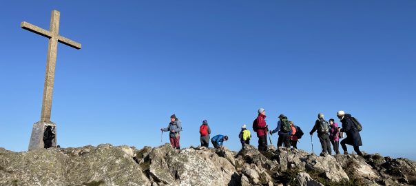
To the south of Bray is Bray Head – which confusingly has several summits. Towering over the town, at 206 metres, and sporting an impressive cross on the top, is the summit locally known as Bray Head. But if you climb to the top and stay up high, there are a couple of other summits nearby (un-named on the map) – all impressively capped in white quartzite, a bit like Beinn Eighe in Scotland. But the main summit of the outcrop is actually about 1500m further south and just to make matters doubly complicated, on the map it is called “Bray Head Hill”. It’s much less well visited and actually seems to be on private land – though there is a rough track and a stile in the fence leading to it. It’s actually a bit higher, too, at 240m
So once we got to Bray, we headed more or less straight up Bray Head and were at the top in about 45 minutes from the station. It’s a bit of a rough climb – quite steep and probably slippy in wet weather – but nothing difficult. The views from the cross were outstanding – there was literally not a cloud in sight, from horizon to horizon. Even though it was midweek today, it was still quite busy on the top so I suspect it could be quite crowded when we do the walk itself on a Sunday in February. The route from Bray Head to Bray Head Hill is easy, along a route known as the “Carriage Path”.
The Carriage Path was built by Lord Neath (the same one who denied access for the railway – as you can see in the pictures below) to transport important visitors round the hill, so they could admire the view. It’s said that it was built with a visit by Queen Victoria in mind, although she never actually used it because the risk of an attack was deemed too high. Anyway, Val and I found it a delight to walk along today, and soon made it to the start of the short path up Bray Head Hill. We took the thin path to the top and, unlike on Bray Head, it was a joy to have the whole place to ourselves – just us, a trig point, and some expansive views. So we sheltered for a few minutes to take it all in, then headed back down the steep zigzag path to meet the Cliff Path heading north from Greystones.
At this point, it started to cloud over, and we were in the shade of the headland anyway, so in the breeze it felt quite cold. We had walked this section only a couple of weeks ago, so it seemed very familiar but even so, and even with the wintry chill, it’s a wonderful walk, with tremendous views.
The highlight of this section – and perhaps of the whole walk, actually, was towards the end when we stopped to chat to some people heading the other way (as you do in Ireland – it’s really quite nice). The reason I mention this is because as we were speaking, I glanced sea-wards over the shoulder of the person we were talking to, and suddenly, right before my eyes, a dolphin leapt out of the water, crashing back in almost as suddenly as it appeared. We stood and watched for a few minutes and it was clear that there was a whole pod of them just offshore – presumably they’d found a shoal of fish and were just settling in for a late lunch. As neither Val nor I had ever seen dolphins in the wild before, it was quite a special occasion.
(By the way – although I tried to take photos, it was hopeless. You never knew where they are going to pop out of the water, and by the time you had got your lens trained on the appropriate spot, they had gone again. To get a decent shot I think you just need to be very lucky and prepared to wait a long time).
Anyway, on that high note, we finished off the walk quickly, and managed to pick up a direct DART back to Malahide with only a 10 minute wait. So all in all, it was an excellent day out and I think it will make a good walk in February. Here’s hoping that it all works out OK and that it doesn’t rain!
Today’s photos (click to enlarge)
 |
 |
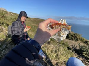
| Enjoying one of Val’s delicious vegan creations on the hillside high above the Irish Sea. This one is a Meera Sodha tomato and pistachio pizza | Looking south over the great sweep of Greystones Bay |
 |
 |
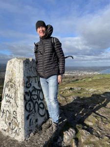
| On the top of Bray Head Hill – not the same as Bray Head (the one in the featured image at the top, with the cross). Bray Head is much more frequently visited, though is actually a bit lower than Bray Head Hill | Back on the Cliff Path, leading to Bray. You might be able to spot the railway in the background, running from Bray to Greystones. The cliff route for the line is actually one of the most expensive sections of track to maintain in the whole of Ireland. It’s actually an illogical place to put the line – there is a much better route inland in a valley behind Bray Head. However at the time the railway was being built in 1850 the then landowner, Lord Meath, didn’t want the line bisecting his land, but was happy for it to go on the more difficult route down the coast. He actually gave the land to the railway company for nothing though in view of the subsequent construction and upkeep costs, it was probably a bit of a poisoned chalice. Isambard Kingdom Brunel directed the construction of the line. |
 |
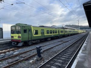 |
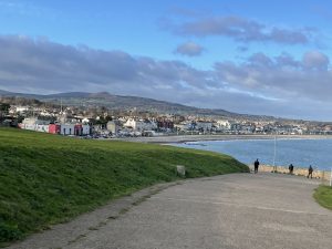
| Returning to Bray at the end of the walk. It feels a little down at heel these days. Apparently most Irish (and presumably British) seaside resorts went into decline in the 1970s when cheap package holidays to the Mediterranean proved a tempting alternative destination for their former clientele. Bray hasn’t suffered as badly as many, though, because of its proximity to Dublin and the DART affording easy access for commuters. | This is one of the DART trains which runs up and down the coast between Malahide and Greystones. They are Japanese trains which may explain their design which is a triumph of functionality over form. It doesn’t explain the colour scheme however, which I have to say looks a bit cabbagey |
 |
|
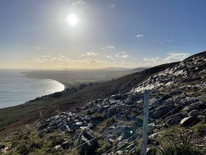
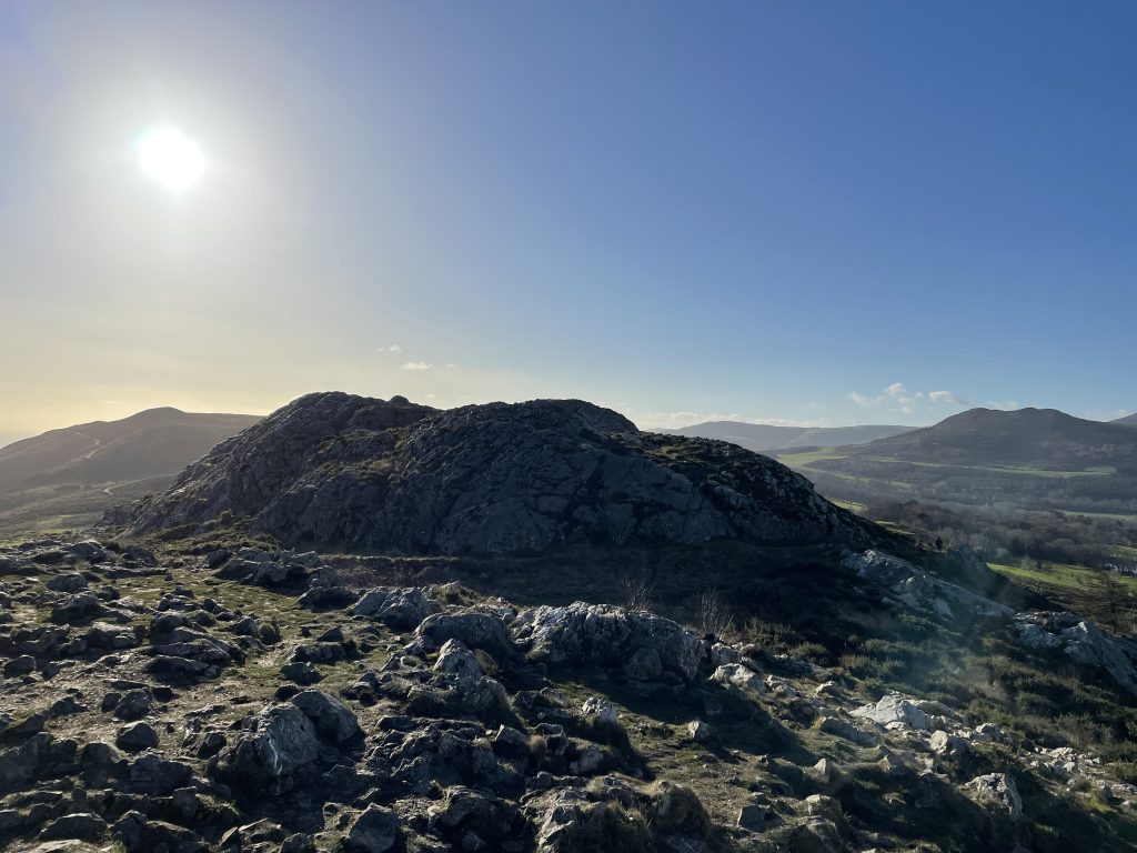
| Looking south from the top of Bray Head (not to be confused with Bray Head Hill, which is a bit further south and a bit higher) over the quartzite domes of the summit. The hill on the horizon at the right is Little Sugarloaf | |
Interactive map:
(Original elevation data)
Max elevation: 247 m
Min elevation: -7 m
Total climbing: 362 m
Total descent: -375 m
Total time: 03:49:31
You can read earlier and later days’ blogs below
Previous day’s blog
Next day’s blog
Ireland home page
 Save as PDF