Ireland day 0114. Thursday 20 January 2022- E8
| Today’s summary | Went with Val to the airport as she has returned to the UK for a brief visit. Then took 702 bus to Dublin and walked from Dublin Port to Marlay Park, following the route of the European E8 long distance path | ||||
| Today’s weather | Dry and bright but feeling raw. No wind, sun or rain. About 4C | ||||
 |
 |
||||
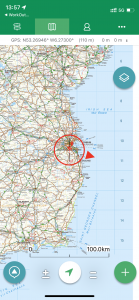
| Today’s overview location (the red cross in a circle shows where Val and I are at the moment) |
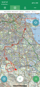
Close-up location (Click button below to download GPX of today’s walk as recorded, or see interactive map at bottom with elevations corrected): E8 Docks to Marlay as recorded |
||||
Commentary
Enthusiastic readers of this blog will have learned that I have a bit of a bee in my bonnet about walking across Ireland. I do hope to get round to it in the course of the next year or two, but while I’m waiting for the necessary planets to align, there as some bits of the cross-country route I can start on straightaway.
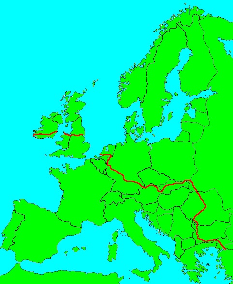
Val has had to return to the UK for a couple of days (she’s back on Monday) so I accompanied her on an eye-wateringly-early 102 to the airport and then made a start on my plan for the day. I’d read that there is a European path, imaginatively named “E8”, which runs right across Europe (even the UK!!), starting in Turkey and finishing on the west coast of Ireland. The Irish section follows a route very similar to Paddy Dillon’s coast to coast, and technically it starts at the beginning of the Wicklow Way, in Marlay Park at the south of Dublin. But, with a nod to purists, there is an extension of the path linking the Wicklow Way to Dublin Port, where the path comes “ashore” from Holyhead in the UK. So I decided that I would download the route and follow it all 18km / 13mi from the Irish Sea to the start of the Wicklow Way.
My first challenge was to work out how exactly to get from the airport to Dublin Port. I consulted Google and as luck would have it, it declared with confidence that the 702 bus would take me pretty much straight there, and it left in 10 minutes (at 8:10 am – yes it really was early). So I hot footed it to the airport bus station and found where the 702 was supposed to leave from – and the whole place was completely deserted. Then I looked at the “official” timetable which said that the first bus wasn’t actually until 2 hours later. So I turned away, slightly disconsolate, and started to head off to get the 102 again, so at least I could get to Malahide again and take the DART. Then as I was walking away, I saw a bus heading my way – and there it was, larger than life, a brand new express coach numbered “702”! So I jumped aboard and was whisked straight to my destination in 13 minutes flat. A real stroke of luck. Always trust your instruments.
I had to walk some distance from the bus stop at the 3Arena to the Port itself, and the start of the walk. Once there, I retraced my steps through the industrial hinterland, following pretty much the same route as I had used when I left Val at the ferry terminal the last time she drove back to the UK. I was soon back in Dublin and made my way to the Grand Canal Dock, on the south bank of the Liffey – where the river Dodder meets the Liffey. This is the same Dodder that we walked along last weekend, by the way.
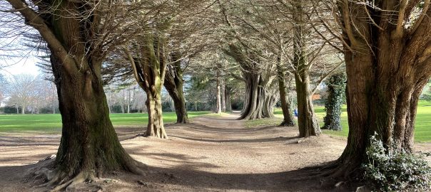
There’s a decent path alongside the Dodder, and it was quite a relief to reach the relative peace and quiet of the riverbank, after the noisy fumy section alongside the road through the docks. The path switches from side to side as you walk upstream, and it’s an easy walk – although hard on the feet as it’s all tarmacked. I quickly arrived at Farmer Brown’s pub – where last weekend’s walk started – and continued on past, and through Orwell Park. Eventually, after about 10km the E8 branches south off the Dodder and roughly follows the route of the Owendoher river through Rathfarnham to St Enda’s Park. By that stage I was only 2 or 3 km from the end of my planned walk and it was still barely noon. So I paused to have a look around. It’s a nice spot, with an attractive walled garden.
The chief attraction of the park is however the Pearse museum. This is set in an old manor house in the middle of the park, and was for a time a school run by Padraig Pearse – one of the leaders of the 1916 uprising at the GPO. He was subsequently executed by the British forces and the museum was set up to record his life. It’s run by the ever-excellent OPW and looks very well done. Given that I had plenty of time, I thought I’d go in and have a look around but sadly there was a burst pipe overnight so the exhibits are closed for the next few days. It’s somewhere, though, to come back to at a later date.
From St Enda’s it’s only a stone’s throw to the adjacent – and much larger – Marlay Park. I crossed the busy R113 and followed the E8 into the park through the Grange Road entrance. Marlay is a huge park – similar in layout and nature to the Malahide Castle demesne – and also features a nice walled garden. The official start of the Wicklow Way is at the car park in the north east of the park. I duly paid it a visit then thought I would extend my walk a bit by following the Way round the edge of the park as far as the point where it dives under the M50 motorway and heads on up Kilmashogue and into the Dublin Mountains.
E8 successfully despatched (well one three-hundredth of it, at any rate), I walked back though the park to catch the no 16 to Tara Street and then a DART back to Malahide. Now that I’m back and have had chance to reflect on the walk – I’d say it was interesting and definitely worth doing (albeit it’s all uphill) with a certain urban rather than rural appeal. I’m glad I’ve ticked off this missing link in the end to end chain but probably it’s not a route that I’ll feel a pressing need to do again for a little while.
Today’s photos (click to enlarge)
 |
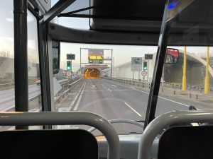 |
| The route of the E8 European long distance path. All 4,700km / 2,900mi of it from Istanbul to Cork | On the 702 from the airport into town, just about to enter the M50 tunnel to the docks. The journey took all of 13 minutes |
 |
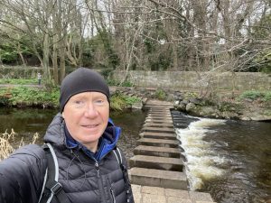 |
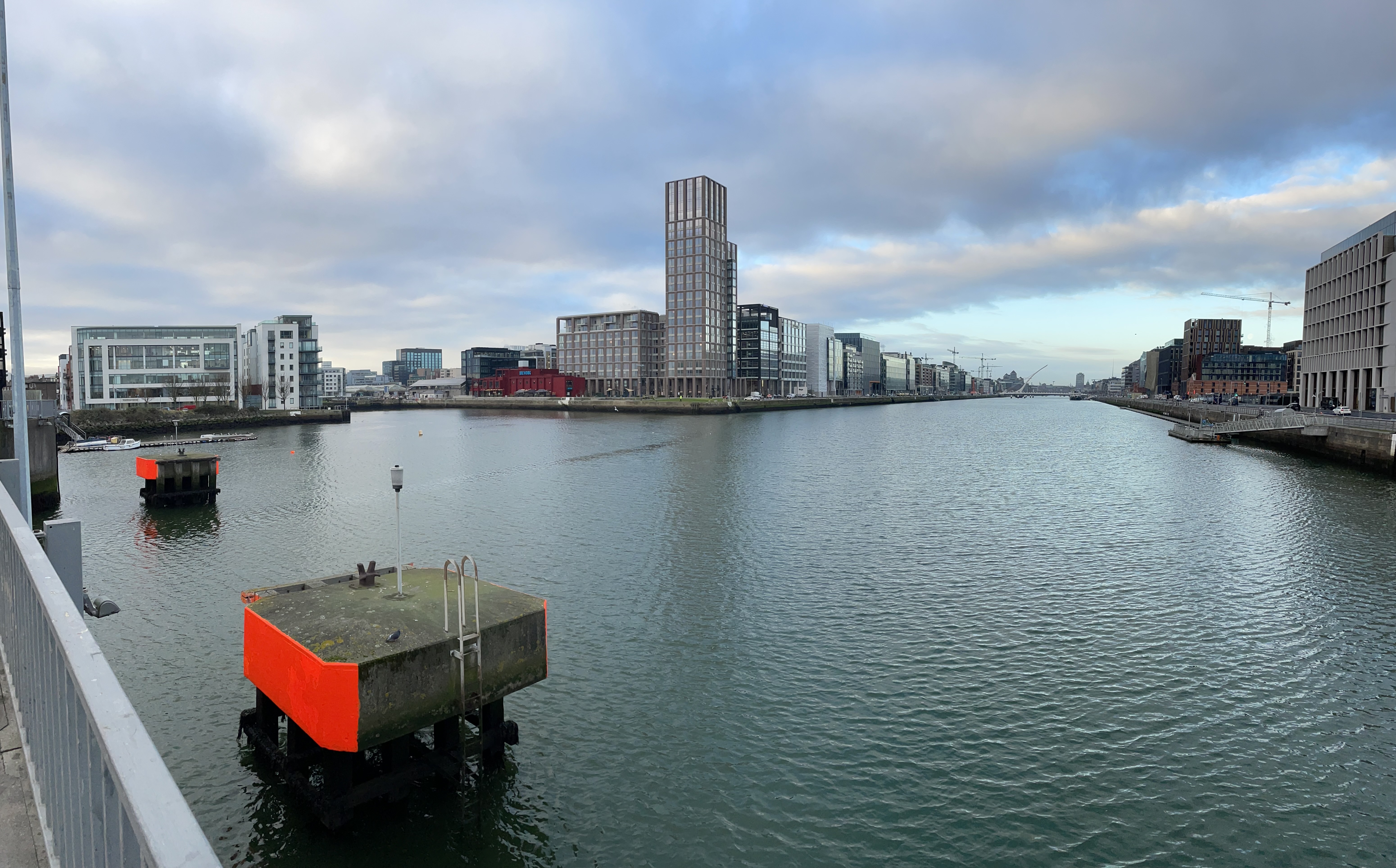
| Crossing the Liffey at the Tom Clarke toll bridge, at the eastern end of Dublin. The Liffey is the body of water to the right, at centre left is the Grand Canal Dock | Splendid stepping stones across the Dodder at Bushy Park |
 |
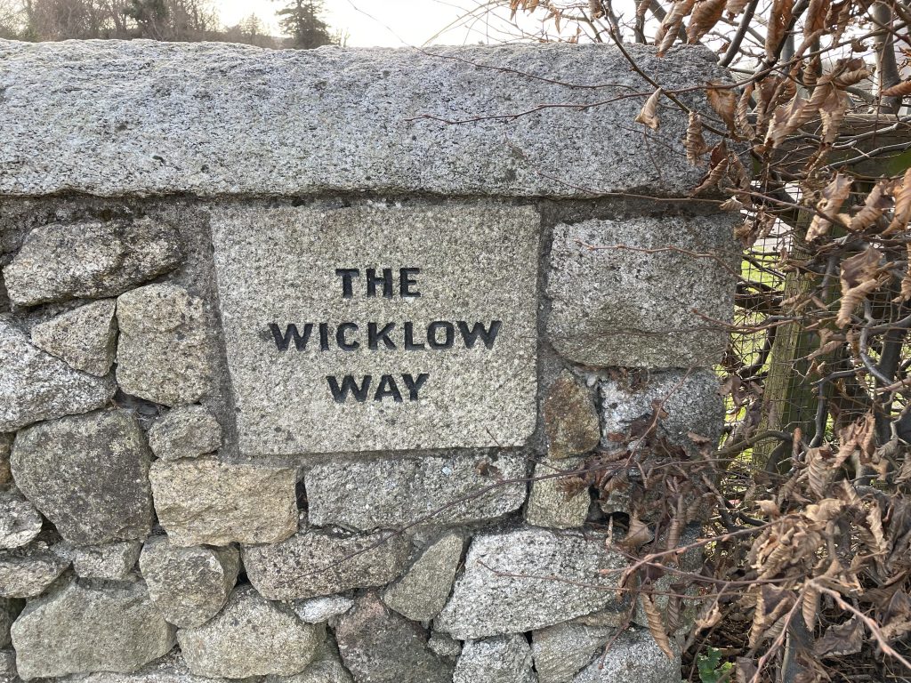 |
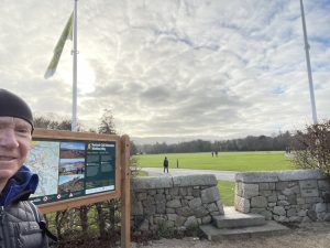
| This is the official start of the Wicklow Way in Marlay Park | And here’s the proof! |
 |
|
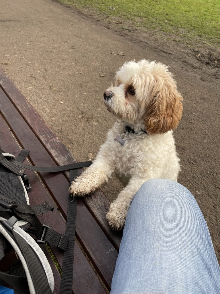
| This small visitor seemed altogether too interested in my sandwiches for my liking. | |
Interactive map
(Elevations corrected at GPS Visualizer: Assign DEM elevation data to coordinates )
Max elevation: 123 m
Min elevation: -2 m
Total climbing: 389 m
Total descent: -276 m
Total time: 04:24:16
You can read earlier and later days’ blogs below
Previous day’s blog
Next day’s blog
Ireland home page
 Save as PDF