Ireland day 0075. Sunday 12 December 2021- GrangeCommons
| Today’s summary | Drove up to Grange, near Carlingford, for walk with Boyne Valley Walkers in the foothills of the Cooleys. Val at work | ||||
| Today’s weather | Mild and very overcast. Thick mist and drizzle at the start, clearer later. No wind or sun. Mild, about 12C | ||||
 |
 |
||||
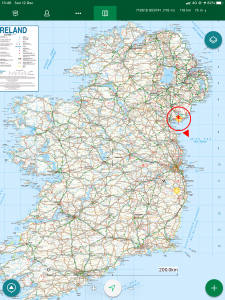
| Today’s overview location (the red cross in a circle shows where Val and I are at the moment) |
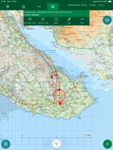
Close-up location (Click button below to download a GPX of today’s walk): Grange Commons BVW |
||||
Commentary
Normally I try to avoid going back to places I’ve been before – at least for a decent while – because it seems to be a bit of a cop-out when there are so many more interesting new places to explore. So today was a bit uncharacteristic because I headed off north up the M1 (that hire car is getting well used!) towards Dundalk and then out east to the village of Grange, near Carlingford. Of course we had visited Carlingford – the gateway to the Cooley mountains – a couple of months ago, so this was a return trip (though sadly Val had to miss it this time due to work commitments).
I decided to go back because I’d seen that the Boyne Valley Walkers were organising a trip there, and the three previous excursions I have been out with them have all been excellent. So I thought there was a fair chance today’s outing would be the same, plus the fact that I might learn something, and meet some interesting new people in the process. And, I have to say, I really like the Cooleys – they exert a charm which to me even the Wicklow Hills can’t emulate. I’m not quite sure why though – perhaps it’s because they are a bit less well known – and therefore mysterious – to me.
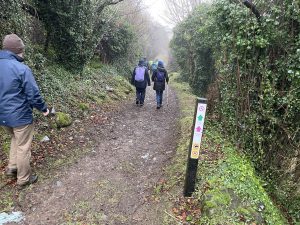
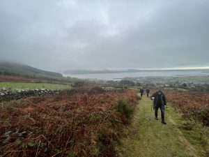
The walk didn’t disappoint, despite an overcast start with heavy drizzle which threatened to soak everything in that horrible claggy but un-refreshing way that the British Isles seems uniquely brilliant at producing. So waterproofs were donned and sweat was produced as we set off under the leadership of Dusty Flanagan – who’s something of a local legend in Drogheda and an excellent walking-companion. We headed roughly north on the hillside parallel to the shoreline – which was completely invisible in the mist – along a series of tarmac-ed roads and grassy boreens towards the Deserted Village.
The name is apt, because the village is indeed deserted, and in a pretty ruinous state too. It’s tucked away on the hillside but is easy to reach on one of the many “official” National Looped Walks which decorate the slopes above Carlingford. If fact Val and I only narrowly missed visiting the village last time we were here, exploring another of those waymarked walks. Despite the expansive views (which weren’t very expansive today because of the fog) over the sea lough to the east, it would be a bleak place to live. The residents of the dozen-or-so huts eked out a subsistence living by growing potatoes and keeping a few animals, but the absence of an obvious source of fresh water, and the lack of trees nearby which might provide firewood, would have made it a tough life.
Locally, it’s said that the village was evacuated during the potato blight epidemic in the mid-nineteenth century (which has led to it being sometimes known as the “famine village”) but actually it was inhabited for nearly a hundred years after that. Most likely, residents slowly drifted away when the attractions of the easier living in nearby towns finally proved irresistible.
A little further on, the path widened out and we paused for a brief lunch stop. Whilst we were chatting over our sandwiches, the mist suddenly began to rise, unveiling a stunning panorama over the village of Carlingford and further out to the lough. The late revelation made the view feel that much more special, simply because it had been hidden from us so completely in the early stages of the walk.
After lunch, we descended a little then made our way back towards the carpark at Grange along a series of greenways which had recently been cleared of undergrowth and were now open to walkers. Excellent walking.
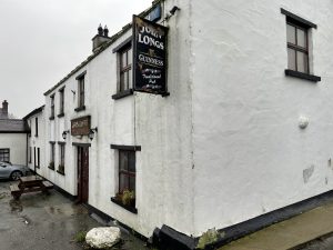
Back at the car park, we packed up and headed over to John Long’s pub for refreshment. Sadly a Guinness wasn’t on offer – on account of the drive home – but they did a pretty good cup of hot coffee which was welcome after a day out in the damp. And as always I had excellent company on the walk – so many interesting and interested people to talk to – I felt that the conversations could have carried on all evening in the pub. Indeed if it had been Guinness rather than coffee, they probably would. Sadly the real world intruded, so we dispersed and went our separate ways, leaving me reflecting on another interesting and happy day out, and looking forward to the next one already.
Today’s photos (click to enlarge)
 |
 |
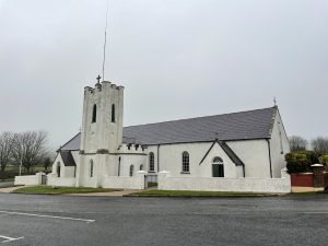
| Essential ingredients of an Irish village (in this case Grange). Part 1 – the church |
Part 2 – the pub |
 |
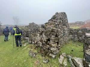 |
| Hiking up the boreen to the Deserted Village | The remains of the village itself, high on the hillside above Carlingford. An inhospitable spot at the best of times. Inhabited from about 1700 to 1930 |
 |
 |
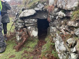
| In the deserted village – compact and bijou but not a dog kennel….Actually it’s a “sweat house” which is a bit like a sauna. Villagers would be put in here with a pile of smouldering turf to sweat out their ailments. Very healthy, I’m sure | Looking out of Europe directly across the lough towards the Mourne mountains, as the mist cleared |
 |
|
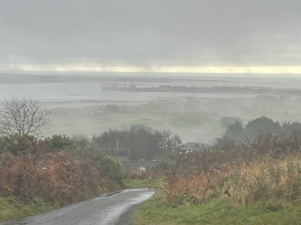
| Surreal landscapes emerged around noon, as the breeze picked up a bit and the mist dispersed. The headland in the middle distance is Greenore Point. There’s a regular ferry service across the lough to Greencastle Point in Northern Ireland. It’s not used very much, because the roads aren’t very good on either side so it doesn’t actually save traffic heading north very much time. | |
You can read earlier and later days’ blogs below
Previous day’s blog
Next day’s blog
Ireland home page
 Save as PDF