
Ireland day 0074. Saturday 11 December 2021- Trooperstown
| Today’s summary | Drove the hire car down to Wicklow to join the Dublin Walking Club for an excellent walk on the slopes of Scarr Mountain. Impromptu birthday for Garry halfway round. Val was at work | ||||
| Today’s weather | Relatively mild. No wind or sun. Overcast with occasional drizzle and heavier showers. About 10C | ||||
 |
 |
||||
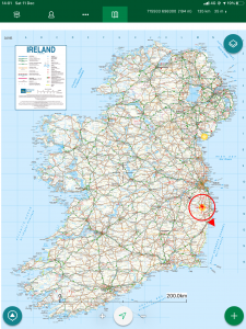
| Today’s overview location (the red cross in a circle shows where Val and I are at the moment) |
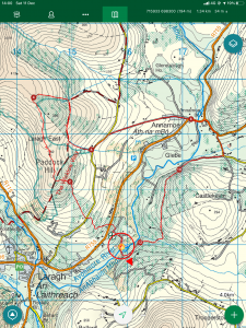
Close-up location (Click button below to download a GPX of today’s walk): Trooperstown loop |
||||
Commentary
I don’t actually like driving very much so, while being without a car for the last few weeks has been a bit inconvenient, it hasn’t really been a major hardship. But as I was cruising round the M50 in the hire car on my way to Wicklow this morning, I suddenly noticed an unexpected sensation of freedom which bordered on exhilaration. No more waiting in the rain at freezing cold bus stops! A couple of days liberation!
The purpose of my journey was to join the Dublin Walking Club for a walk in the Wicklow hills. Sadly, Val is still working so I was on my own as I headed about 100km / 60 mi south from Malahide to the far side of Dublin. The rendezvous was at the gritty-eyed-early (for me) time of 9:30 am in the Trooperstown car park, near Laragh. Getting there by public transport would have been well-nigh impossible so the car was essential today.
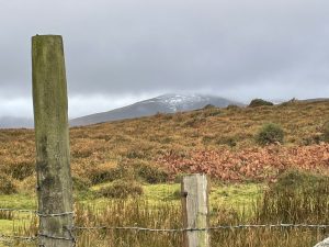
Trooperstown isn’t actually a town – well at least as far as I could tell it isn’t – rather it is a flat area by the Avonmore river where British troops camped while quelling one of the many rebellions which have rocked the island over the past few centuries (this particular one was in 1798). I joined a group of friendly faces from the Dublin Walking Club at the carpark and we swiftly headed off up out of the valley and onto the slopes of Scarr Mountain, to the west. Climbing up through pine forestry, we came out onto the open hillside, right on the Wicklow Way. The views immediately opened up with snow on the more distant higher summits, just visible in the drifting mist. The snow fell as storm Barra passed through last week, but the temperature has risen a lot in the last couple of days – it was about 10C today – so the snowline is rapidly receding. But more storms are forecast so it looks like we might have just got lucky and hit a decent weather window today.
The first landmark of note was the Gossan stones – an unobtrusive pair of stones arranged about 2 metres apart just to the west of the path. The name is said to come from the Norman “Garçon” – or boy – as the stones are roughly the same size as two children facing each other. The stones are unassuming enough but the locally-renowned archaeologist Chris Corlett has observed that on the equinoxes in September and March, the sun rises exactly between the two of them when viewed so that the Devil’s Glen – a notch on the eastern horizon – is aligned with the mid-point of the stones. It strongly suggests that the stones are a man-made artefact though the symbolism and age is obscure. You can see the stones with a suitable model highlighting the gnomon (although looking the other way – to the west) in the header image to this blog.
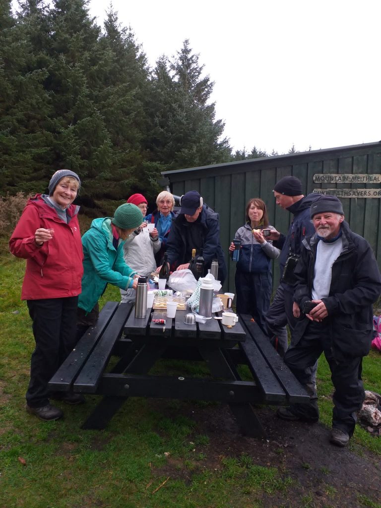
Archaeology done for the day, we continued our exploration of the area and stopped for an early lunch at a rather nice open shelter – the Brusher Gap hut – a little way down from the ridge. As it was our walk leader Garry’s birthday earlier in the week, a couple of club members surprised the rest of us by whipping out a bottle of port, some prosecco and a large birthday cake (with candle) from their day-packs, so we had a pop-up party halfway up the mountain. What an amazing surprise and a fabulous way to celebrate a birthday.
Sadly, as I was driving (another downside of not using public transport) I couldn’t really enjoy the alcohol, but that’s probably actually a good thing as I might otherwise have lapsed into a bit of a stupor for the second half of the walk and not really have noticed too much of what was going on.
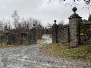
Suitably birthday-ed up, we made our way back down into the valley and eventually to the car park. En route we passed a couple of imposing sets of gates leading into vast demesnes (that word again) attached to historically significant, but currently privately owned, stately homes. The first was Glendalough House, home of former Irish President, Erskine Hamilton Childers and before him, of his father Erskine Childers. Erskine senior was secretary to the Irish delegation which signed the Anglo Irish treaty a hundred years ago last Monday. And just a little way further on, we came across the gateway to the demesne of Castlekevin House, believed to be owned by the actor Daniel Day-Lewis. There’s a lot of depth to Ireland, but it’s not all on display and you have to know where to look.
We were back at the car park by 2pm so after we had bade our farewells, I hung back a little longer to have the sandwiches I had postponed from Brusher Hut, then packed up and headed for Malahide. All in all, another good journey into the Irish hinterland, with friendship, history and archaeology all rolled into one excellent day out.
Today’s photos (click to enlarge)
 |
 |
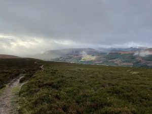
| A quick stride out from the Trooperstown car park and we were on the slopes of Scarr, heading to the Wicklow Way again | We crossed a stile to access the WW then headed straight across it into the hills. Tonelagee mountain in the background still sporting the remnants of last week’s snow |
 |
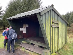 |
| Rain washed vistas out to the east. Stunning clarity and the drifting mist made it almost feel like it was alive | The Brusher Gap hut on the Wicklow Way, erected by a Mountain Meitheal* team in 2011 *“Meitheal” is the Irish word for a workgroup usually made up of volunteers who come together to work on a project for the common good or to benefit the community. |
 |
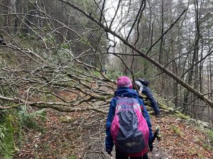 |
| Ireland is littered with semi ruinous gateways like this, behind which, out of sight from the road, lurk grand manor houses (often also semi ruinous). At the end of this track is Castlekevin house, believed to be owned and renovated by the actor Daniel Day-Lewis | Evidence of Barra’s passage last week, blocking the path |
 |
|
| It was Garry’s birthday a couple of days ago, and halfway round, the Club threw a surprise party complete with port, prosecco and cake (with candles) to celebrate. Shame I was driving or else the afternoon section of the walk might have completely passed me by (Photo: Dublin Walking Club) |
|
You can read earlier and later days’ blogs below
Previous day’s blog
Next day’s blog
Ireland home page
 Save as PDF