Ireland day 0044. Thursday 11 November 2021- Broadmeadow
| Today’s summary | Did the cycle ride round the Broadmeadow estuary that was postponed from yesterday. Walked down and up Donabate beach then cycled back to Malahide. North coastal road shown on map doesn’t exist | ||||
| Today’s weather | Dry but overcast with leaden skies. Rain later in the evening. Strong south easterly wind. About 12C | ||||
 |
 |
||||
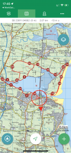
| Today’s overview location (the red cross in a circle shows where Val and I are at the moment) |
Close-up location (Click the button to download a GPX of today’s cycle ride / walk) Broadmeadow |
||||
Commentary
Having taken delivery of the PPS number yesterday, and used it to start the process of registering with a GP and fixing up eye tests, there wasn’t much more I could do on the life-admin front until Val got back and until we had got the eye test results. So having progressed these matters as far as I could, I was free now to do the Broadmeadow exploration that I had promised myself yesterday, but never quite got round to.
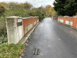
By way of a refresher, the Broadmeadow is the small river to the north of Malahide. Since the construction of the railway embankment, the estuary has ballooned into a huge lagoon, about 1500m / 1 mi wide. The estuary narrows again just to the east of the embankment, and at one point a river channel less than 100m wide separates Malahide from the southern tip of the Donabate peninsula on the other side. The two shores are tantalisingly close but there is no bridge and no ferry so if you want to go and explore the other side, there is no option but to make a 17km / 11mi detour inland. You can cross the Broadmeadow at an old bridge where it is much narrower, just beyond the M1 viaduct.
Getting from the south shore to the north and back again, without a car or public transport, was my mission for today.
I started the process by doing a bit of map research and open streetmap convinced me that there was a small road running all along the north side of the lagoon leading more or less to Donabate. I planned to leave my bike at the nearby beach at Balcarrick then head off on foot south down the beach on the seaward side of the peninsula, then to try and find a path back north up the lagoon-side western shore. I thought the coastal road would a preferable route to the main road so I duly got the sandwiches made, prepared the bike, and set off.
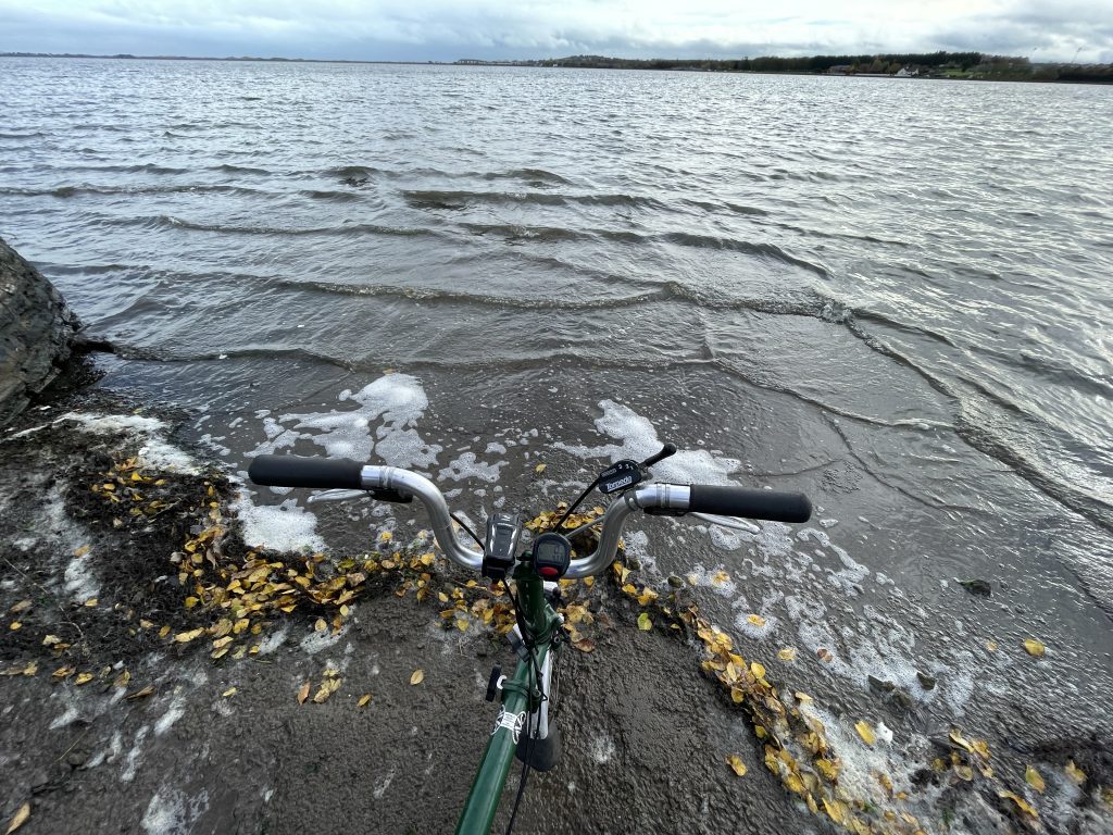
Everything was going swimmingly well as I was happily cycling down the very scenic north shore road until it – quite literally – just disappeared under water. From the shadow in the sea, and the change in the wave pattern, I could see that the road did indeed continue right along the coast. It was just that it was under about half a metre / 1 ft of water. Quite how this came about I don’t know. Maybe it was high tide – although the railway embankment stops the lagoon being very tidal – or maybe it was a real manifestation of the icecaps melting.
Either way, my plans were thwarted and I was about to turn back and take the main road option, when I realised that there was a narrow path on a wall-top just above the shore. So I made a leap of faith and climbed up to the path, carrying my bike with me. The path appeared to continue all the way along the shore up to the point where I knew a “proper” road would come down to the sea to meet it. So I doggedly followed it , carrying my reluctant bike with me, for a couple of km till I reached the road at the other end. At one point the path just became a narrow ledge about 15cm wide with quite a long drop to the sea, but I pressed on despite the hazard, and successfully negotiated the chicane.
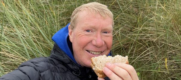
Once I reached the road, the rest of the cycle to Balcarrick was a doddle. So I left the bike near the Martello tower and headed back down the beach in the general direction of Malahide. T he wind was quite fierce and blowing loose sand like spindrift, so at times it was rather hard going. I eventually reached the southern end and gazed across at Malahide just a hundred meters away – yet it had taken me 2 hours and a 17 km ride and walk to get there. I headed on round the back of the peninsula – past the point where Val and I turned back on a previous visit – and found a sheltered spot out of the wind where I could enjoy lunch. The sandwiches were fabulous, by the way.
After lunch, I pressed on up the western side of the peninsula, and found that there was indeed a rough path, which eventually led through the dunes and back onto the beach a little further up. From there, I more or less retraced my steps to Malahide, though as it was beginning to get dark and I could see that the tide was definitely rising, I chose to stay on the main road and avoid the coastal heroics. The easterly wind helped me speed along the busiest section, so I was through it in no more than 15 minutes.
So now I’m back in the flat preparing dinner. It’s roast sausages with grilled tomatoes and baked potatoes tonight. It promises to be a calorie bonanza, which is probably a good thing as I’m starving after today’s wind-blown aquatic adventures. But right now perhaps even more urgently I think I’m in need of a cold beer!
Today’s photos (click to enlarge)
 |
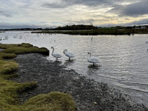 |
| The bridge over the western end of the estuary. The Broadmeadow river is only a few metres across here, then dramatically widens to about 1500m just a couple of hundred meters downstream | The estuary / lagoon seems to be a favourite with swans. I was enjoying watching then until one of the larger ones started striding purposefully towards me with a “get orf my land” sort of look on its face. At that point I jumped back on the bike and beat a hasty retreat |
 |
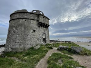 |
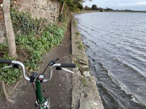
| When the road disappeared below the shoreline, I was forced to push my bike along a wall top just above the water. A little further on the dry ledge narrowed to about 15cm wide so it required some careful footwork to keep bike and rider dry | The Donabate Martello Tower. We last visited here a couple of weeks ago when we walked north to Portrane |
 |
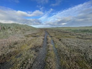 |
| Not sure where this walker was heading – but it was a one-way set of footsteps and they definitely weren’t mine | Round the back side of the Donabate peninsula, heading north. We had resolved to come and explore this area when we last visited but ran out of time. An interesting swampy wilderness |
 |
|
| My map showed a road going along the north shore of the estuary, and Google directed me along it to Donabate. What all my information sources neglected to mention was that in fact the majority of the road was actually under water | |
You can read earlier and later days’ blogs below
Previous day’s blog
Next day’s blog
Ireland home page
 Save as PDF