Ireland day 0227. Friday 13 May 2022- Geology
| Today’s summary | Spent the morning on admin tasks then went into Dublin at lunchtime to research the Geological Survey of Ireland exhibition at the Collins Barracks for a short article I am writing | ||||
| Today’s weather | Dry, bright and breezy. Moderate blustery westerly wind. About 18C. | ||||
 |
 |
||||
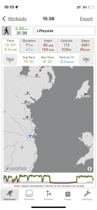
| Today’s overview location (The blue mark shows the location of my route) |
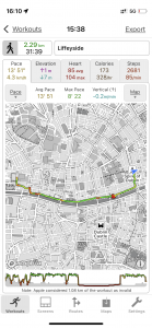
Close-up location (The green line shows where I walked) (Click button below to download GPX of today’s walk as recorded, or see interactive map at bottom with elevations corrected): Liffeyside Collins to O'Connell then Connolly |
||||
Commentary
A few weeks ago I think I had a bit of a rush of blood to the head. I seem to remember that I rashly promised that I would write a short article on “Geology in Ireland” for a local group of the Geological Society back in the UK. I had completely forgotten about this until this morning when I suddenly remembered that the deadline was the end of May. So I thought I had better get my skates on, given that there is likely to be an extended period of prevarication before I actually get round to putting pen to paper.
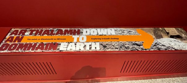
The first thing I had to decide was what to write about. There’s no point in writing about some obscure technical point of geological interest, because there are bound to be a million papers already out there on the subject, written by people who really do know what they are talking about. Then after some moments consideration, I realised there was another angle I could take. A few months ago, Val and I had paid a visit to the National Museum of Ireland – Decorative Arts & History exhibition down at the Collins Barracks, and discovered slightly incongruously that a geological exhibition was being co-hosted on the same site.
In fact this second exhibition celebrates 175 years of the Geological Survey of Ireland (GSI) (the event was delayed by a couple of years by the pandemic) and I thought that I could use it as the basis for writing something fairly low-key but relatively interesting, about the history and current priorities of the Survey. It’s a good exhibition and runs until the end of the year (and possibly longer, as I understand there is some uncertainty about what will fill the exhibition space once the geologists depart).
So today, as Val was at work, I thought that once the morning’s admin and shopping chores were complete, it would be the ideal opportunity for me to take the train into Dublin and do some fact finding down at the Barracks.
And so it proved to be. The exhibition was as good as I had remembered it being last time, and the process was greatly helped by a chance meeting with GSI’s Research Manager, who was on duty today helping answer questions from punters like me. She was extremely helpful and told me a lot more about the background to the exhibition and some of the GSI’s current priorities. It seems the main activities of their hundred-or-so staff nowadays fall into three main areas:
First is surveying and monitoring groundwater. Ireland gets an unusually large proportion – about a third – of its drinking water from groundwater (rather than reservoirs). This water is generally very clean, having been purified through layers of rock. However because a sizeable proportion of Ireland is covered in Karstic limestone (i.e. rock with holes in it), in these areas surface contamination can travel quickly into the groundwater, unfiltered, through this highly permeable rock. Pollution from farms in one county can end up in drinking water two counties away – a problem which creates the necessity for careful monitoring.
The second priority is “Tellus” – a massive, detailed project to gather geochemical data for the rocks, soils and water of the whole of the island of Ireland (it was in fact started by the Geological Survey of Northern Ireland). A combination of aerial surveying and ground-based sampling is being used to compile the database, which will be used for mineral exploration, agricultural productivity and environmental management. It’s about three quarters finished so far but funding, as ever, is in short supply to complete it. Apparently the relevant ministries are struggling to appreciate its value as much as the geologists who actually use it do.
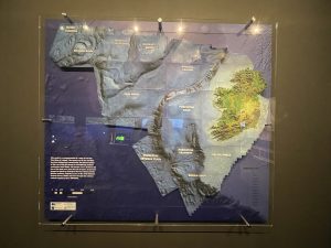
And the final big priority is the INFOMAR programme to map the whole of Ireland’s seabed as far as the edge of the continental shelf – and area ten times as big as the landmass of Ireland itself. The data is some of the most detailed in the world, and will be useful in, among other things, the siting of offshore wind farms, and for monitoring the effects of climate change on coasts.
Well, I think that should be plenty to get me started on my article, and the GSI representative has agreed to provide me with more information should I need it. So a completely successful outing, I think, and I celebrated afterwards by walking down to Mountain Warehouse in O’Connell street to buy a new pair of trainers. That too turned out to be a surprisingly rewarding trip as the helpful shop assistant seemed to be falling over himself to give me discounts. So I ended up with a decent pair of shoes, plus two sets of sorbothane insoles, for €32, reduced from €88. And they actually feel comfortable and don’t look too bad either. Hooray for today!
Today’s photos (click to enlarge)
 |
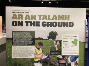 |
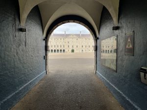
| Entering the Collins Barracks. Since it was discontinued from military use in 1997, it was taken over by the OPW and the space converted to house the National Museum of Ireland – Decorative Arts & History. At the moment it is also co-hosting an exhibition on the history and current main priorities of the Geological Society of Ireland – in celebration of its 175th anniversary. | The Geological Survey Ireland “Tellus” project is a world-leading geochemical survey of the whole of the island of Ireland. It’s about 75% complete at the moment |
 |
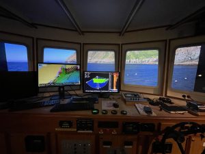 |
| The “Real map of Ireland” – the territory claimed by Ireland out to the margins of the continental shelf. The area which is above sea level is only about 10% of the total | A view from the “virtual” bridge of one of the seven vessels currently surveying Ireland’s continental shelf territory as part of the INFOMAR project. Like Tellus, it’s pretty leading edge and is in fact one of the world’s largest marine mapping projects |
 |
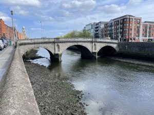 |
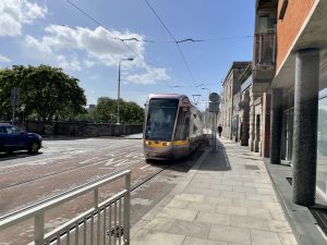
| Dublin streetscape from outside the museum. The Luas (Irish for “speed”) trams first arrived in 2004 and there are two lines – “Red” which runs roughly east-west, and “Green” which runs roughly north south. You can tell which is which because the dot matrix displays on the front are either red or green, depending on the route. | The Liffey at low tide. It’s actually quite a small river and in parts it actually looks so shallow that (at low tide) you could almost paddle across it |
 |
|
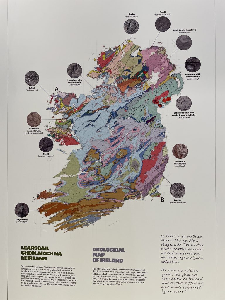
| A geological map of Ireland. The geology here is actually extraordinarily complex, for such a small country. The first geological maps of the island were produced in 1838 by Richard Griffith, a mining engineer and chairman of the Irish Board of Works. The geological Survey of Great Britain and Ireland was founded in 1845. The Irish branch became increasing autonomous and presumably completely separated after Independence. The GSI maintained close links with the British Geological Survey (BGS), though the UK’s recent decision to leave the EU has added some complexities to the relationship which are still being worked through. | |
Interactive map
(Elevations corrected at GPS Visualizer: Assign DEM elevation data to coordinates )
Max elevation: 14 m
Min elevation: 3 m
Total climbing: 46 m
Total descent: -49 m
Total time: 00:31:38
You can read earlier and later days’ blogs below
Previous day’s blog
Next day’s blog
Ireland home page
 Save as PDF