Ireland day 0193. Saturday 09 April 2022- Weekend!
| Today’s summary | Leisurely morning, then a nice sunny walk down the coast (at low tide) and back over Robswall Hill. Out for dinner in Ardcath tonight | ||||
| Today’s weather | Cool, dry and bright. Long sunny intervals in the morning, more cloudy in the afternoon. Light south easterly wind. About 9C | ||||
 |
 |
||||
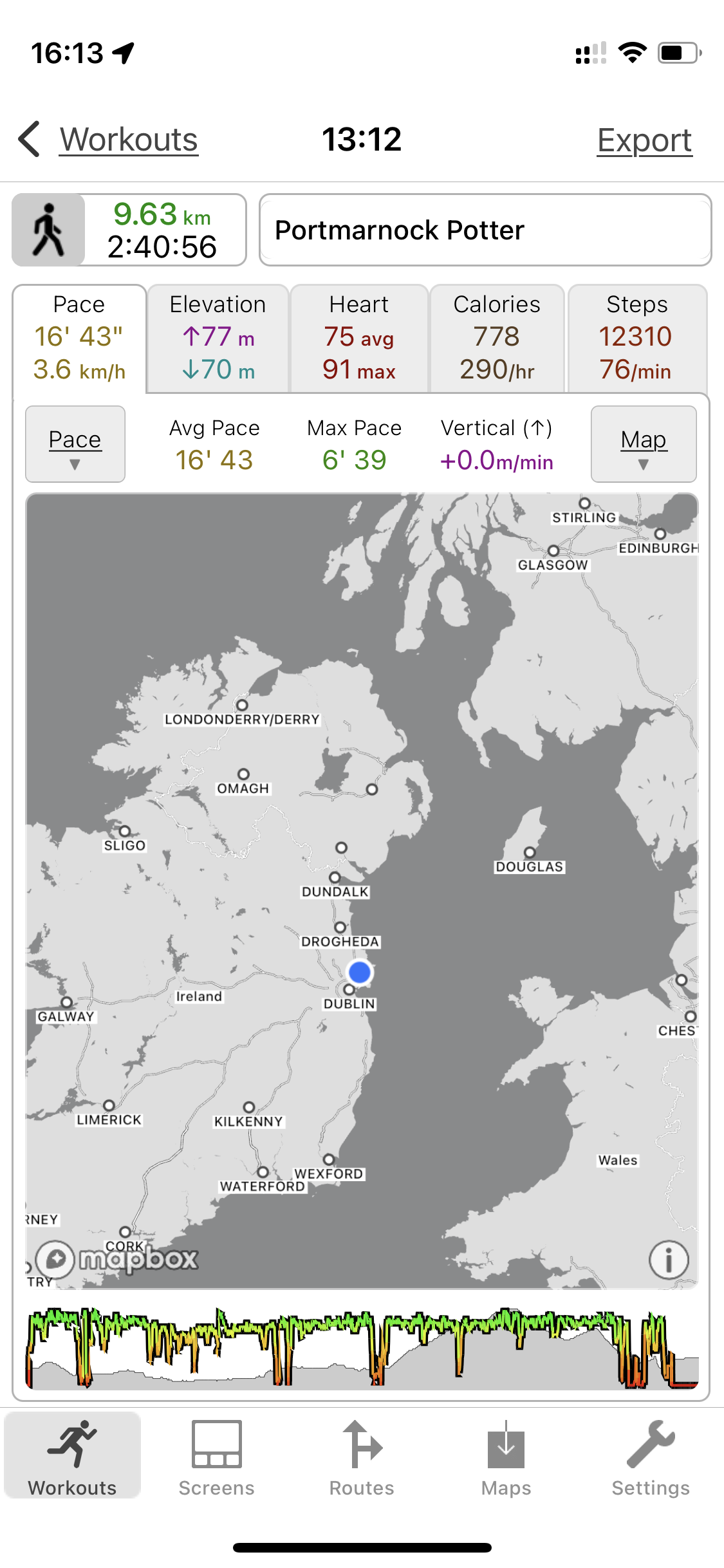
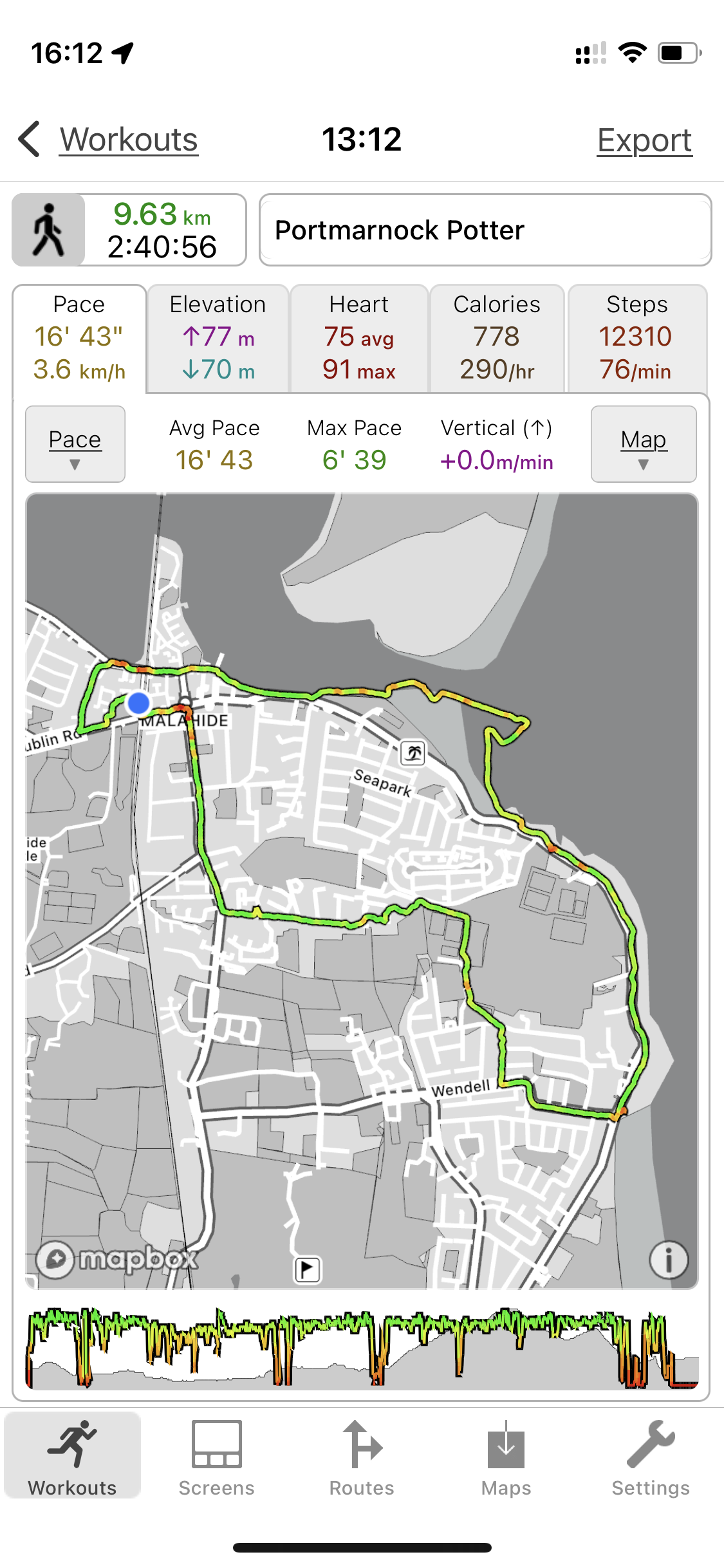
| Today’s overview location (The blue mark shows the location of our route) |
Close-up location (The green line shows where we walked) (Click button below to download GPX of today’s walk as recorded, or see interactive map at bottom with elevations corrected): Portmarnock Potter |
||||
Commentary
Today was a slightly special day, particularly for Val. Pretty much continuously for the last month, she has been on the go. First doing the ski marathon in Switzerland, then catching Covid, then walking part of the Wicklow Way, then nursing three sick friends and family, then climbing Lugnaquilla and the Cooleys, then searching out a long lost great-great-grandfather and then starting a new job. So more then anything, today she was adamant that she wanted to have a “proper” weekend day off. I have to say I thought that sounded entirely reasonable to me.
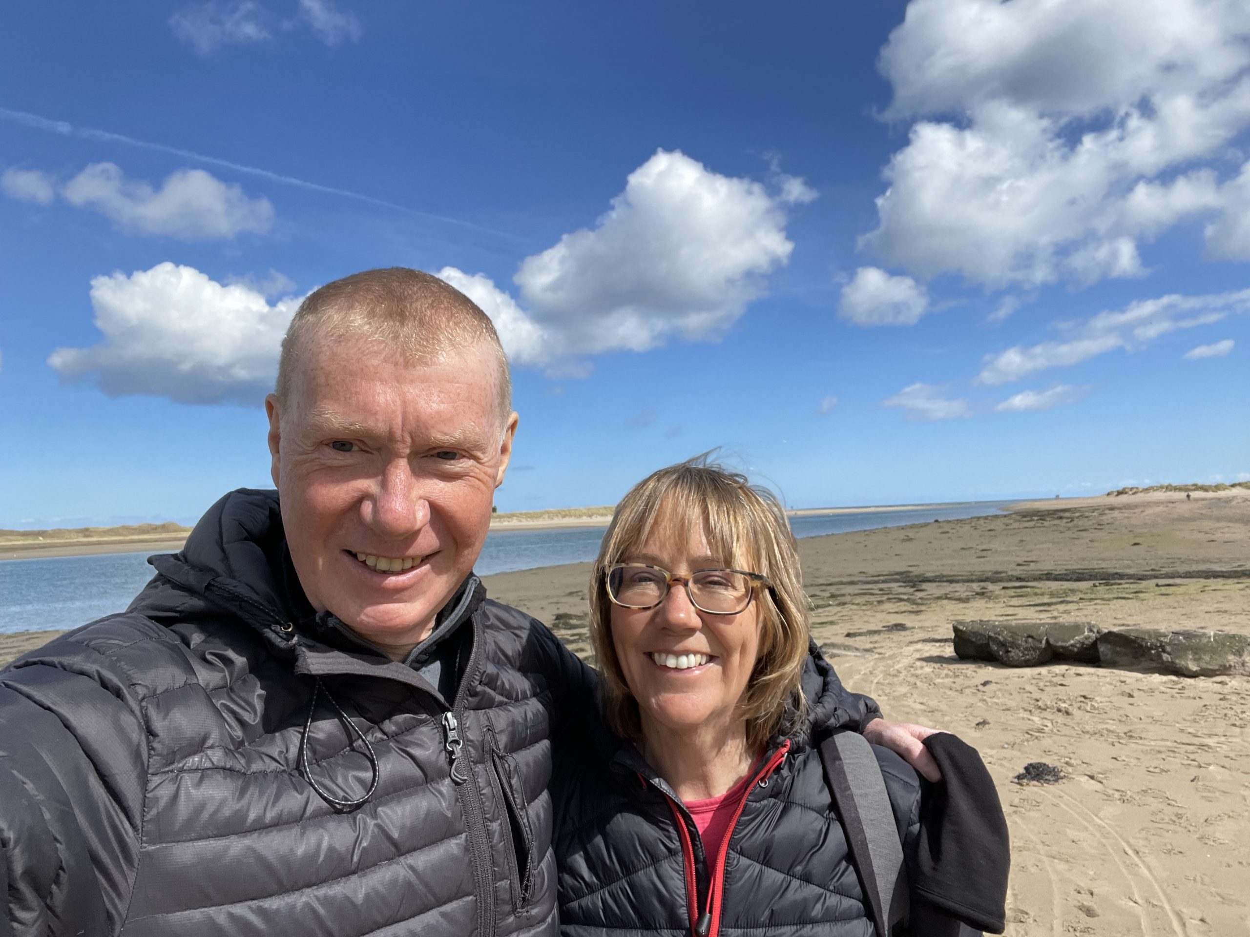
So that is pretty much what we have been doing today. Enjoying a leisurely start to the day – no rushing to make packed lunches – then definitely no household chores. Instead we had a late breakfast in bed, then as the sun was (still) shining brilliantly, we wandered off down Hanlon’s Lane to the shore, and then out onto the beach.
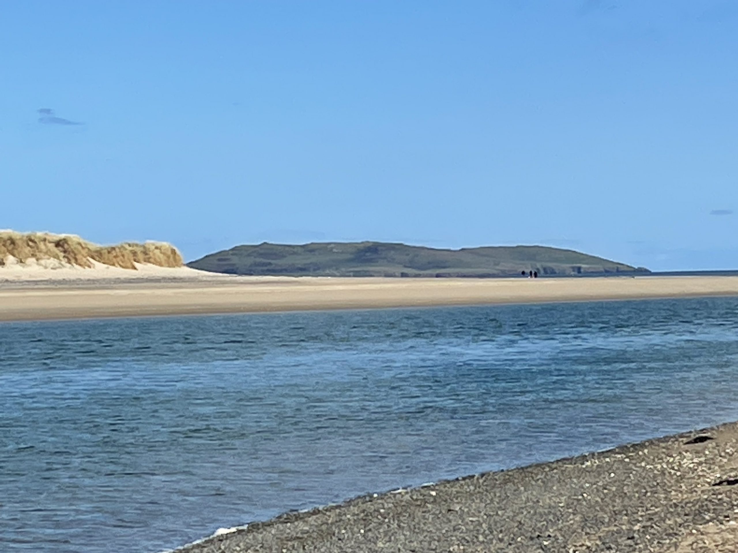
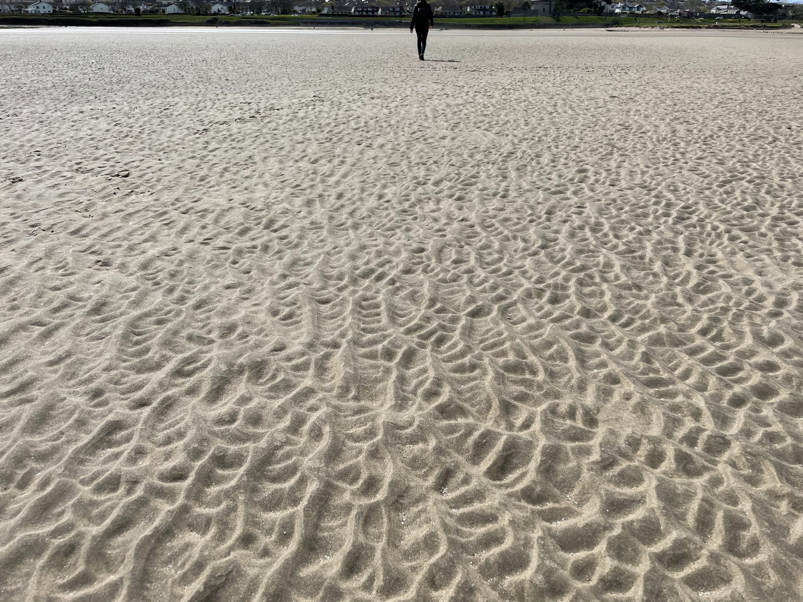
The tide was coming in but still very low when we got to the shore – which had some interesting consequences for the prospects of walking round the Broadmeadow Lagoon – as you can see in the caption to the big photo below.. We decided to take a chance and head out onto the vast expanse of sand flats that are exposed at low tide – knowing that the tide would start rising at any moment, so our time out there was strictly limited. But if the circumstances are right – as they were today – it’s lovely out there. The sea and sky were azure, and the air was so clear it felt like you could almost reach out and touch Lambay Island.
We noticed that the little streams and pools in the sand around us were starting to fill up alarmingly fast, so we decided not to push our luck and headed swiftly shoreward, to the safe refuge of Lithostrotion beach. Back on dry land again, it was an easy walk round the coast to Portmarnock, then back up Paddy’s Hill into Robswall Park and finally back down into Malahide.
So it’s been a very nice, laid back sort of a day. But Saturday hasn’t quite done with us tonight. Because we have been invited back up to Ardcath for dinner tonight, by our very first landlord in Ireland. Now that we have a car, getting there and back late at night is a practical proposition – it’s just a shame I won’t be able to drink anything (Val really does need to familiarise herself with the Yaris…). Anyway it’s really exciting to be invited out like this – our first dinner invitation in a foreign country. We’re looking forward to it very much indeed.
Today’s photos (click to enlarge)
 |
 |
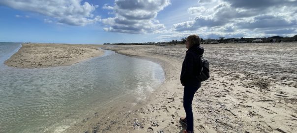
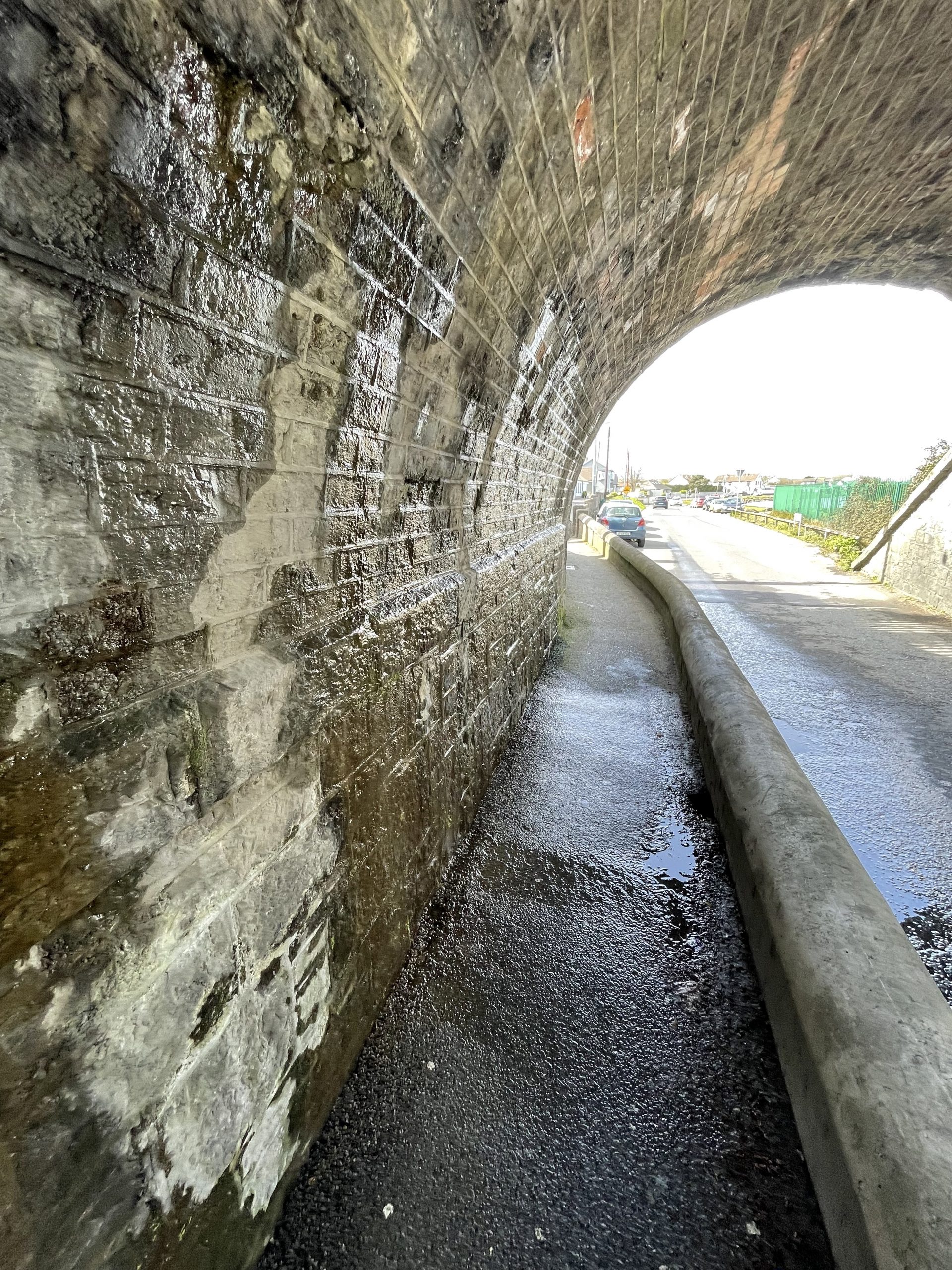
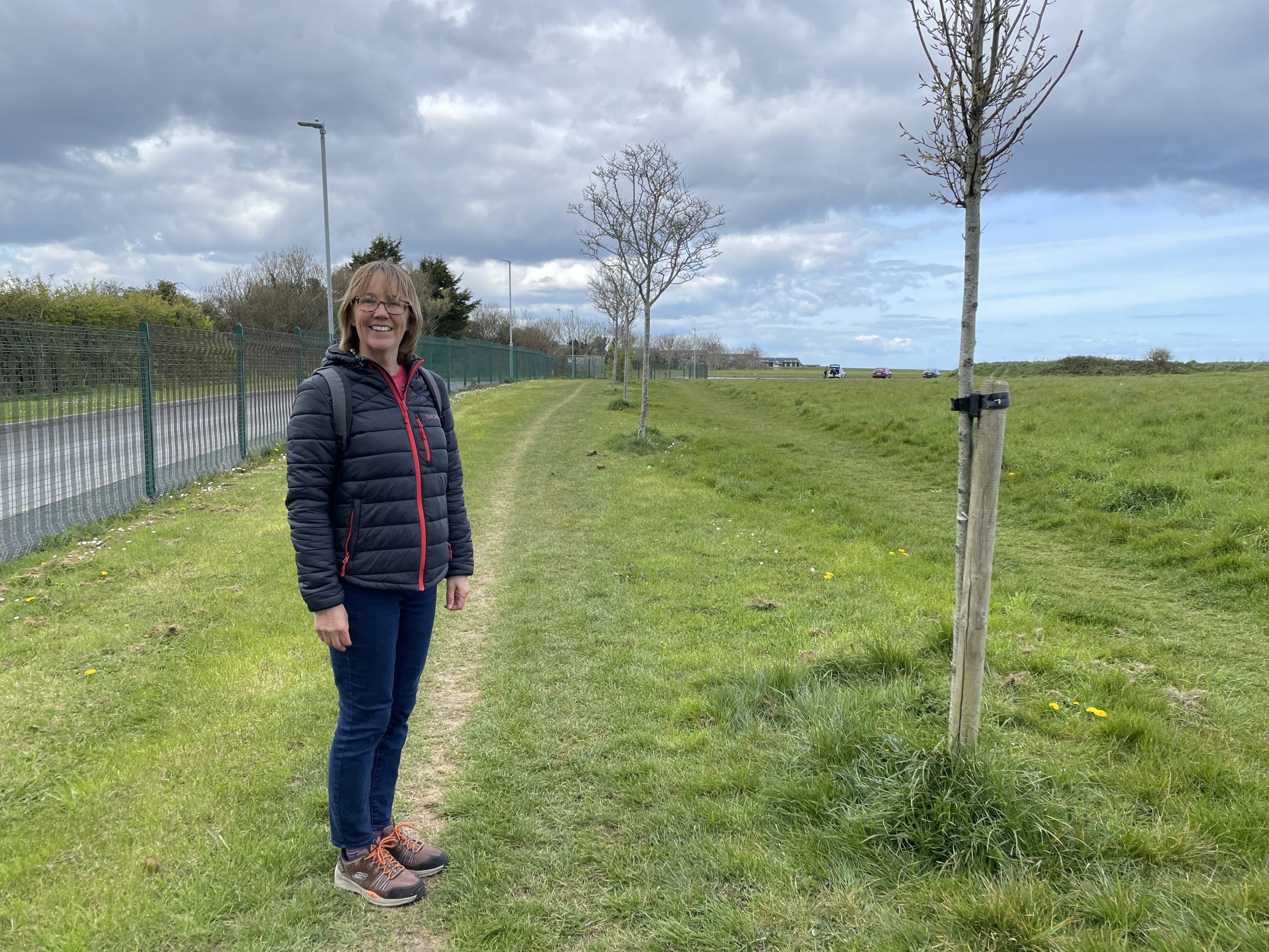
| This is the Coast Road bridge under the railway. Ever since we arrived six months ago water has been pouring out of the wall and into the road. I had assumed it was just rain water draining through the tracks and out through the stonework, but it hasn’t rained much lately and the flow is is as copious as ever. So I am wondering if there is a broken water pipe or spring somewhere in the embankment above. Either way it’s probably the busiest railway line in Ireland, and the main line to Belfast. It can’t be very good for the structural integrity of this important bridge to have uncontrolled water leaking through it 24 hours a day. I feel a stern letter to Iarnród Éireann coming on! | Down on the beach this lunchtime. I can’t believe how fast my hair is growing!! |
 |
 |
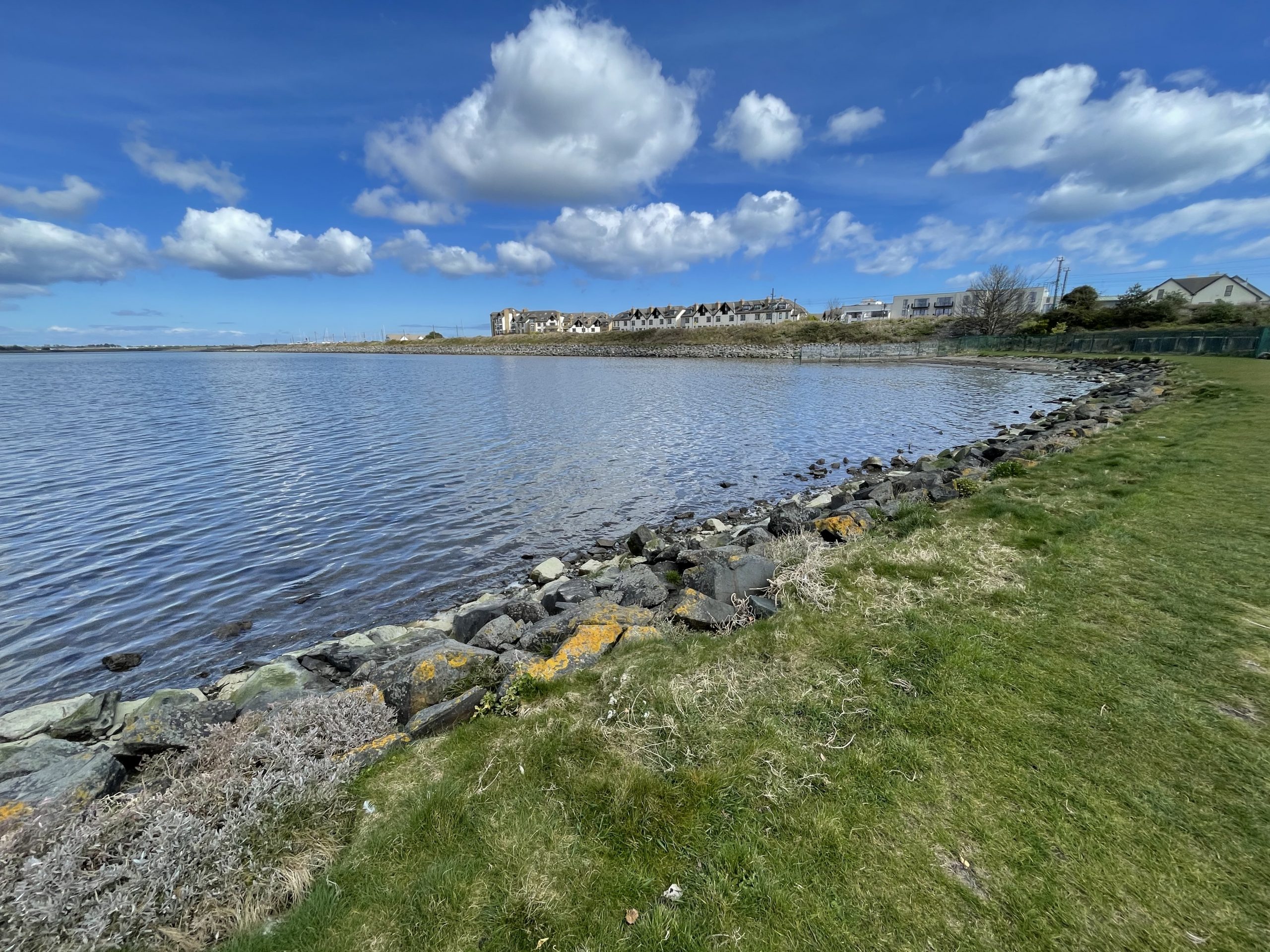
| The view down the estuary across to Lambay island. The sea looks blue and inviting but appearances can be deceptive. The tide was flowing strongly through the channel and you could see the powerful currents just below the surface, surging through the channel. And it was still pretty cold – just about 9C. So not quite the Côte d’Azur today and definitely no swimming here | Val beating a hasty shore-ward retreat as the tide started heading our way and nipping at our heels |
 |
 |
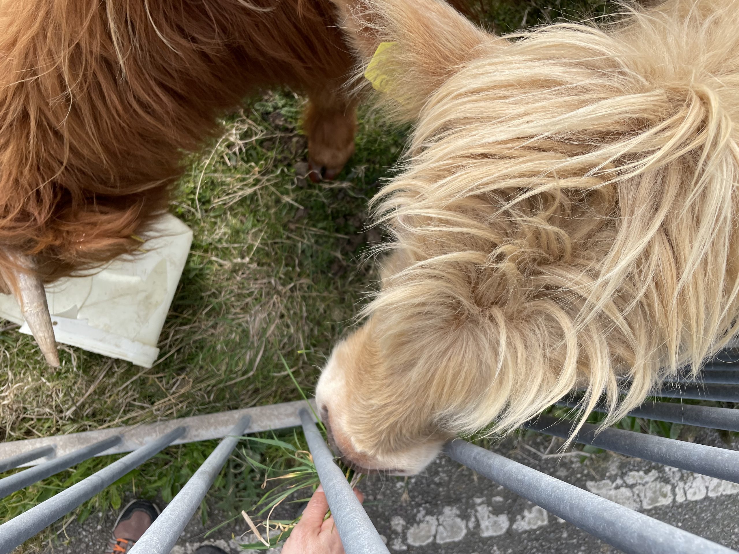
| Val seems to have made friends with the Malahide Moo! Funny how the grass is always greener outside the fence. These bovines are very easily pleased | Heading back up over Robswall Hill. The sun had gone in by mid-afternoon and up on the hill in the breeze, it felt pretty chilly. |
 |
|
| There is sometimes more to the view than meets the eye. I took this picture of the Broadmeadow Lagoon about two hours after low tide and as far as I could tell the water level in the lagoon was still falling. When I thought about it a bit, this was actually logical. Because the height of the sluice under the middle of the railway embankment is some way above the low tide mark in the open sea, and because the water drains out of the lagoon more slowly than the tide in the downstream estuary goes out, the water level in the lagoon continues to fall as long as the water level in the outer, downstream, estuary is below the level of the sluice. This means that the water level in the lagoon will still be falling for a while even when the tide is rising in the outer estuary. Anyway the upshot of all this is that if I want to have any chance of walking round the tidal road on the north side of the lagoon, without having to paddle, the best time to try will probably be an hour or two after low tide in the harbour (which is downstream of the sluice) at Malahide. I.e. the point when the tide has fallen to its low point, then started to rise again but not quite reached the level of the sluice, when the inner lagoon will start filling up again. All this assumes of course that there is essentially no inflow into the lagoon from the Broadmeadow river – which is basically true, especially when it’s not rained for a while, as the river is tiny. I will try and put my theory to the test the next time two hours after low tide occurs at a convenient hour, and will report back. Watch this space! |
|
Interactive map
(Elevations corrected at GPS Visualizer: Assign DEM elevation data to coordinates )
Max elevation: 50 m
Min elevation: 0 m
Total climbing: 140 m
Total descent: -140 m
Total time: 02:40:56
You can read earlier and later days’ blogs below
Previous day’s blog
Next day’s blog
Ireland home page
 Save as PDF