Ireland day 0152. Sunday 27 February 2022- Cooleys3
| Today’s summary | Another trip up to the Cooleys, near Ballymakellett, with the Boyne Valley Walking Club. A good leg-stretch, but very windy on the tops. Lots of history and great views. | ||||
| Today’s weather | Dry and sunny when we set off from Malahide but the Cooley summits were covered in a blanket of cloud. Looked threatening but stayed dry all day. Still the same strong south easterly wind as yesterday, near gale force on the tops. No sun. About 7C. | ||||
 |
 |
||||
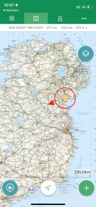
| Today’s overview location (the red cross in a circle shows where Val and I are at the moment) |
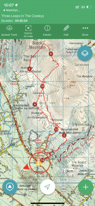
Close-up location (Click button below to download GPX of today’s walk as recorded, or see interactive map at bottom with elevations corrected): Cooleys three loops |
||||
Commentary
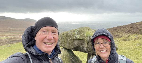
The reason why we hired a car yesterday can be revealed at last. The Boyne Valley Walking Club, based in Drogheda, had organised a walk up in the Cooley Hills today. The Cooleys are a nice range of hills in the north of the Republic. They are less well visited than the Wicklow and Dublin mountains, the eastern section, which we were visiting today, especially so. And because I haven’t really got the hang of where you are actually allowed to walk in Ireland yet, we were keen to join a group rather than for Val and I to try and go it alone. It was our third visit to these hills, and already they are beginning to be become a bit addictive.
There is a major downside with joining a group walk, though, which is that you have to set off at the time the walk leader decides, rather than at the time you would actually choose yourself. For me that was particularly hard today as the start time of 9:30 am meant leaving the flat at 8:15 and that in turn meant getting up just after 7am. At the best of times that’s a bit of a challenge for me and especially on a Sunday.
But it was worth it! A group of twenty or so enthusiastic (and chatty) walkers pitched up at the assigned time in the car park of the Lumpers pub in Ballymakellett, and headed for the hills, under the leadership of the redoubtable Dusty Flanagan (you can read about him on Wikipedia). It was dry and bright but quite breezy in the car park, and as we climbed higher, the cloud closed in and the wind rose to gale force. It was the same very strong south-easterly wind as we experienced yesterday in Howth and it’s happening because at the moment Ireland is sandwiched between a deep depression in the Atlantic and an anticyclone over Denmark.
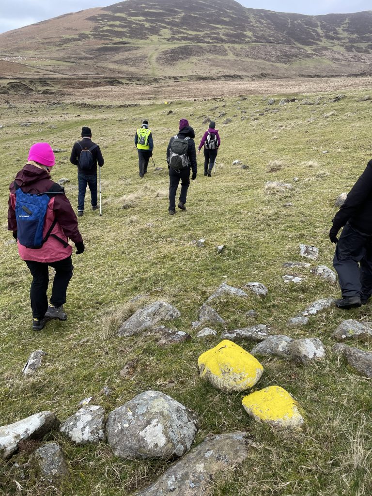
It felt great to be completely away from the crowds, heading over open moorland with fantastic views to the south over the Irish Sea, then as we climbed higher, over to the other side of the peninsula, north to Carlingford Lough. There was lots of natural and human history along the way – you can read more about it in the captions to the pictures below. It was particularly interesting to learn that although the moorlands are heather covered, they are not managed for game hunting like they are in Scotland. The is no grouse-shooting and up until relatively recently, any gunshots you heard up here, just a couple of km from the border, were likely to be of a rather more sinister nature.
Eventually, after a quick lunch stop in an incredibly cold windy spot, we climbed up to the summit ridge – it’s only 400m high but on a blowy February day like today, it felt high enough. Just below the cloud-base, the views were expansive and fortunately not obscured by mist. We headed south down the ridge in the middle of the Carlingford Peninsula and then eventually beat a retreat back down the hillside to the pub, a few km along from the summit. It’s a lovely area and my map seems to suggests there is a reasonably good network of tracks up there, so sometime – once we have a car of course – we can come back and explore in more depth on a nice warm summer day. Here’s hoping!
Much as I would have loved a pint in the Lumpers at the end, the drive home precluded it so we compromised with a cup of coffee from the Thermos while sitting in the car (again). Despite being a rather ageing thing to do, it actually felt to be good in the relative warmth of a tin box, basking in the glow of a good exhilarating day out, well done. Let there be many more like it.
Today’s photos (click to enlarge)
 |
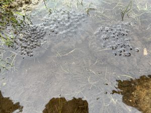 |
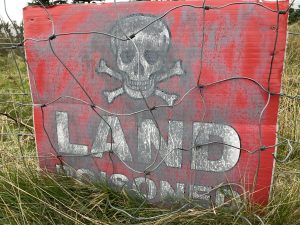
| Landowners really don’t go out of their way to make you feel welcome up here | Frogspawn! A pretty bleak spot to do your metamorphosis from blob to frog – and the first I’ve seen for many years actually. Obviously I haven’t been out and about enough! |
 |
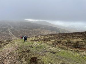 |
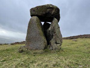
| On the slopes of The Ben Rock near Anaverna – this looks like an ancient dolmen but it’s believed to have been constructed much more recently. There’s a mock stone circle nearby of similar vintage – but that is as much as anyone seems to know about it. | Just below the summit of Clermont Cairn, at about 400m. Walking roughly down the centre of the Carlingford Peninsula. On the right, looking south, is the Irish Sea near Dundalk. Carlingford Lough, to the north, was visible from this point if you turned a bit further to the left. |
 |
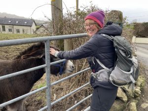 |
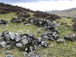
| These are the ruins of a Booley Hut, up on the hillside above Ballymakellett. “Booleying” was the process of taking cattle into the uplands to graze between May and October, to free up the pasture land at lower levels for growing crops. “Booley” is derived from an ancient Irish word meaning “cattle”. The booley huts would be used as shelter by the people tending the cattle. They were thatched with grass or reeds. The last one was probably built about 200 years ago. | Val’s new best friend! No, we can’t have one in the flat. A very emotional moment. |
 |
|
| Now, this is an interesting thing. The yellow marker stones on the slopes of The Ben Rock aren’t boundary markers or even path waypoints. They are actually targets used in the annual poc fada competition, held here in August. It’s a GAA sport, designed to test the skill of hurling (men) and camogie (women) players. The idea is to puck (pitch by striking or throwing) the sliotar (ball) using a hurley (hockey-stick shaped bat) from stone to stone round a course that is usually about 5km long. The winner is the person who manages to hit all the stones with the fewest pucks. Sort of like golf but with stones to hit rather than holes to go in. Usually the winners are hurling team goalkeepers as they have the most powerful strike and can puck the farthest. | |
Interactive map
(Elevations corrected at GPS Visualizer: Assign DEM elevation data to coordinates )
Max elevation: 458 m
Min elevation: 58 m
Total climbing: 633 m
Total descent: -634 m
Total time: 04:35:24
You can read earlier and later days’ blogs below
Previous day’s blog
Next day’s blog
Ireland home page
 Save as PDF