Ireland day 0098. Tuesday 04 January 2022- DunLaoghaire
| Today’s summary | Admin tasks in the flat this morning, then took the DART down to Dun Laoghaire. A short walk down the East pier and back, then a repeat on the West pier. Didn’t hang around as it was quite cold | ||||
| Today’s weather | Clear bright and dry. Moderate north westerly wind, stronger on the coast. Felt much colder than lately in the breeze. About 4C | ||||
 |
 |
||||
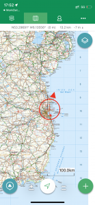
| Today’s overview location (the red cross in a circle shows where Val and I are at the moment) |
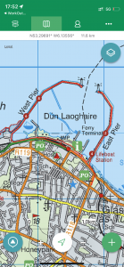
Close-up location (Click button below to download a GPX of our walk round the harbour): Dun Laoghaire harbour |
||||
Commentary
I’ve noticed that my blogs have been getting longer and longer lately, so today I’ve decided to spare us all and keep this one a bit more brief.
We spent the morning catching up on admin, paperwork and cleaning, then packed our lunch and headed out into the sunshine to catch the DART train down to Dun Laoghaire. This is the third time in four days that we have been south of the Liffey and our objective today was to check out what the engineer John Rennie had done with the millions of tonnes of granite that had been removed from Killiney quarry in the early 1800s.
What he did with them was actually, in a modest sort of way, quite spectacular. He designed and commissioned the two harbour piers – to provide a new safe “asylum” deep water port at Dun Laoghaire with easy access to Dublin – and started work in 1817. Each pier is more than a kilometer long. It took until 1842 to complete the matching pair of sea walls, and continued despite Rennie’s death in 1821 (his son, also – confusingly – called John – took over on his father’s death). When it was finished, Rennie had created the largest manmade harbour in Europe, and the effect is quite spectacular (well it is if you are a fan of large stone objects).
The walls at their base are some eighty meters wide and they rise about 20 meters from the seabed. There are spacious walkways – which feel wide and long enough to land a jumbo jet on – running along their tops and both the east and west piers are fully accessible to pedestrians. It’s only when you start walking along them you realise quite how massive they are. Quite simply they are huge and despite their age they appear to, the untrained eye at least, to be as good as new. A testament to the durability of the rock and the quality of the engineering.
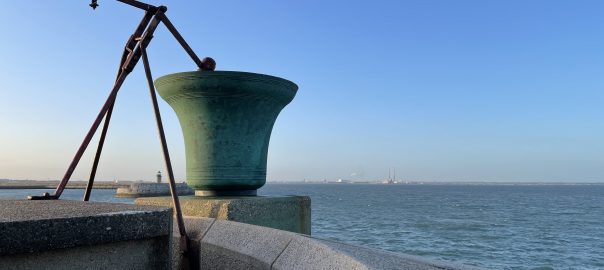
We walked down the east pier first. It’s slightly better paved than the west, and is more popular with walkers. There’s even a small pop up café at the end. We had planned to have our sandwiches on the pier but it was biting cold exposed on the pier top to the wind, so we turned on our heels at the end and walked back to the mainland again. By the way, in case you were wondering, the upside down bell thing in the header image is a fog bell at the end of the eastern pier. Notice the peculiar striking mechanism.
We paused for lunch in a sheltered spot by the Commissioners of Irish Lights’ rather impressive head office, then made our way down the west pier, completing possibly the most geometrically symmetrical walk I have ever managed. Despite being less popular than the east pier, and a bit rougher underfoot, we both agreed it was the more enjoyable walk of the two – although possibly that was because it was a bit better sheltered and not quite as uncomfortably cold.
Anyway I am going to be true to my word and stop now. Except to say that I thought that I ought to include a better way of displaying the perfect symmetry of our walk, rather than just asking you to take my word for it. So I’ve included an interactive map at the bottom for you to play with. I do hope you like it!
Today’s photos (click to enlarge)
 |
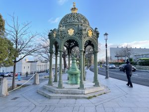 |
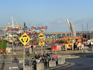
| All the fun of the fair – I am constantly amazed by just how long young children can spend mucking about in playgrounds and funfairs on winter days while their frozen parents hang around desperately wishing they could hurry back home or at least anywhere a bit warmer. this particularly frigid example was on the Dun Laoghaire promenade, right next to the station | A bit of Victoriana – a throwback to the colonial era perhaps |
 |
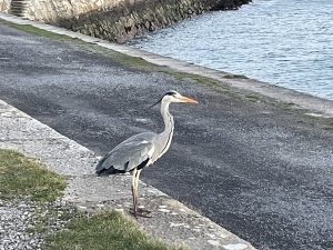 |
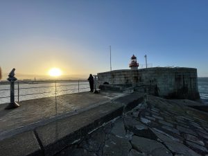
| Approaching the lighthouse at the end of the Eastern pier, which is on port side as you approach the harbour from the sea. Hence the red colour | A remarkably tame heron on the Western pier. There are plenty of fishermen on the pier near here and they probably hang around on the off chance of finding discarded bits of bait |
 |
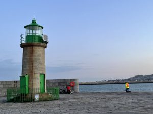 |
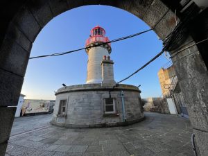
| Lighthouse at the end of the eastern (Port / Red) pier | And its opposite number on the western (Starboard / green) pier |
 |
|
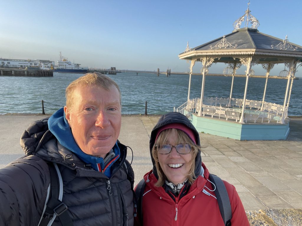
| I don’t normally look like that so I think we must have been sharing a joke at the time. But I have no idea what it was. | |
Max elevation: 15 m
Min elevation: -2 m
Total climbing: 73 m
Total descent: -78 m
Total time: 02:20:04
You can read earlier and later days’ blogs below
Previous day’s blog
Next day’s blog
Ireland home page
 Save as PDF