Ireland day 0026. Sunday 24 October 2021- Howth
| Today’s summary | A circular walk around the Howth peninsula, with Dublin Walking Club | ||||
| Today’s weather | Heavy rain most of the night but cleared by morning to leave a bright sunny day till a rain shower in the evening. Very warm in the sun. Little wind. About 13C | ||||
 |
 |
||||
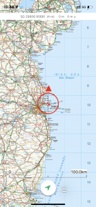
| Today’s overview location (the red cross in a circle shows where Val and I are at the moment) |
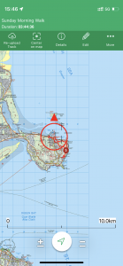
Close-up location | ||||
Commentary
We had a complete day off from admin and house-moving duties today. A nice change, though our walk with the Dublin Walking Club meant another early start and I am rapidly discovering that neither of us are morning people.
But it was worth it. We had lain in bed last night as the rain poured down and the wind howled through the rafters wondering if today’s outing could be anything other than a rain-sodden disaster. But when we emerged from under the duvet, a miraculous transformation seemed to have happened. The rain had gone, the wind had dropped, and the sun was just coming out. So we rapidly had breakfast, packed our things, and hot footed it 50km / 30 miles south down the M1 to Howth (“Hoath“, remember, like “Oath“) to join up with the rest of the group at 11.
We arrived a bit early so had a quick look round the harbour and concluded from an examination of the car park that Howth was an extremely prosperous spot. Amongst the giant 4x4s and the shiny Mercedes I even spotted a Defender Chelsea landrover. I couldn’t help thinking that this was a bit of contradiction in terms and a rather ridiculous creation.
Anyway, it’s sparking harbour, crammed with yachts and boatie types cheek by jowl with an active fishing fleet. Overlooking the harbour is the large roughly circular Howth headland, a rocky outcrop about 4km / 2.5mi across. Rarely for Ireland, the headland is crisscrossed with paths, and there is even a reasonably well made up path going almost round the whole of the outcrop from the Nose of Howth. It’s connected to the mainland by a narrow low-lying spit of land at Sutton.
We had passed last weekend’s “easy” test walk with the walking club, as we were invited to join today’s “intermediate” level walk. It turned out to be an extremely enjoyable short hike up and around the headland, using some of the less well-known paths scouted out by one the members who lives nearby.
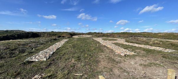
The views in all directions were spectacular – Ireland’s Eye and Lambay Island to the north, and the vast Dublin harbour to the south. But the most interesting feature was on the headland itself. Near the summit, the word “EIRE” is spelled out on the ground in giant stone letters , with an equally gigantic number “6” above it (see the featured image at the top of this blog). I was briefly tempted to let readers work out for themselves what it means – but decided against it because it’s an interesting story worth telling here. Actually, there are 83 such stone signs dotted all round the border of the Republic of Ireland. They were installed in the Second World War when Ireland was a neutral country (unlike Northern Ireland, which was part of the UK and therefore at war, meaning that cities like Belfast suffered heavy bombing but neighbouring settlements in the Republic escaped). The signs were visible from the air, and were meant to direct Allied and German bombers away. They appear to have been largely successful, though Dublin was “accidentally” bombed by the Germans twice during the war.
Another lovely walk successfully completed, we were allowed to graduate to a “hard” walk, so next weekend we will be heading to the Wicklow mountains to join the club for a 6 hour hike from Enniskerry. We are very much looking forward to it. But in the meantime, there’s a house move to be completed, and a new property to be equipped, so plenty to keep us busy for the next few days!
Today’s photos (click to enlarge)
 |
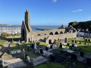 |
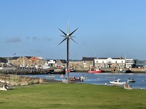
| Realt Na Mára — Star of the Sea – in Howth Harbour. An impressive structure, created by Robert McColgan of Sligo, and erected in 2013 | St Mary’s church. Built in the 13th century but crumbling into ruination nowadays. Situated in a commanding position overlooking Howth harbour |
 |
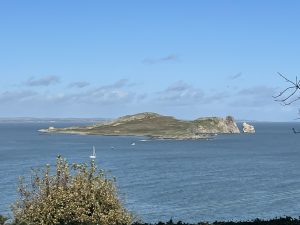 |
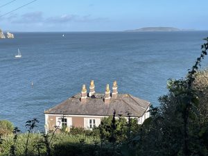
| Howth is bustling and very up-market. We were reliably advised by one of the walkers in the group that this detached residence with fine views over Ireland’s Eye is currently on the market for a cool €5mln. I ruled it out though because it’s on a northerly site and doesn’t get much sun. Shame. | Ireland’s Eye – a lovely little island, located just north of Howth harbour halfway to Portharnock. You can get a small boat to take you there for about €20 in the summer months |
 |
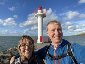 |
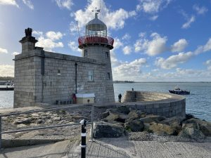
| The Howth Harbour lighthouse, built in 1817 | Howth Harbour Light. Not to be confused with the lighthouse. |
 |
|
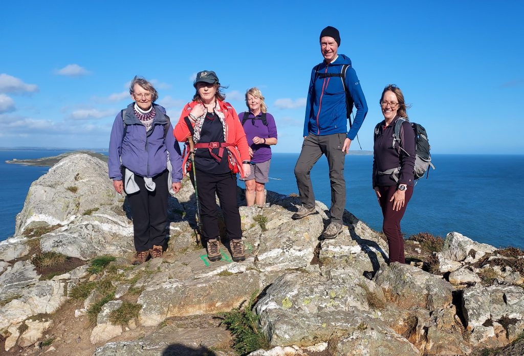
| On the summit of one of the tops of Howth Peninsula, with Walking Club members. The Howth Stone which outcrops here is a sought after building material, with an attractive honey shade (Photo: Dublin Walking Club) |
|
You can read earlier and later days’ blogs below
Previous day’s blog
Next day’s blog
Ireland home page
 Save as PDF