Ireland day 0234. Friday 20 May 2022- Enniskerry
| Today’s summary | Revisiting the Wicklow Way, which we missed in March due to Covid. Day 1 of the four that we are doing this time, today from Marlay Park to Enniskerry. A good walk with plenty of distant views to Dublin, the Sugarloaves, and the coast near Bray. Dodged most of the showers. | ||||
| Today’s weather | Mostly overcast with occasional sunny intervals. Some rain around lunchtime. Strong southerly wind. Feeling cool. About 12C | ||||
 |
 |
||||
| Today’s overview location (The blue mark shows the location of our route) |
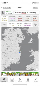
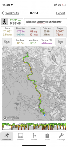
Close-up location (The green line shows where we walked) (Click button below to download GPX of today’s walk as recorded, or see interactive map at bottom with elevations corrected): Marlay to Enniskerry |
||||
Commentary
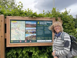
Back in March, Val and I, along with our friends Bev and Pete, had tried to walk the Wicklow Way – Ireland’s most popular long distance path – but as we all, one by one, succumbed to Covid, we had to abandon the walk before it had really begun. (Interestingly, we discovered today that the group that had set off the week after us had also all come down in Covid, and had had to abandon on day 1). Anyway, this weekend we are trying to put things right by walking the first four sections of the Way – from Dublin to Glenmalure. Sadly, Bev and Pete won’t joining us this time, but they’re with us in spirit.
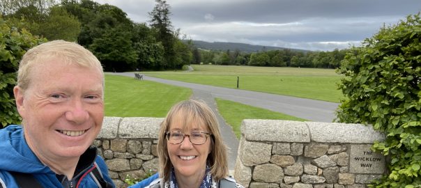
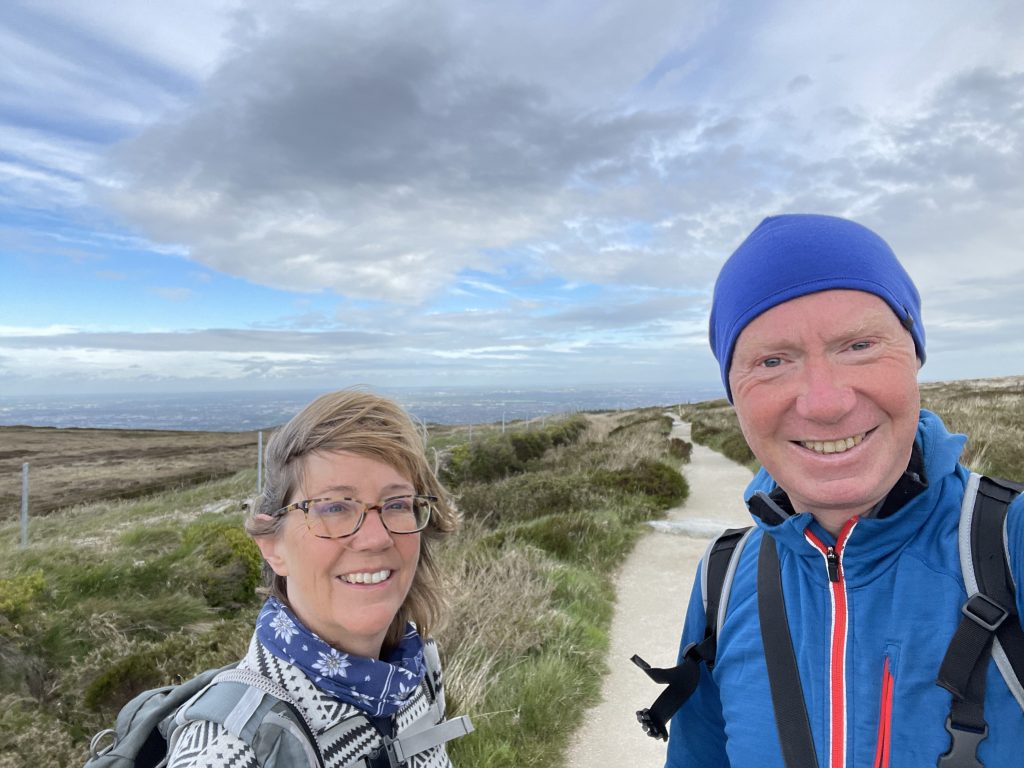
Today was the first day of the walk – a lovely 23km / 14mi stretch across two ranges of hills, from Marlay Park on the southern outskirts of Dublin, down to Crone Woods near Enniskerry. The only downside to today’s expedition was the early start. Various factors required us to be collected by taxi from Malahide at 7:00 am, and we duly were deposited at the start of the walk in Marlay Park shortly afterwards. We were up and away walking by the eye-wateringly early time of 7:45 am. I’m definitely not a natural inhabitant of that time zone, but it did feel good to be up and about before the crowds.
By way of a little background, the Wicklow Way runs 131km / 81 miles from Marlay Park near Dublin to Clonegal in the south. It was the brainchild of the Irish hill-walking enthusiast J. B. Malone, and it eventually came into being in its full form in 1982. It’s Ireland’s most well known and well-walked long distance path. This time, Val and I are just walking the first half – we will come back and do the rest at a later date (although, as it involves quite a lot of road-walking, it isn’t a top priority right now).
Setting off so early meant that there were very few other walkers about today, and indeed we had finished the whole thing by 2:30pm – despite having two lunch breaks on the way. It was a thoroughly enjoyable walk – lofty views in all directions from the two high passes near the Fair Castle / Two Rocks and on the slopes of Prince William’s Seat. Everywhere, the Sugarloaf Mountain, Howth and Lambay Island sprung into view – inescapable from almost every vantage point on the east coast of Ireland, it seems. Rain threatened on a couple of occasions but we only had one brief soaking – lasting about half an hour around noon. The most noticeable characteristic of the weather, actually, was the wind and the low temperature. I think it was actually colder today than it was in March. But it certainly did make for an invigorating day.
Anyway, we’re supposed to be having a mini-break now, and as we have a nice long afternoon in the B&B before we head down to Enniskerry for dinner later, I am going to stop now and go and get a cup of tea. Check back in tomorrow, to find out how stage 2 – over the hills to Roundwood – works out.
Today’s photos (click to enlarge)
 |
 |
| At the start of the walk in Marlay Park at the ungodly hour of 7:45am | Looking north to Howth (on the right) and Lambay Island (on the horizon) from the slopes of Fairy Castle. |
 |
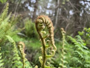 |
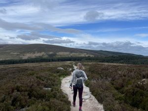
| Striding out from Two Rock montain, on the section where the Wicklow Way and the Dublin Mountains Way coincide | Like a fiddlehead – unfurling frond in Kilmashogue woods. |
 |
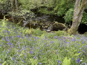 |
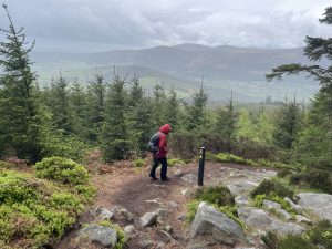
| On the way down from Prince William’s Seat to Glencree. At this point we got caught by a shower bit fortunately it didn’t last long | Bluebells still going strong down by the Glencree River. Shortly down stream it joins the river Dargle, which flows into the sea at Bray |
 |
|
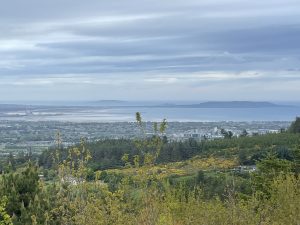
| Looking back on Dublin from the path up Fairy Castle | |
Interactive map
(Elevations corrected at GPS Visualizer: Assign DEM elevation data to coordinates )
Max elevation: 488 m
Min elevation: 86 m
Total climbing: 927 m
Total descent: -859 m
Total time: 06:38:41
You can read earlier and later days’ blogs below
Previous day’s blog
Next day’s blog
Ireland home page
 Save as PDF