Ireland day 0235. Saturday 21 May 2022- Roundwood
| Today’s summary | Day 2 of our Wicklow Way reprised visit. A really enjoyable high level walk from Enniskerry to Roundwood via the summit of Djouce mountain (725m / 2379ft). Mostly dry but caught a heavy showed around lunchtime. Felt quite cold until the sun came out in the late afternoon | ||||
| Today’s weather | Overcast, grey and cool in the morning. Rain at midday. Some warm sun in the afternoon. Moderate southerly wind, stronger at altitude. About 13C | ||||
 |
 |
||||
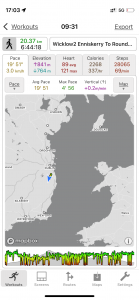
| Today’s overview location (The blue mark shows the location of our route) |
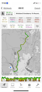
Close-up location (The green line shows where we walked) (Click button below to download GPX of today’s walk as recorded, or see interactive map at bottom with elevations corrected): Wicklow revisited Enniskerry to Roundwood walk |
||||
Commentary
Today’s blog is going to be short as we are about to go to the pub (hurrah) and I need to have a shower first.
Suffice it to say that day 2 of our walk was possibly even better than day 1. OK part of that was because we set off two hours later so we didn’t have quite such an eye-wateringly early start. But the scenery was particularly spectacular – looking down on the Powerscout Waterfall, then the expansive views from the top of Djouce Mountain, and then seeing the renowned Guinness lake (Lough Dan) from the JB Malone memorial stone.
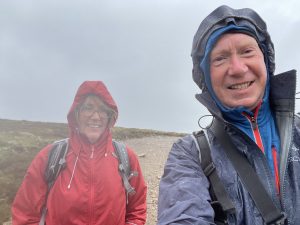
The Wicklow Way doesn’t officially go to the top of Djouce (pronounced “Jouse”, like “house”) but it passes so close that we simply had to make the detour to the summit. Especially as I’d never been before and I’d heard the panoramas would make the effort worthwhile. They certainly were good, but while we were up there we got caught in a downpour which felt surprisingly cold.
Quite a lot of the Way today was on railway-sleeper boardwalks. They are great for keeping your feet dry in the bog (and for stopping damage to the underlying terrain). But they are quite slippery when they get wet, and also narrow so when you meet someone coming the other way, you have one of those visual negotiations about who is going to chicken first and jump off to let the other pass by. The ones in the Djouce area are maintained by the OPW but they almost had to be ripped out in 2016 after a walker slipped and cut their knee and successfully sued the National Park Service for €40,000. Fortunately for the mountain environment and for mountain access in general, the decision was overturned on appeal and the boardwalks were reprieved.
Once the rain was out of the way – it lasted less than a couple of hours – it began to feel quite a lot warmer and we soon dried out. We enjoyed the views of Lough Tay, more distant Lough Dan (we are staying in a B&B above the Lough’s shores tonight), the Roundwood Reservoirs, and over in the distance, the Irish Sea.
When you get to the end of today’s section of the Wicklow Way, you have to turn off and road-walk a couple of km uphill to the B&B. Neither of us was particularly looking forward to this, coming at the end of a good walk already, so were were enormously relieved when a passing motorist – who turned out to be the proprietor of the B&B – stopped and gave us a lift.
Anyway I really must stop now so I can have that shower – or else I won’t be allowed in the pub. Come back tomorrow to find out how we get on on the short stretch over the hill to Glendalough.
Today’s photos (click to enlarge)
 |
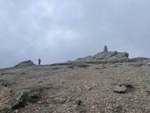 |
| Setting off from Crone Woods this morning, with the Great Sugarloaf mountain in the background. | Approaching the Djouce with Val cutting a lonely figure on the horizon |
 |
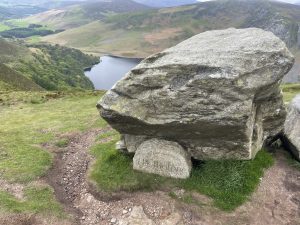 |
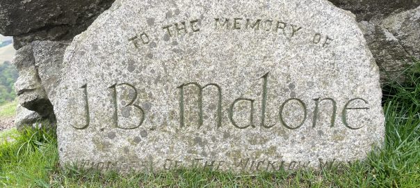
| Cheerful despite the rain. I think. | The boulder with the memorial to JB Malone – founder of the Wicklow Way |
 |
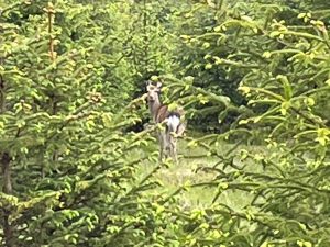 |
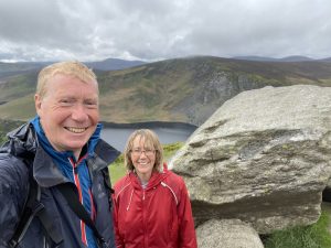
| At the memorial, with Lough Tay in the background | On the way down to Lough Dan we came across this deer bouncing around in the woods. It is apparently a hybrid between the native red deer and the sika deer, which were introduced into Powerscourt Estate but from where they escaped |
 |
|
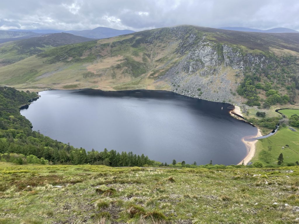
| Lough Tay. It and all the land around it is privately owned, so you can’t actually visit it – this is the view from just below J B Malone’s boulder and is about as close as you can get. The estate is owned by the Guinness family and in a fit of vanity, they imported the sand at the right hand end of the lake to make the whole thing look like a giant pint of Guinness with a creamy head. On account of its ownership and its appearance, it is sometimes known as “the Guinness Lake” | |
Interactive map
(Elevations corrected at GPS Visualizer: Assign DEM elevation data to coordinates )
Max elevation: 721 m
Min elevation: 154 m
Total climbing: 961 m
Total descent: -893 m
Total time: 06:44:04
You can read earlier and later days’ blogs below
Previous day’s blog
Next day’s blog
Ireland home page
 Save as PDF